Garba Tula Airport

Last updated

Garba Tula
Summary
Airport type Public, Civilian
Owner Kenya Airports Authority
Serves Garba Tula, Kenya
Location Garba Tula, Flag of Kenya.svg Kenya
Elevation  AMSL 2,000 ft / 610 m
Coordinates 00°31′12″N38°30′56″E / 0.52000°N 38.51556°E / 0.52000; 38.51556 (Garba Tula Airport)
Map
Kenya adm location map.svg
Airplane silhouette.svg
HKGT
Location of Garba Tula Airport in Kenya
Placement on map is approximate
Runways
Direction Length Surface
ft m
2-20 3,280 1,000 Unpaved

Garba Tula Airport is an airport in Kenya.

Location

Garba Tula Airport ( IATA : n/a, ICAO : HKGT) is located in Garba Tula District, Eastern Province, in the northeastern part of Kenya, near the town of Garba Tula.

An IATA airport code, also known as an IATA location identifier, IATA station code or simply a location identifier, is a three-letter code designating many airports around the world, defined by the International Air Transport Association (IATA). The characters prominently displayed on baggage tags attached at airport check-in desks are an example of a way these codes are used.

ICAO airport code four-letter code designating many airports around the world

The ICAOairport code or location indicator is a four-letter code designating aerodromes around the world. These codes, as defined by the International Civil Aviation Organization and published in ICAO Document 7910: Location Indicators, are used by air traffic control and airline operations such as flight planning.

Eastern Province (Kenya) Former Province in Kenya

The Eastern Province of Kenya was one of 8 Provinces of Kenya. Its northern boundary ran along with that of Ethiopia; the North Eastern Province and Coast Province lay to the east and south; and the remainder of Kenya's provinces, including Central Province, ran along its western border. The provincial capital was Embu.

Contents

Its location lies approximately 271 kilometres (168 mi), by air, northeast of Nairobi International Airport, the country's largest civilian airport. [1] The geographic coordinates of this airport are:0° 31' 12.00"N, 38° 30' 56.00"E (Latitude:0.520000; Longitude:38.515555).

Overview

Garba Tula Airport is a small civilian airport, serving Garba Tula and surrounding communities. Situated 610 metres (2,000 ft) above sea level, the airport has a single unpaved runway 2-20 that measures 3,280 feet (1,000 m) long. [2]

Garba Tulla is a town in Northern Kenya. The town has an urban population of about 5,500. In 2007 it was up-graded to a District status. The First Settlement of Indian was back in 1900. In 1940's Graba Tulla Was a very small Village and only had three shops on main road. Mr. Joseph Onyango became the first District Commissioner on 17 November 2007. The district is already a fully fledged one. The town has been known for its famous National School run by NCCK. Garba Tula is located 120 km East of Isiolo town. The urban center of Mado Gashi is located about 100 km North East of Garba Tula. It is about 90 km to Maua town via Kinna, up to which the road is an all-weather one, and then tarmac which starts right at the gates of Meru National Park which is about 60 km away from Garba Tula town and about 14 km from Kinna town. The locals of the town are the Boran people of mostly Muslim background.

Airlines and destinations

None at the moment

See also

Kenya Airports Authority

Kenya Airports Authority (KAA) is the owner and operator of nine civilian airports and airstrips in Kenya. Kenya Airports Authority was established by an act of Parliament in 1992, by the ruling Kenya African National Union government. The KAA Act, Cap 395, provides for the powers and functions of the Authority. Its head office is on the property of Jomo Kenyatta International Airport in Embakasi, Nairobi.

Kenya Civil Aviation Authority government agency

Kenya Civil Aviation Authority (KCAA) is a state corporation of Kenya that is responsible for regulating the aviation industry in Kenya and for providing air navigation services in the Kenya flight region.

Related Research Articles

Lewa Airport

Lewa Airport is an airport in Kenya.

Mulika Lodge Airport airport

Mulika Lodge Airport is an airport in Meru National Park, Kenya.

Samburu Airport

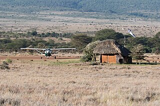
Samburu Airport is an airport in Samburu County, Kenya.

Busia Airport

Busia Airport is an airport in Kenya.

Voi Airport Airport in Voi, Kenya

Voi Airport is an airport in Voi, Kenya.

Naivasha Airport airport

Naivasha Airport is an airport in Naivasha, Kenya.

Mtito Andei Airport

Mtito Andei Airport is an airport in Kenya.

Eliye Springs Airport

Eliye Springs Airport is an airport in the Turkana County, Kenya.

Garissa Airport airport

Garissa Airport is an airport in Kenya.

Marsabit Airport airport

Marsabit Airport is an airport in Marsabit, Kenya.

Kericho Airport

Kericho Airport is an airport in Kenya.

Kisima Airport

Kisima Airport is an airport in Kenya.

Mandera Airport

Mandera Airport is an airport in Mandera, Kenya.

Kilaguni Airport

Kilaguni Airport is an airport in Kenya.

Makindu Airport

Makindu Airport is an airport in Makindu, Kenya.

Magadi Airport

Magadi Airport is an airport near Magadi, Kenya.

Kimwarer Airport

Kimwarer Airport is an airport in Kenya.

Kisii Airport

Kisii Airport is an airport in Kisii County, Kenya.

Loiyangalani Airport

Loiyangalani Airport is an airport in Loiyangalani, Kenya.

Mackinnon Road Airport

Mackinnon Road Airport is an airport in Mackinnon Road, Kenya.

References

Coordinates: 0°31′12″N38°30′56″E / 0.520000°N 38.515555°E / 0.520000; 38.515555

Geographic coordinate system Coordinate system

A geographic coordinate system is a coordinate system that enables every location on Earth to be specified by a set of numbers, letters or symbols. The coordinates are often chosen such that one of the numbers represents a vertical position and two or three of the numbers represent a horizontal position; alternatively, a geographic position may be expressed in a combined three-dimensional Cartesian vector. A common choice of coordinates is latitude, longitude and elevation. To specify a location on a plane requires a map projection.