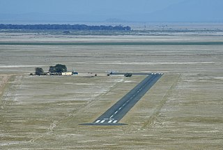
Lokichogio, is a town in the Turkana District in northwest Kenya. It is often called Loki for short. The town lies on the A1 road, and is served by the Lokichogio Airport.
Manda Airport, also called Lamu Airport, is an airport in Kenya.

Amboseli Airport is an airport in Kenya.
Yambio Airport is an airport serving Yambio in South Sudan.
Adjumani Airport is an airport that serves the town of Adjumani in the Northern Region of Uganda, close to the international border with South Sudan. It is approximately 376 kilometres (234 mi) by air north of Entebbe International Airport, the country's largest civilian and military airport.
Tonj Airport is an airport serving Tonj in South Sudan. It is located in Tonj South County in Warrap State, in the town of Tonj, in the Bahr el Ghazal region of South Sudan. The airport is just outside town to the west of the central business district.
Bungoma Airport is an airport in Kenya.
Voi Airport is an airport in Voi, Kenya.
Nyeri Airport is an airport in Nyeri County, Kenya.
Narok Airport is an airport in Narok, Kenya.
Naivasha Airport is an airport in Naivasha, Kenya.
Moyale Airport, also referred to as Moyale Lower Airport, is an airport located in the town of Moyale, Marsabit County, in the northern part of the Republic of Kenya, at the international border with Ethiopia. Its location is approximately 590 kilometres (370 mi), by air, northeast of Nairobi International Airport, the country's largest civilian airport. The geographic coordinates of this airport are:3° 27' 54.00"N, 39° 6' 18.00"E.
Eliye Springs Airport is an airport in the Turkana County, Kenya.
Marsabit Airport is an airport in Marsabit, Kenya.
Kakamega Airport is a small airport in Kenya. It serves the town of Kakamega. At 1,530 metres (5,020 ft) above sea level, the airport has a single asphalt runway which measures 4,200 feet (1,300 m) in length and 49 feet (15 m) in width.
Makindu Airport is an airport in Makindu, Kenya.
Magadi Airport is an airport near Magadi, Kenya.

Lodwar Airport is an airport in Kenya.
Loiyangalani Airport is an airport in Loiyangalani, Kenya.
Lokitaung Airport is an airport in Lokitaung, Kenya.


