Garden, Utah | |
---|---|
Coordinates: 41°53′12″N111°25′58″W / 41.88667°N 111.43278°W | |
Country | United States |
State | Utah |
County | Rich |
Area | |
• Total | 28.3 sq mi (73.3 km2) |
• Land | 28.3 sq mi (73.3 km2) |
• Water | 0.0 sq mi (0.0 km2) |
Elevation | 6,664 ft (2,031 m) |
Population (2020) | |
• Total | 240 |
• Density | 2.9/sq mi (1.1/km2) |
Time zone | UTC-7 (Mountain (MST)) |
• Summer (DST) | UTC-6 (MDT) |
FIPS code | 49-27902 [2] |
GNIS feature ID | 2408276 [1] |
Garden is a census-designated place (CDP) in Rich County, Utah, United States. It includes the southernmost subdivision of Garden City at its northeast and the hamlet of Meadowville at its southeast; otherwise it is farmland. The population was 240 at the 2020 census.
As defined by the United States Census Bureau, the CDP has a total area of 28.3 square miles (73.3 km2), of which 28.3 square miles (73.3 km2) is land and 0.04 square mile (0.1 km2) (0.07%) is water.
Climate data for Usu Doc Daniel, Utah, 2008–2020 normals: 8270ft (2521m) | |||||||||||||
---|---|---|---|---|---|---|---|---|---|---|---|---|---|
Month | Jan | Feb | Mar | Apr | May | Jun | Jul | Aug | Sep | Oct | Nov | Dec | Year |
Record high °F (°C) | 52 (11) | 48 (9) | 56 (13) | 67 (19) | 73 (23) | 82 (28) | 83 (28) | 83 (28) | 81 (27) | 73 (23) | 56 (13) | 48 (9) | 83 (28) |
Mean maximum °F (°C) | 39.1 (3.9) | 40.4 (4.7) | 50.2 (10.1) | 59.0 (15.0) | 66.9 (19.4) | 77.2 (25.1) | 81.1 (27.3) | 80.3 (26.8) | 74.4 (23.6) | 62.9 (17.2) | 50.4 (10.2) | 39.6 (4.2) | 81.8 (27.7) |
Mean daily maximum °F (°C) | 27.9 (−2.3) | 29.1 (−1.6) | 37.6 (3.1) | 43.7 (6.5) | 52.2 (11.2) | 63.9 (17.7) | 73.5 (23.1) | 71.6 (22.0) | 62.0 (16.7) | 46.6 (8.1) | 35.1 (1.7) | 26.1 (−3.3) | 47.4 (8.6) |
Daily mean °F (°C) | 21.7 (−5.7) | 21.9 (−5.6) | 29.1 (−1.6) | 34.0 (1.1) | 42.6 (5.9) | 53.0 (11.7) | 62.3 (16.8) | 60.5 (15.8) | 52.3 (11.3) | 38.9 (3.8) | 28.5 (−1.9) | 19.9 (−6.7) | 38.7 (3.7) |
Mean daily minimum °F (°C) | 15.5 (−9.2) | 14.7 (−9.6) | 20.5 (−6.4) | 24.3 (−4.3) | 33.0 (0.6) | 42.1 (5.6) | 51.1 (10.6) | 49.5 (9.7) | 42.5 (5.8) | 31.1 (−0.5) | 21.9 (−5.6) | 13.8 (−10.1) | 30.0 (−1.1) |
Mean minimum °F (°C) | −3.8 (−19.9) | −1.8 (−18.8) | 6.4 (−14.2) | 10.8 (−11.8) | 19.8 (−6.8) | 29.2 (−1.6) | 41.5 (5.3) | 39.8 (4.3) | 28.0 (−2.2) | 15.0 (−9.4) | 5.3 (−14.8) | −5.6 (−20.9) | −9.4 (−23.0) |
Record low °F (°C) | −14 (−26) | −18 (−28) | 0 (−18) | 1 (−17) | 14 (−10) | 24 (−4) | 33 (1) | 32 (0) | 21 (−6) | −7 (−22) | −9 (−23) | −12 (−24) | −18 (−28) |
Average precipitation inches (mm) | 6.11 (155) | 5.50 (140) | 4.58 (116) | 3.53 (90) | 3.57 (91) | 1.57 (40) | 0.65 (17) | 0.98 (25) | 2.04 (52) | 2.84 (72) | 3.92 (100) | 5.25 (133) | 40.54 (1,031) |
Source 1: XMACIS2 [3] | |||||||||||||
Source 2: NOAA (Precipitation) [4] |
Census | Pop. | Note | %± |
---|---|---|---|
2000 | 83 | — | |
2010 | 181 | 118.1% | |
2020 | 240 | 32.6% |
As of the census [2] of 2000, there were 83 people, 37 households, and 27 families residing in the CDP. The population density was 2.9 people per square mile (1.1/km2). There were 533 housing units at an average density of 18.8/sq mi (7.3/km2). The racial makeup of the CDP was 100.00% White.
There were 37 households, out of which 27.0% had children under the age of 18 living with them, 59.5% were married couples living together, 8.1% had a female householder with no husband present, and 27.0% were non-families. 24.3% of all households were made up of individuals, and 8.1% had someone living alone who was 65 years of age or older. The average household size was 2.24 and the average family size was 2.67.
In the CDP, the population was spread out, with 22.9% under the age of 18, 2.4% from 18 to 24, 22.9% from 25 to 44, 30.1% from 45 to 64, and 21.7% who were 65 years of age or older. The median age was 48 years. For every 100 females, there were 102.4 males. For every 100 females age 18 and over, there were 106.5 males.
The median income for a household in the CDP was $37,188, and the median income for a family was $43,750. Males had a median income of $35,893 versus $38,750 for females. The per capita income for the CDP was $21,596. There were 7.4% of families and 8.3% of the population living below the poverty line, including 10.0% of under eighteens and 14.3% of those over 64.
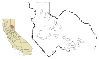
Spring Garden is a census-designated place (CDP) in Plumas County, California, United States. The population was 16 at the 2010 census, down from 55 at the 2000 census.
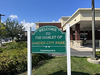
Garden City Park is a hamlet and census-designated place (CDP) located in the Town of North Hempstead in Nassau County, New York, on Long Island. It's a suburb of New York City, located approximately 20 miles (32 km) from Midtown Manhattan. The population was 7,806 at the 2010 census.
Mount Healthy Heights is a census-designated place (CDP) in Colerain Township, Hamilton County, Ohio, United States. The population was 2,918 at the 2020 census.
Sherwood is a census-designated place (CDP) in Anderson Township, Hamilton County, Ohio, United States. The population was 3,633 at the 2020 census.
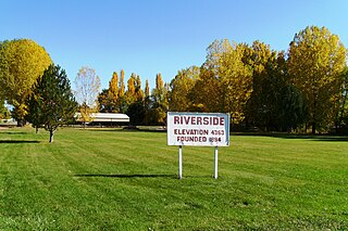
Riverside is a census-designated place (CDP) in Box Elder County, Utah, United States. The population was 760 at the 2010 census.
South Willard is a census-designated place (CDP) in Box Elder County, Utah, United States. The population was 1,571 at the 2010 census.
Cache Junction is a census-designated place (CDP) in Cache County, Utah, United States. The population was 38 at the 2010 census. It is included in the Logan, Utah-Idaho (partial) Metropolitan Statistical Area.
Cove is a census-designated place (CDP) in Cache County, Utah, United States. The population was 494 at the 2020 census. It is included in the Logan, Utah-Idaho Metropolitan Statistical Area.
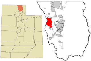
Peter also known as Petersboro is a census-designated place (CDP) on the west-central edge of Cache County, Utah, United States. The population was 324 at the 2010 census. It is included in the Logan, Utah-Idaho (partial) Metropolitan Statistical Area.
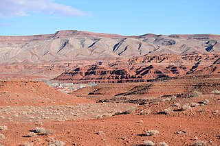
Halchita is a census-designated place (CDP) in San Juan County, Utah, United States. The population was 270 at the 2000 census.
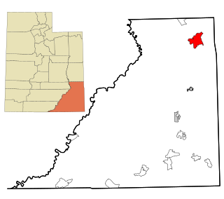
La Sal is a census-designated place (CDP) in northeastern San Juan County, Utah, United States. The population was 339 at the 2000 census. The name comes from the La Sal Mountains which means in Spanish "The Salt". The area is known for its uranium resources.
Montezuma Creek is a census-designated place (CDP) in San Juan County, Utah, United States. The population was 335 at the 2010 census, a decrease from the 2000 figure of 507.
Summit Park is a census-designated place (CDP) on the western edge of Summit County, Utah, United States. The population was 6,597 at the 2000 census.
Woodland is a census-designated place (CDP) in Summit County, Utah, United States. The population was 335 at the 2000 census and 375 at 2020 census.
Lake Shore is a census-designated place (CDP) in Utah County, Utah, United States. It is part of the Provo–Orem Metropolitan Statistical Area. The population was 817 at the 2010 census.
Palmyra is a census-designated place (CDP) in Utah County, Utah, United States. It is part of the Provo–Orem Metropolitan Statistical Area. The population was 491 at the 2010 census. Palmyra is located directly west of Springville and northwest of Spanish Fork.
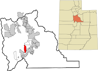
West Mountain is a census-designated place (CDP) in Utah County, Utah, United States. It is part of the Provo–Orem Metropolitan Statistical Area. As of the 2010 census, the CDP population was 1,186. The town is at the base of West Mountain and bears its name.
Timber Lakes is a census-designated place (CDP) in Wasatch County, Utah, United States. The population was 607 at the 2010 census, up from 289 in 2000.
Loveland Park is a census-designated place (CDP) located in Symmes Township, Hamilton County and Deerfield Township, Warren County, in the southwestern part of the U.S. state of Ohio. The CDP is named after the city of Loveland. The population was 1,737 at the 2020 census.
Milton is a census-designated place (CDP) in the town of Milton in Saratoga County, New York, United States. The population was 2,692 at the 2000 census.
Media related to Garden, Utah at Wikimedia Commons