Related Research Articles

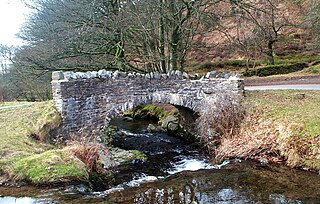
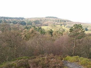
Exmoor is loosely defined as an area of hilly open moorland in west Somerset and north Devon in South West England. It is named after the River Exe, the source of which is situated in the centre of the area, two miles north-west of Simonsbath. Exmoor is more precisely defined as the area of the former ancient royal hunting forest, also called Exmoor, which was officially surveyed 1815–1818 as 18,810 acres (7,610 ha) in extent. The moor has given its name to a National Park, which includes the Brendon Hills, the East Lyn Valley, the Vale of Porlock and 55 km (34 mi) of the Bristol Channel coast. The total area of the Exmoor National Park is 692.8 km2 (267.5 sq mi), of which 71% is in Somerset and 29% in Devon.

Old Red Sandstone, abbreviated ORS, is an assemblage of rocks in the North Atlantic region largely of Devonian age. It extends in the east across Great Britain, Ireland and Norway, and in the west along the eastern seaboard of North America. It also extends northwards into Greenland and Svalbard. These areas were a part of the paleocontinent of Euramerica (Laurussia). In Britain it is a lithostratigraphic unit to which stratigraphers accord supergroup status and which is of considerable importance to early paleontology. The presence of Old in the name is to distinguish the sequence from the younger New Red Sandstone which also occurs widely throughout Britain.

The A39 is an A road in south west England. It runs south-west from Bath in Somerset through Wells, Glastonbury, Street and Bridgwater. It then follows the north coast of Somerset, Devon and Cornwall through Williton, Minehead, Porlock, Lynmouth, Barnstaple, Bideford, Stratton, Camelford, Wadebridge and St Columb Major. It then joins the route of the A30 road for around 5 miles (8.0 km), re-emerging near Zelah to head for the south Cornish coast via Truro and Falmouth.

The Lickey Hills are a range of hills in Worcestershire, England, 11 miles (18 km) to the south-west of the centre of Birmingham near the villages of Lickey, Cofton Hackett and Barnt Green. The hills are a popular country park area and they afford panoramic views over much of the surrounding countryside.

Somerset is a rural county in the southwest of England, covering 4,171 square kilometres (1,610 sq mi). It is bounded on the north-west by the Bristol Channel, on the north by Bristol and Gloucestershire, on the north-east by Wiltshire, on the south-east by Dorset, and on the south west and west by Devon. It has broad central plains with several ranges of low hills. The landscape divides into four main geological sections from the Silurian through the Devonian and Carboniferous to the Permian which influence the landscape, together with water-related features.
Oare is a village and civil parish on Oare Water on Exmoor in the Somerset West and Taunton district of Somerset, England. It is located 6 miles (10 km) east of Lynton and the parish includes the hamlet of Oareford and the village of Culbone which contains its own tiny church.
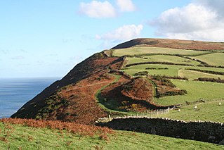
Hangman cliffs, consisting of Great Hangman and Little Hangman, are near Combe Martin on the north coast of Devon, England, where Exmoor meets the sea.
Bilberry Hill is one of the Lickey Hills in northern Worcestershire, England, 10.3 miles southwest of Birmingham and 24 miles northeast of Worcester. It stands above and to the west of the village of Cofton Hackett, and is part of the Lickey Hills Country Park.
The Lias Group or Lias is a lithostratigraphic unit found in a large area of western Europe, including the British Isles, the North Sea, the Low Countries and the north of Germany. It consists of marine limestones, shales, marls and clays.

The Mercia Mudstone Group is an early Triassic lithostratigraphic group which is widespread in Britain, especially in the English Midlands—the name is derived from the ancient kingdom of Mercia which corresponds to that area. It is frequently encountered in older literature as the Keuper Marl or Keuper Marl Series.

For the Skiddaw group of hills, see Skiddaw Group

The Sherwood Sandstone Group is a Triassic lithostratigraphic group which is widespread in Britain, especially in the English Midlands. The name is derived from Sherwood Forest in Nottinghamshire which is underlain by rocks of this age. It has economic importance as the reservoir of the Morecambe Bay gas field, the second largest gas field in the UK.

The Exeter Group is a Permian lithostratigraphic group which occurs through East Devon in southwest England. The name is derived from the city of Exeter in Devon which is partly underlain by rocks of this age.
Haffield Breccia, or Clent Breccia, consist of a texturally immature compacted gravel, rich in volcanic clasts with some sedimentary rocks, in a sandy or muddy matrix, which outcrops in the English Midlands, in South Staffordshire, Birmingham and the Malverns. It is thought to have been deposited by during flash floods in rivers that were flowing through a desert, somewhere between 200 and 280 million years ago during the Permian period. The gravel consists of angular fragments, showing that they have not been transported over long distances.

The Milford Haven Group is a late Silurian to early Devonian lithostratigraphic group in west Wales. The name is derived from the estuary and town of Milford Haven in south Pembrokeshire. The Group comprises calcareous marls with occasional sandstones along with conglomerates and breccias.

The Exmoor Group is a late Devonian to early Carboniferous lithostratigraphic group in southwest England whose outcrop extends from Croyde in north Devon east across Exmoor to Minehead in west Somerset. The group comprises the following formations :
The Tyrone Group is a lithostratigraphical term coined to refer to a particular succession of rock strata which occur in Northern Ireland within the Visean Stage of the Carboniferous Period. It comprises a series of limestones, shales and sandstones which accumulated to a thickness of 2400m in the northwest Carboniferous basin of Ireland. The type areas for the group are the Clogher Valley of County Tyrone and the Fermanagh Highlands of nearby County Fermanagh. The rocks of the group sit unconformably on older rocks of the Shanmullagh Formation of the Fintona Group which are the local representatives of the Lower Old Red Sandstone. The top of the Dartry Limestone, the uppermost part of the group, is a disconformity, above which are the layered sandstones and shales of the Meenymore Formation of the Leitrim Group. The succession continues south and west across the border into the Republic of Ireland, though different names are typically applied.
The geology of Loch Lomond and The Trossachs National Park in the southwestern part of the Scottish Highlands consists largely of Neoproterozoic and Palaeozoic bedrock faulted and folded and subjected to low grade metamorphism during the Caledonian orogeny. These older rocks, assigned to the Dalradian Supergroup, lie to the northwest of the northeast – southwest aligned Highland Boundary Fault which defines the southern edge of the Highlands. A part of this mountainous park extends south of this major geological divide into an area characterised by younger Devonian rocks which are assigned to the Old Red Sandstone.
The geology of the Peak District National Park in England is dominated by a thick succession of faulted and folded sedimentary rocks of Carboniferous age. The Peak District is often divided into a southerly White Peak where Carboniferous Limestone outcrops and a northerly Dark Peak where the overlying succession of sandstones and mudstones dominate the landscape. The scarp and dip slope landscape which characterises the Dark Peak also extends along the eastern and western margins of the park. Although older rocks are present at depth, the oldest rocks which are to be found at the surface in the national park are dolomitic limestones of the Woo Dale Limestone Formation seen where Woo Dale enters Wye Dale east of Buxton.
The geology of the North York Moors National Park in northern England is provided largely by a thick southerly dipping sequence of sedimentary rocks deposited in the Cleveland Basin during the Jurassic Period. A series of ice ages during the Quaternary period has left a variety of glacial deposits, particularly around the margins of the National Park.
References
- ↑ British Geological Survey. "Lynton Formation". BGS Lexicon of Named Rock Units. Retrieved 2 November 2019.
- ↑ British Geological Survey. "Hangman Sandstone Formation". BGS Lexicon of Named Rock Units. Retrieved 2 November 2019.
- ↑ Brosnan, Greg. "World's earliest fossilised forest discovered in Minehead, Somerset". BBC. Retrieved 7 March 2024.
- ↑ British Geological Survey. "Ilfracombe Slates Formation". BGS Lexicon of Named Rock Units. Retrieved 2 November 2019.
- ↑ British Geological Survey. "Morte Slates Formation". BGS Lexicon of Named Rock Units. Retrieved 2 November 2019.
- ↑ British Geological Survey. "Pickwell Down Sandstones Formation". BGS Lexicon of Named Rock Units. Retrieved 2 November 2019.
- ↑ British Geological Survey. "Upcott Slates Formation". BGS Lexicon of Named Rock Units. Retrieved 2 November 2019.
- ↑ British Geological Survey. "Baggy Sandstones Formation". BGS Lexicon of Named Rock Units. Retrieved 2 November 2019.
- ↑ http://www.exmoor-nationalpark.gov.uk/learning?a=116440 p4,5
- ↑ British Geological Survey. "Luccombe Breccia Formation". BGS Lexicon of Named Rock Units. Retrieved 2 November 2019.
- 1 2 3 British Geological Survey. "Sheet 278 & pt of 294 Minehead (solid & drift geology)". BGS Maps Portal. Retrieved 2 November 2019.
- ↑ Harrison,S. and Keen, D.H. in Lewis, C.A. and Richards, A.E. 2005 The glaciations of Wales and adjacent areas Logaston Press, Bristol
- ↑ "Geology of Britain viewer | British Geological Survey (BGS)". Archived from the original on 2 December 2016. Retrieved 29 October 2019.
- 1 2 "Geology on Exmoor". Exmoor National Park. Exmoor National Park Authority. Retrieved 2 November 2019.