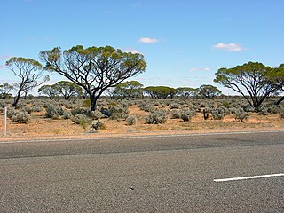
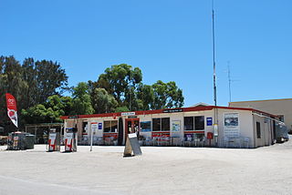
Glendambo is a town and locality in the Australian state of South Australia located on the Stuart Highway about 592 kilometres (368 mi) from the state capital of Adelaide and about 254 kilometres (158 mi) from Coober Pedy.

Innamincka, formerly Hopetoun, is a township and locality in north-east South Australia with a population of 44 people as of the 2016 census. By air it is 820 kilometres north-east of the state capital, Adelaide, and 365 kilometres north-east of the closest town, Lyndhurst. It is 66 kilometres north-east of the Moomba Gas Refinery. The town lies within the Innamincka Regional Reserve and is surrounded by the Strzelecki Desert to the south and the Sturt Stony Desert to the north. It is linked by road to Lyndhurst via the Strzelecki Track, to the Birdsville Developmental Road via Cordillo Downs Road and Arrabury Road, and the Walkers Crossing Track to the Birdsville Track. The Walkers Crossing Track is closed in summer and only traversable in dry weather. The township is situated along the Cooper Creek, a part of the Lake Eyre basin.

Cadell is a town and locality situated near the north western edge of South Australia's Riverland on the inside of the large southward bend in the Murray River. It is named after Captain Francis Cadell, a pioneer of steam-powered navigation on the Murray River. The town of Cadell was surveyed in 1919 and named in 1920. It is slightly upstream of the earlier failed village settlement of New Era, however what is now the Cadell Irrigation Area is the same as was previously the New Era irrigation area.

Yunta is a town and locality in the Australian state of South Australia located in the state's east about 275 kilometres (171 mi) north-east of the state capital of Adelaide. It is a service centre supporting both the local area and travellers passing through on the Barrier Highway. It lies south west of Broken Hill and north east of Peterborough.

Olary is a town and locality on the Barrier Highway in South Australia. It is situated near Olary Creek and is one of the easternmost settlements in South Australia. The name "Olary" was first given to a nearby well or waterhole by pastoralists Duffield, Harrold and Hurd.

Southend is a town and locality in the Australian state of South Australia located in the south-east of the state on the southern shore of Rivoli Bay about 324 kilometres (201 mi) south-east of the state capital of Adelaide.
Corny Point is a locality in the Australian state of South Australia located about 7.5 kilometres to the east of the north-western tip of the Yorke Peninsula. It was named after the nearby headland, Corny Point. The first pastoral lease was taken up in 1846 by James Coutts.
Yellabinna is a locality in the Australian state of South Australia located to the north of the town of Ceduna in the western part of the state.
Danggali is a locality in the Australian state of South Australia located about 70 kilometres north of the town of Renmark and about 230 kilometres north east of the state capital of Adelaide.
Calperum Station is a locality in the Australian state of South Australia located on the northern side of the Murray River about 10 kilometres to the north of the town of Renmark and about 250 kilometres east of the centre of the capital city of Adelaide.
Gawler Ranges is a locality in the Australian state of South Australia located on Eyre Peninsula about 380 kilometres north-west of the Adelaide city centre and about 48 kilometres north of the town centre of Wudinna and which is associated with the protected area known as the Gawler Ranges National Park.

Stuarts Creek is a remote locality in the Australian state of South Australia in the states's Far North region. The name and boundaries were formalised on 26 April 2013, named after Stuart Creek Station, in respect of the long established local name.
Emeroo is a locality in the Australian state of South Australia about 295 kilometres north of the state capital of Adelaide and about 18 kilometres northeast of Port Augusta in the state’s Far North region.
Bookabie is a town and locality in the Australian state of South Australia located on the state’s west coast overlooking the Great Australian Bight about 648 kilometres north-west of the state capital of Adelaide and about 103 kilometres west of the town centre of Ceduna.
Mount Willoughby is a locality in the Australian state of South Australia located about 837 kilometres north-west of the capital city of Adelaide and about 84 kilometres north-west of the town of Coober Pedy.
Woolundunga is a locality in the Australian state of South Australia located on the western side of the Flinders Ranges about 271 kilometres (168 mi) north of the state capital of Adelaide and about 21 kilometres (13 mi) south-east of the city of Port Augusta.
Clay Wells is a locality in the Australian state of South Australia located in the state's south-east within the Limestone Coast region about 300 kilometres (190 mi) south east of the state capital of Adelaide, and about 39 kilometres (24 mi) south-east and about 35 kilometres (22 mi) north-west respectively of the municipal seats of Robe and Millicent.
Allandale Station is a locality in the Australian state of South Australia located about 848 kilometres (527 mi) north of the state capital of Adelaide and about 20 kilometres (12 mi) south-east of the town of Oodnadatta.
Kelly is a locality in the Australian state of South Australia located on the Eyre Peninsula about 270 kilometres (170 mi) north-west of the state capital of Adelaide and about 13 kilometres (8.1 mi) south-east of the municipal seat in Kimba.
Mount Clarence Station is a locality in the Australian state of South Australia located about 771 kilometres (479 mi) north-west of the state capital of Adelaide and about 37 kilometres (23 mi) west of the town of Coober Pedy.
