Skelton Glacier is a large glacier flowing from the polar plateau into the Ross Ice Shelf at Skelton Inlet on the Hillary Coast, south of Victoria Land, Antarctica.
The Ohio Range is a range in the Transantarctic Mountains of Antarctica. It is about 30 nautical miles long and 10 nautical miles wide, extending west-southwest – east-northeast from Eldridge Peak to Mirsky Ledge. The range forms the northeast end of the Horlick Mountains and consists primarily of a large snow-topped plateau with steep northern cliffs and several flat-topped ridges and mountains. The highest point, 2,990 metres (9,810 ft), is the summit of Mount Schopf.
The Tapley Mountains is a range of mountains fronting on the eastern side of the Scott Glacier, extending eastward for 35 nautical miles between Leverett Glacier and Albanus Glacier in the Queen Maud Mountains of Antarctica.
The Keltie Glacier is a large Antarctic glacier, 30 nautical miles (56 km) long, draining from Pain Névé southwest around the southern extremity of the Commonwealth Range, and then northwest to enter Beardmore Glacier at Ranfurly Point. It was discovered by the British Antarctic Expedition, 1907–09, under Ernest Shackleton, who named it for Sir John Scott Keltie, Secretary of the Royal Geographical Society, 1892–1915.
The Prince Olav Mountains is a mountain group in the Queen Maud Mountains in Antarctica stretching from Shackleton Glacier to Liv Glacier at the head of the Ross Ice Shelf.

Yochelson Ridge is a rugged, partly snow-covered ridge, about 4 miles (6 km) long, extending north-northwest from Eley Peak, Soholt Peaks, in the Heritage Range, Ellsworth Mountains. It was mapped by United States Geological Survey (USGS) from surveys and U.S. Navy aerial photographs from 1961 to 1966. It was named by the Advisory Committee on Antarctic Names (US-ACAN) after Ellis L. Yochelson, a USGS geologist at the National Museum of Natural History in Washington, DC and a paleontologist with the United States Antarctic Research Program (USARP) Ellsworth Mountains Expedition of 1979–80.
Ahrnsbrak Glacier is a glacier in the Enterprise Hills of the Heritage Range in Antarctica, flowing north between Sutton Peak and Shoemaker Peak to the confluent ice at the lower end of Union Glacier. It was mapped by the United States Geological Survey from surveys and U.S. Navy air photos, 1961–66, and was named by the Advisory Committee on Antarctic Names for William F. Ahrnsbrak of the United States Antarctic Research Program, a glaciologist at Palmer Station in 1965.
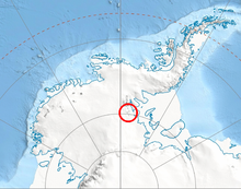
On the continent of Antarctica, the Aramis Range is the third range south in the Prince Charles Mountains, situated 11 miles southeast of the Porthos Range and extending for about 30 miles in a southwest–northeast direction. It was first visited in January 1957 by Australian National Antarctic Research Expeditions (ANARE) southern party led by W.G. Bewsher, who named it for a character in Alexandre Dumas' novel The Three Musketeers, the most popular book read on the southern journey.
Balish Glacier is a glacier, 18 nautical miles (33 km) long, flowing north from the Soholt Peaks to enter Splettstoesser Glacier just northeast of Springer Peak, in the Heritage Range, Ellsworth Mountains. It was mapped by the United States Geological Survey from surveys and from U.S. Navy air photos, 1961–66, and was named by the Advisory Committee on Antarctic Names for Commander Daniel Balish, Executive Officer of U.S. Navy Squadron VX-6 during Operation Deep Freeze 1965, and Commanding Officer in 1967.
The Brown Hills are a group of mainly snow-free hills in the Cook Mountains of Antarctica.
Cochran Peak is a sharp peak rising in the southern part of the Gifford Peaks, in the Heritage Range, Ellsworth Mountains. It was mapped by the United States Geological Survey from ground surveys and from U.S. Navy air photos, 1961–66, and named by the Advisory Committee on Antarctic Names for Henry B. Cochran, International Geophysical Year weather central meteorologist at Little America V in 1958.
Conglomerate Ridge is a ridge, 1 nautical mile (2 km) long, located 4 nautical miles (7 km) east-southeast of Mount Bursik in the Soholt Peaks, Heritage Range, Ellsworth Mountains of Antarctica. The ridge trends northwest–southeast and rises to about 1,650 metres (5,400 ft). It was so named from the conglomerate composition of the ridge by Gerald F. Webers, leader of the United States Antarctic Research Program Ellsworth Mountains Expedition, 1979–80.
Navigator Peak is a sharp and prominent peak, 1,910 m, standing 4 nautical miles (7 km) east of Zavis Peak in the north part of the White Escarpment, Heritage Range. It was named by the University of Minnesota Geological Party to these mountains in 1963–64 because the peak served as a landmark to navigators and pilots returning to camp from flights in the southern part of the Heritage Range.
Fendorf Glacier is a broad glacier draining from the eastern slopes of the Gifford Peaks and flowing north to merge with Dobbratz Glacier, in the Heritage Range of the Ellsworth Mountains, Antarctica. It was mapped by the United States Geological Survey from ground surveys and U.S. Navy air photos, 1961–66, and was named by the Advisory Committee on Antarctic Names for Lieutenant Commander James E. Fendorf, U.S. Navy, a pilot with Squadron VX-6 during Operation Deep Freeze 1966.
The Marshall Mountains are a group of mountains overlooking Beardmore Glacier in the Queen Alexandra Range, Antarctica. They are bounded on the north by Berwick Glacier, and on the south by Swinford Glacier.
Hurst Peak is a prominent rock peak, with an altitude of 1,790 metres (5,870 ft), at the southern end of the Webers Peaks in the Heritage Range of Antarctica. It was named by the University of Minnesota Geological Party, 1963–64, for aviation machinist James E. Hurst, who served as a crew member aboard the LC-47 aircraft that made the first 1963–64 flight to the Ellsworth Mountains.
Soholt Peaks are a group of rugged, ice-free peaks rising between Gifford Peaks and Drake Icefall in the Heritage Range of the Ellsworth Mountains in Antarctica. They were named by the University of Minnesota Ellsworth Mountains Party of 1962–63 for Donald E. Soholt, a geologist with that party. The Soholt Peaks were first traversed in December 2013 by Ralf Laier, Pachi Ibarra and Seth Timpano in Alpine style. The expedition was split into two phases due to adverse weather conditions and lasted in total eight days and six nights. It included the First Ascent of First Soholt Peak 2328m, Eley Peak (2311m), Lillywhite Peak (2321m), Fourth Peak (22610m), Rooster Comb Ridge (2250m), Cerro Catedral (2412m), Mount Macalester (2480m) and also the First Descent via the Phylon Ice Fall.
Splettstoesser Glacier is a glacier, 35 nautical miles long, draining from the plateau just south of Founders Escarpment and flowing east-northeast through the Heritage Range to the south of Founders Peaks and Anderson Massif to enter the Minnesota Glacier. Named by the University of Minnesota Ellsworth Mountains Party which explored the area in 1961-62 for John F. Splettstoesser, geologist with that party.
Lamb Peak is a conspicuous bare rock peak located 2 nautical miles (4 km) south-southeast of Maagoe Peak in the Gifford Peaks of the Heritage Range, Ellsworth Mountains, Antarctica. It was mapped by the United States Geological Survey from surveys and U.S. Navy air photos from 1961 to 1966, and was named by the Advisory Committee on Antarctic Names for Lieutenant Commander Arthur D. Lamb, who contributed to the success of austral summer resupply activities for three seasons in his capacity as operations and communications officer through U.S. Navy Operation Deep Freeze 1966.

Donnellan Glacier is a steep valley glacier fed by highland ice adjacent to Opalchenie Peak and Fukushima Peak on Vinson Plateau, the summit plateau of Vinson Massif, in the Sentinel Range of the Ellsworth Mountains, Antarctica. The glacier flows west-southwestward from Opalchenie Peak along the northwest side of Mount Slaughter into Nimitz Glacier.