
Gilliat is an abandoned outback town in the locality of Julia Creek in the Shire of Mckinlay, Queensland, Australia. [1]
Gilliat is an abandoned outback town in the locality of Julia Creek in the Shire of Mckinlay, Queensland, Australia. [1]
The town is adjacent to the Gilliat railway station ( 20°41′29″S141°29′57″E / 20.6913°S 141.4992°E ) on the Great Northern railway line.
As at 2020, there is only one building in the town ( 20°41′24″S141°30′00″E / 20.6899°S 141.5001°E ). [2]
The area was originally traversed by Ludwig Leichhardt. The first Europeans to take advantage of the region’s pastoral potential were Duncan and Donald McIntyre. In 1862, these two men brought a substantial number of sheep into the area, but poor seasons, isolation and adverse weather conditions caused their venture to fail. Later, the area was explored in a more systematic way with permanent pastoral settlements such as Dalgonally and Lara being established. [3]
The town of Gilliat was initially surveyed as a railway town on 17 November 1900 by James Stroud. The settlement was originally located adjacent to Eddington Station ( 20°39′59″S141°28′34″E / 20.6665°S 141.47608°E ), on the road which crossed the eastern channel of the Gilliat River. However, the settlement was subsequently moved to its present site due to on-going flooding of the original site. The name Gilliat is said to be derived from a Mr Gilliat who had previously been sent from the Bowen River area to establish Lara Station. [3]
The town of Gilliat is shown on a 1907 survey plan. [1]
The town experienced intermittent growth and decline throughout its life. As with many other settlements in isolated areas, its viability was tied to the prosperity of the industries or commercial activity in the surrounding area. During its more prosperous times, the town had a telegraph office, situated at the point where the rail line crossed the Gilliat River. A postal receiving office was also opened in 1900, moving along with the town, to the railway site in around 1906. When the Gilliat railway station opened in 1909, a permanent post office was established, maintaining operations until 1973. [3]
At the Queensland Country Women's Association annual conference in August 1930, the Gilliart branch proposed that the association should work to establish a school at Gilliat as there were 31 school-aged children in the district and the association voted to do so. [4] Gilliart State School opened circa 1931 but closed circa 1934. [5]
The town’s hotel was called the Eddington, which was originally established soon after the town’s formation, with Isobel Walters as the first licensee. This hotel eventually changed its name to the Eddington Arms and remained in business until 2000, with its closure effectively marking the end of the town. As well, Shell operated a depot here from around 1939 until its eventual de-commissioning. [3]

Chillagoe is a rural town and locality in the Shire of Mareeba, Queensland, Australia. In the 2016 census the locality of Chillagoe had a population of 251 people.

Banana is a rural town and locality in the Shire of Banana, Queensland, Australia. In the 2016 census, the locality of Banana had a population of 356 people.

Normanton is an outback town and coastal locality in the Shire of Carpentaria, Queensland, Australia. In the 2016 census the locality of Normanton had a population of 1,257 people, of whom 750 (60%) identified as Aboriginal and/or Torres Strait Islander people, while the town of Normanton had a population of 1,210 people, of whom 743 (62%) identified as Aboriginal and/or Torres Strait Islander people.

Croydon is a town and locality within the Shire of Croydon in Queensland, Australia. It is a terminus for the Normanton to Croydon railway line, which operates the Gulflander tourist train. At the 2016 census, Croydon had a population of 258 people.

Nobby is a rural town and locality on the Darling Downs in the Toowoomba Region, Queensland, Australia. It is located halfway between Toowoomba and Warwick. In the 2016 census, Nobby had a population of 563 people.

Drayton is a rural locality in the Toowoomba Region, Queensland, Australia. In the 2016 census, Drayton had a population of 1,710 people.
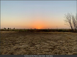
Julia Creek is an outback town and locality in the Shire of Mckinlay, Queensland, Australia. In the 2016 census, the locality of Julia Creek had a population of 511 people.

Pittsworth is a rural town and locality in the Toowoomba Region, Queensland, Australia. In the 2016 census, the locality of Pittsworth had a population of 3,294 people.

Richmond is a rural town and locality in the Shire of Richmond, Queensland, Australia. In the 2016 census, the locality of Richmond had a population of 648 people.

Kowanyama is a town and coastal locality in the Aboriginal Shire of Kowanyama, Queensland, Australia.

St Lawrence is a rural town and locality in the Isaac Region, Queensland, Australia. In the 2016 census the locality of St Lawrence had a population of 235 people.

The Shire of Mckinlay is a local government area in outback north-western Queensland, Australia.

Thallon is a town and a locality in the Shire of Balonne, Queensland, Australia. In the 2016 census, Thallon had a population of 257 people.

Acland is a rural town and locality in the Toowoomba Region, Queensland, Australia. In the 2016 census the locality of Acland had a population of 32 people.
Adavale is a rural town and locality in the Shire of Quilpie, Queensland, Australia. In the 2016 census, the locality of Adavale had a population of 93 people.

Maxwelton is an outback town and locality in the Shire of Richmond in central north Queensland, Australia. In the 2016 census, the locality of Maxwelton had a population of 22 people.
Marathon is a rural town and locality in the Flinders Shire, Queensland, Australia. Although the town has existed since circa 1916, the locality was created in November 2021.

Taldora is an outback locality in the Shire of Mckinlay, Queensland, Australia. In the 2016 census Taldora had a population of 37 people.
Richmond–Winton Road is a continuous 145 kilometres (90 mi) road route in the Richmond and Winton local government areas of Queensland, Australia. It is a state-controlled district road rated as a local road of regional significance (LRRS). It is part of the shortest route from the Croydon / Georgetown area to Winton and Longreach. It is also part of the inland freight network linking cattle properties to major freight routes on the Landsborough and Flinders highways.
Cloncurry–Dajarra Road is a continuous 169 kilometres (105 mi) road route in the Cloncurry local government area of Queensland, Australia. It is a state-controlled district road rated as a local road of regional significance (LRRS). It is a north-east to south-west link between the Barkly Highway and the Diamantina Developmental Road, servicing a number of cattle grazing and production areas in northern Queensland.
{{cite web}}: CS1 maint: url-status (link) ![]() This Wikipedia article incorporates text from Queensland Places - Gillart (30 May 2017) published by the State Library of Queensland under CC-BY licence , accessed on 1 January 2021.
This Wikipedia article incorporates text from Queensland Places - Gillart (30 May 2017) published by the State Library of Queensland under CC-BY licence , accessed on 1 January 2021.
{{cite web}}: CS1 maint: url-status (link) — both old and new location are shown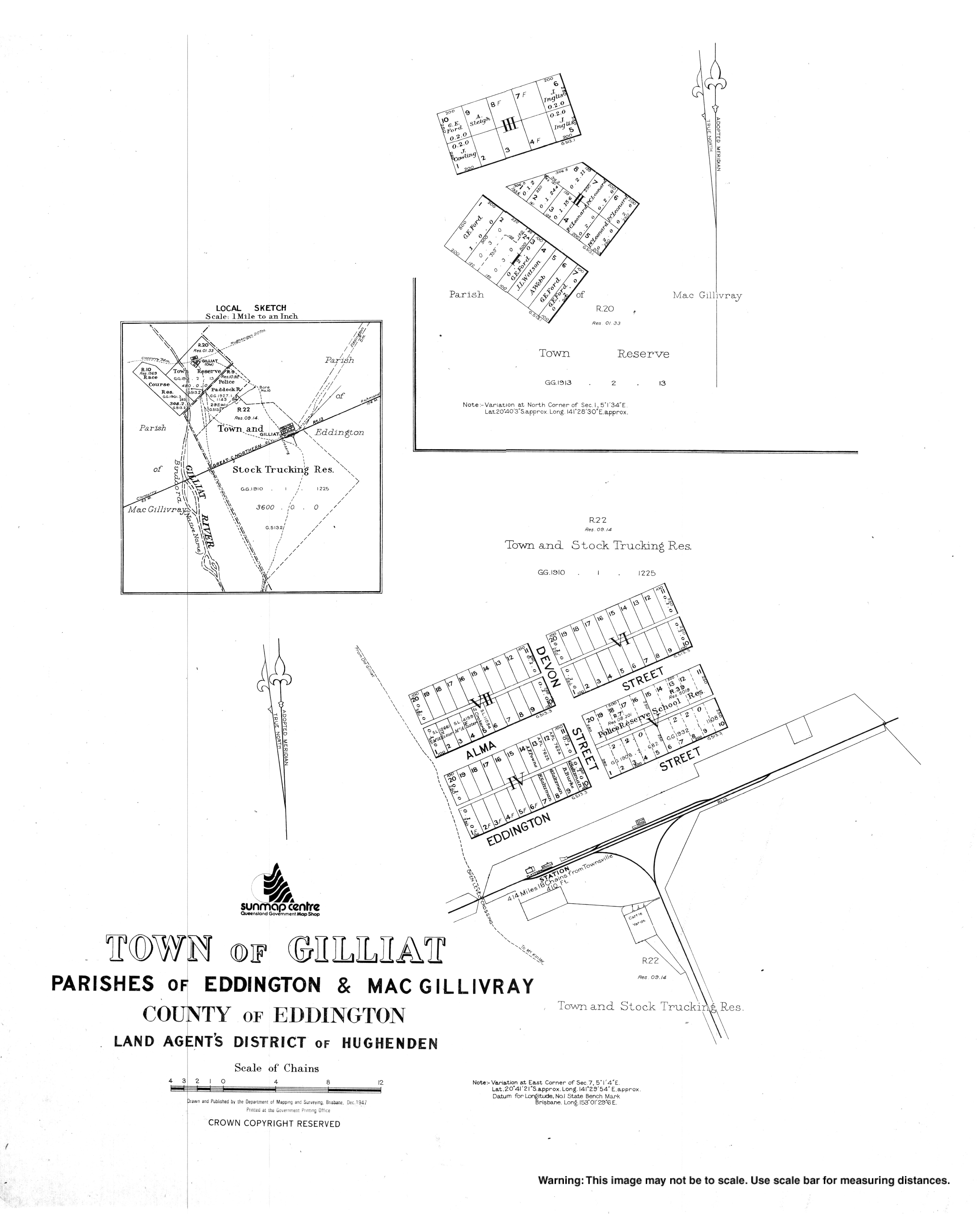