Glen Flora, Texas

Last updated
Glen Flora, Texas
Relief map of Texas.png
Red pog.svg
Glen Flora, Texas
Location within the state of Texas
Coordinates: 29°20′51″N96°11′36″W / 29.34750°N 96.19333°W / 29.34750; -96.19333 Coordinates: 29°20′51″N96°11′36″W / 29.34750°N 96.19333°W / 29.34750; -96.19333
Country United States
State Texas
County Wharton
Elevation
118 ft (36 m)
Time zone UTC-6 (Central (CST))
  Summer (DST) UTC-5 (CDT)
ZIP code
77443
Area code 979

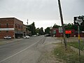
Glen Flora is an unincorporated community in Wharton County, Texas, United States. According to the Handbook of Texas, the community had an estimated population of 210 in 2000. It is located within the Greater Houston metropolitan area.

Contents

History

John C. Clark and Robert Kuykendall of Stephen F. Austin's Old Three Hundred were some of the first settlers in Glen Flora. C. H. Waterhouse relocated to Wharton County around 1890 and bought substantial parcels of land on the Colorado River's west bank. To tenant-farm his land, he invited German families from his native Pennsylvania. A cotton gin and a sizable sugar mill were built by him across the river from his house. The pumping facility was touted as being the biggest in Texas. The Waterhouse Rice and Sugar Company underwent multiple name changes as well as ownership changes. When partners were added, it was first known as Waterhouse; after that, it changed its name to Pittsburg-Glen Flora Sugar Company; after being sold, it was given the name Kincheloe Irrigation Company (as it was located in one of the Kincheloe leagues). R. H. Hancock then resold it under the name Wharton County Irrigation Company. Almost a mile west of the sugar plant, the German people settled. Waterhouse designated five acres of that land for a chapel and a cemetery. Vesperville was the name given to the community by the locals. They constructed St. John's Lutheran in 1895; its services were only held in German. During its stay at this location, the church edifice was completely destroyed three times: by a hurricane in 1909, by a tornado in 1910, and by a fire in 1918. The next year, the congregation relocated the church to Glen Flora, but the brand-new building was obliterated by a tornado in 1929. The congregation chose to relocate the fifth building to Wharton and rename it St. Paul's Lutheran because there was already a church there with that name. This decision was made in 1941. The townsite of Glen Flora was founded in 1898 on the east side of the Colorado River, just across from the Waterhouse factory, following the building of the Cane Belt Railroad. William Thomas Eldridge and William Dunovant were two of the principal railroad investors. One of these two men has a street named after him in Glen Flora, one on either side of the railroad tracks. Eldridge fatally shot Dunovant in 1902 as he was on one of their trains. August 1900 saw the opening of the local post office, and May 1902 saw the formation of the Glen Flora Town Corporation, with Waterhouse serving as its president. 1906 saw a reorganization, with G. C. Gifford serving as president. William Hood, who co-owned and ran a mercantile establishment in the neighborhood with R. M. Martin, proposed the name Glen Flora; it was also the name of Hood's plantation. Hood later constructed a large three-story brick building there after the store was relocated to the townsite. The community expanded quickly and housed a wide variety of companies, including several mercantile shops, two cotton gins, a meat market, a drugstore, a hotel, a bank, a gristmill, a lumberyard, and eventually a movie theater, and a telephone company. To transport its cane and cotton to the Cane Belt Railroad for shipping, the sugar mill was permitted by the county commissioners to build a rail line that ran down the middle of the bridge over the Colorado. Mules would pull the carriages. Rich farmlands surround Glen Flora. Rice, corn, and cotton became significant cash crops after sugarcane's fall; before scab put an end to that business, potatoes were farmed and exported out by the carload. A sizable commercial fruit orchard was started in the early 1980s, and a neighborhood store for sales was constructed. After 1960, Glen Flora's population started to fall, and as residents started migrating to Wharton, businesses there started to collapse. The Atchison, Topeka and Santa Fe Railway, sometimes known as the "Cane Belt," stopped providing service in 1992. The right-of-way was sold or given back to the contingent landowners once the railroad track, ties, and gravel bed were taken out. The population was 210 from 1980 through 2000. [1]

On November 21, 1992, an F1 tornado destroyed several barns northeast of the community. [2] Four homes were damaged by another tornado on November 23, 2004. [3]

Glen Flora has a post office with the zip code 77443. [4]

Geography

It is located at the junction of FM 102 and FM 960, 6 miles (9.7 km) northwest of Wharton, 17 miles (27.4 km) south of Eagle Lake and 5 miles (8.0 km) south of the unincorporated community of Egypt. [5]

Education

Glen Flora School District was established sometime after 1900 and had 37 students and one teacher in 1905. There were two separate schools for Black children in the community. The school for White students joined the Crescent school district in 1948 until it became a part of the larger El Campo Independent School District. Both black schools soon came together as one and was named for principal Thomas Lane Pink. Starting in 1961, all students went to either El Campo or Wharton Independent School District after schools were desegregated. [1]

Notable people

Related Research Articles

<span class="mw-page-title-main">Windsor, Colorado</span> Town in Colorado, United States

Windsor is a home rule municipality in Larimer and Weld counties in the U.S. state of Colorado. According to the 2020 census, the population of the town was 32,716. Windsor is located in the Northern Colorado region.

<span class="mw-page-title-main">Temple, Texas</span> City in Texas, United States

Temple is a city in Bell County, Texas, United States. As of 2020, the city has a population of 82,073 according to the U.S. census, and is one of the two principal cities in Bell County.

<span class="mw-page-title-main">Sweeny, Texas</span> City in Texas, United States

Sweeny is a city in Brazoria County, Texas, United States, the westernmost incorporated town in the county. The population is 3,626 as of 2020. The city's motto is "A City with Pride". The city was once known as Adamston.

<span class="mw-page-title-main">Hungerford, Texas</span> CDP in Texas, United States

Hungerford is a census-designated place (CDP) in northeastern Wharton County, Texas, United States. U.S. Route 59, Texas State Highway 60, and Farm to Market Road 1161 intersect in the community. The Kansas City Southern Railway Co. passes through Hungerford. The population was 347 at the 2010 census. It is located on what in the 1820s was part of colonist Alexander Jackson's land grant north of George E. Quinan's home. By the 1870s, the Quinan settlement grew up a short distance away, but its residents moved to the new town when the railroad came through Hungerford.

<span class="mw-page-title-main">Wharton, Texas</span> City in Texas, United States

Wharton is a city in and the county seat of Wharton County, Texas, United States. This city is 60 mi (97 km) southwest of Houston. Its population was 8,832 at the 2010 census and 8,627 at the 2020 census. Wharton is located on the Colorado River of Texas. U.S. Highway 59 passes west of it.

<span class="mw-page-title-main">Neches, Texas</span> Unincorporated community in Texas, United States

Neches is an unincorporated community in east central Anderson County, in the U.S. state of Texas. According to the Handbook of Texas, the community had a population of 175 in 2000. It is located within the Palestine, Texas micropolitan area.

<span class="mw-page-title-main">Foster, Fort Bend County, Texas</span> Unincorporated community in Texas, United States

Foster exists in memory as a pioneer Texas community that is located in Fort Bend County, Texas, United States along Farm to Market Road 359, beginning approximately 1.0 mile (1.6 km) northwest of its intersection with Farm to Market Road 723. It is considered by local homeowners to be an unincorporated community.

<span class="mw-page-title-main">Bonus, Texas</span> Unincorporated community in Texas, United States

Bonus is an unincorporated community in northern Wharton County, Texas, United States located about 15 miles (24 km) north of Wharton near the intersection of Farm to Market Road 102 and Farm to Market Road 2614.

<span class="mw-page-title-main">Egypt, Wharton County, Texas</span> Unincorporated community in Texas, United States

Egypt is an unincorporated community in northern Wharton County in the U.S. state of Texas. According to the Handbook of Texas, the community had a population of 26 in 2000. It is located within the Greater Houston metropolitan area.

<span class="mw-page-title-main">Caney Creek (Matagorda Bay)</span> River in Texas, US

Caney Creek (Matagorda Bay) is a river in Texas that begins northwest of Wharton, flows generally southeast, and empties into the Gulf of Mexico near Sargent. The major waterway to the west is the Colorado River while the next major waterway to the east is the San Bernard River.

Pierce is an unincorporated community in Wharton County, Texas, United States. According to the Handbook of Texas, Pierce had an estimated population of 49 in 2000. It is located within the Greater Houston metropolitan area.

<span class="mw-page-title-main">Lane City, Texas</span> Unincorporated community in Texas, United States

Lane City is an unincorporated community in Wharton County, Texas, United States. According to the Handbook of Texas, the community had an estimated population of 111 in 2000. It is located within the Greater Houston metro area.

Alexander is an unincorporated community located in southern Erath County in Central Texas. Alexander is in the southern part of the county along Texas State Highway 6 and Fm-914. The town was originally called: "Harper's Mill" when the Post Office was approved for operation around the 1870s. The name was changed in the 1880s when the Texas Central line part of the historic Katy Railroad was built from east to west through the townsite on its way from the Waco area to Stamford with a branch to Cross Plains from the line at De Leon. In 1907 the Stephenville North and South Texas Railway part of the Cotton Belt Route was constructed from north to south and crossed with the Katy's line in Alexander. This made the town an important community for business in the area. The Cotton Belt Route ran from Stephenville through to nearby Carlton. On October 17, 1934, the Cotton Belt Route was abandoned from Stephenville to Hamilton. The Katy Railroad remained through Alexander until its abandonment in the late 1960s. The Alexander post office closed in 1970 and the population remained at a steady 40 from the 1970s through 2000.

<span class="mw-page-title-main">Farm to Market Road 102</span> Highway

Farm to Market Road 102 (FM 102) is a state highway in the U.S. state of Texas. The highway begins at State Highway 60 (SH 60) in Wharton in Wharton County. It heads northwest through Eagle Lake in Colorado County and ends at Interstate 10 (I-10) near Alleyton, which is just east of Columbus in Colorado County.

<span class="mw-page-title-main">Farm to Market Road 960</span>

Farm to Market Road 960 (FM 960) is a state highway in the U.S. state of Texas that stays within Wharton County. The two-lane road starts at Future Business Interstate 69 /Business U.S. Route 59-S (Bus 59) northeast of El Campo, goes in a northerly direction through farmlands and ends at FM 102 at Glen Flora.

Matthews is an unincorporated community on the southeastern edge of Colorado County, in the U.S. state of Texas. The community is located south of Eagle Lake near the junction of FM 102 and FM 950. The settlement was named for a man who owned an area plantation before the American Civil War. By 2013, the school, post office, businesses and railroad line that once served Matthews were gone, but the number of silos in the neighborhood indicated that the land was still being intensively farmed.

<span class="mw-page-title-main">Cane Belt Railroad</span>

The Cane Belt Railroad was chartered in the U.S. state of Texas in 1898. Formed by a group of businessmen from Eagle Lake, the short-line railroad was intended to bring the area's sugarcane to market. In 1902 a disagreement between two of the railroad's chief promoters proved deadly. By 1904 the line was in operation from Sealy to Matagorda on the Gulf of Mexico. That year the company's stock was bought by the Atchison, Topeka and Santa Fe Railway and the line continued operations under lease to the Gulf, Colorado and Santa Fe Railway starting in 1905. By the 1920s, the local sugarcane industry collapsed but the railroad was saved by the discovery of two nearby sulphur mines. In 1948, the Cane Belt was merged into the Gulf, Colorado and Santa Fe Railway. In the 1990s most of the original line was abandoned after the last sulphur mine closed. By 2013, only a small portion of the line south of Bay City was operating as part of the BNSF Railway.

Duke is a ghost town in Fort Bend County, in the U.S. state of Texas. The former settlement's location was west of Arcola along the BNSF Railway near Houston Southwest Airport. In 2014 the town site was no longer accessible by public roads.

<span class="mw-page-title-main">Don-Tol, Texas</span> Unincorporated community in Texas, United States

Don-Tol is a small unincorporated community in southeastern Wharton County, in the U.S. state of Texas. The community is located along FM 1301 southeast of Boling. There is a Don-Tol sign on FM 1301 at County Road 100. The name was used by Mexican workers to address William Toliver Taylor, the owner of a post-Civil War sugar cane plantation.

Bono is an unincorporated community in Johnson County, Texas. Located on Farm to Market Road 2331 in the southwestern portion of the county, Bono is a mile west of U.S. Highway 67.

References

  1. 1 2 "Glen Flora, Texas". The Handbook of Texas online. Retrieved 2009-08-11.
  2. Texas Event Report: F1 Tornado (Report). National Centers for Environmental Information. 1992. Retrieved January 27, 2023.
  3. National Weather Service in Houston, Texas (2004). [Texas Event Report: F0 Tornado] (Report). National Centers for Environmental Information. Retrieved January 25, 2023.
  4. USPS – Cities by ZIP Code
  5. "Glen Flora, Texas". Texas Escapes Online Magazine. Retrieved 2009-08-11.
  6. "Hall of Honor". Texas Military Forces Museum.
  7. "Iris Kyle Wins Ms International at the Arnold Sports Festival". docstoc.com. Retrieved March 24, 2013.