Eagle Lake, Texas

Last updated

Eagle Lake
Aeaglelake.jpg
The 100 block of McCarty Ave, part of the Eagle Lake Commercial Historic District
Colorado County EagleLake.svg
Location of Eagle Lake, Texas
Coordinates: 29°35′16″N96°19′48″W / 29.58778°N 96.33000°W / 29.58778; -96.33000
Country United States
State Texas
County Colorado
Area
[1]
  Total2.94 sq mi (7.61 km2)
  Land2.93 sq mi (7.59 km2)
  Water0.01 sq mi (0.02 km2)
Elevation
174 ft (53 m)
Population
 (2020)
  Total3,442
  Density1,288.64/sq mi (497.54/km2)
Time zone UTC-6 (Central (CST))
  Summer (DST) UTC-5 (CDT)
ZIP code
77434
Area code 979
FIPS code 48-21844 [2]
GNIS feature ID1334847 [3]
Website coeltx.net

Eagle Lake is a city in southeastern Colorado County, Texas, United States. The population was 3,442 at the 2020 census. [4] It is home to a golf course, the largest private lake in Texas, [5] and the Eagle Lake Regional Airport, which serves light aircraft.

Contents

The lake, along with adjacent rice paddies, attracts a large variety of migratory birds. The city is known as the "Goose-hunting Capital of the World" and also borders a wildlife preserve.

History

The first newspaper in Eagle Lake was established by Joseph J. Mansfield in 1888. [6]

Geography

Eagle Lake is located in eastern Colorado County at 29°35′16″N96°19′48″W / 29.587790°N 96.330128°W / 29.587790; -96.330128 . [7]

U.S. Route 90 Alternate (US 90 Alt.) travels through Eagle Lake, leading east 66 miles (106 km) to Houston and west 38 miles (61 km) to Hallettsville. Eagle Lake is 16 miles (26 km) southeast of Columbus, the Colorado County seat.

According to the United States Census Bureau, the city of Eagle Lake has a total area of 2.8 square miles (7.2 km2), of which 0.004 square miles (0.01 km2), or 0.19%, is covered by water. [4]

Demographics

Historical population
CensusPop.Note
1880 406
1890 76989.4%
1900 1,10744.0%
1910 1,71755.1%
1920 2,01717.5%
1930 2,34316.2%
1940 2,124−9.3%
1950 2,78731.2%
1960 3,56527.9%
1970 3,5870.6%
1980 3,9219.3%
1990 3,551−9.4%
2000 3,6643.2%
2010 3,639−0.7%
2020 3,442−5.4%
U.S. Decennial Census [8]
Eagle Lake racial composition as of 2020 [9]
(NH = Non-Hispanic) [lower-alpha 1]
RaceNumberPercentage
White (NH)67819.7%
Black or African American (NH)68119.79%
Native American or Alaska Native (NH)40.12%
Asian (NH)60.17%
Some Other Race (NH)100.29%
Mixed/Multi-Racial (NH)461.34%
Hispanic or Latino 2,01758.6%
Total3,442

As of the 2020 United States census, there were 3,442 people, 1,109 households, and 782 families residing in the city.

As of the census [2] of 2000, 3,664 people, 1,296 households, and 935 families resided in the city. The population density was 1,344.6 inhabitants per square mile (519.2/km2). The 1,500 housing units averaged 550.5/sq mi (212.9/km2). The racial makeup of the city was 52.78% White, 23.39% African American, 0.66% Native American, 0.03% Pacific Islander, 20.47% from other races, and 2.67% from two or more races. Hispanics or Latinos of any race were 44.21% of the population.

Of the 1,296 households, 36.3% had children under the age of 18 living with them, 52.0% were married couples living together, 16.5% had a female householder with no husband present, and 27.8% were not families. About 23.8% of all households were made up of individuals, and 11.5% had someone living alone who was 65 years of age or older. The average household size was 2.78 and the average family size was 3.31.

In the city, the population was distributed as 29.9% under the age of 18, 9.2% from 18 to 24, 25.0% from 25 to 44, 22.0% from 45 to 64, and 13.9% who were 65 years of age or older. The median age was 34 years. For every 100 females, there were 95.9 males. For every 100 females age 18 and over, there were 91.9 males.

Economy

Historically, Eagle Lake has been an agricultural community, with rice being the main crop. Other key products include cotton, grain, and cattle, along with sand and gravel from mines in the surrounding area.

In the 2000 census, the median income for a household in the city was $27,101, and for a family was $29,201. Males had a median income of $26,025 versus $20,299 for females. The per capita income for the city was $12,426. About 15.0% of families and 19.7% of the population were below the poverty line, including 24.0% of those under age 18 and 17.8% of those age 65 or over.

Education

Eagle Lake is served by the Rice Consolidated Independent School District.

The Eula and David Wintermann Library is the public library in the city, opened on February 9, 1975. Mr. and Mrs. David R. Wintermann had originally proposed to erect and furnish the new library building in 1973. Architect for the project was Arthur J. Willrodt of Columbus, Texas. [11] It replaced the existing library, which was housed in a small portion of the Community Center.

The designated community college for Rice CISD is Wharton County Junior College. [12]

Notable person

Ryan Trahan, YouTuber and content creator

Media

The city is served by a weekly newspaper, the Colorado County Citizen.

See also

Related Research Articles

<span class="mw-page-title-main">Scurry County, Texas</span> County in Texas, United States

Scurry County is a county located in the U.S. state of Texas. As of the 2020 census, its population was 16,932. Its county seat is Snyder, which is the home for Western Texas College. Scurry County is named for Confederate General William Scurry. The county was created in 1876 and organized in 1884. Scurry County was one of 46 prohibition, or entirely dry, counties in the state of Texas, until a 2006 election approved the sale of beer and wine in Snyder, and a 2008 election approved the sale of liquor by the drink throughout the county.

<span class="mw-page-title-main">Mitchell County, Texas</span> County in Texas, United States

Mitchell County is a county in the U.S. state of Texas. As of the 2020 census, its population was 8,990. Its county seat is Colorado City. The county was created in 1876 and organized in 1881. It is named for Asa and Eli Mitchell, two early settlers and soldiers in the Texas Revolution.

<span class="mw-page-title-main">Matagorda County, Texas</span> County in Texas, United States

Matagorda County is a county located in the U.S. state of Texas. As of the 2020 census, the population was 36,255. Its county seat is Bay City, not to be confused with the larger Baytown in Harris and Chambers Counties. Matagorda County is named for the canebrakes that once grew along the coast.

<span class="mw-page-title-main">Jackson County, Texas</span> County in Texas, United States

Jackson County is a county in the U.S. state of Texas. As of the 2020 census its population was 14,988. Its county seat is Edna. The county was created in 1835 as a municipality in Mexico and in 1836 was organized as a county. It is named for Andrew Jackson, President of the United States from 1829 to 1837.

<span class="mw-page-title-main">Cooke County, Texas</span> County in Texas, United States

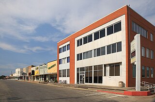
Cooke County is a county in the U.S. state of Texas. At the 2020 census, its population was 41,668. The county seat is Gainesville. The county was founded in 1848 and organized the next year. It is named for William Gordon Cooke, a soldier during the Texas Revolution. It is a part of the Texoma region.

<span class="mw-page-title-main">Colorado County, Texas</span> County in Texas, United States

Colorado County is a county located in the U.S. state of Texas. As of the 2020 census, its population was 20,557. Its county seat is Columbus. It is named for the Colorado River of Texas. The county was founded in 1836 and organized the next year.

<span class="mw-page-title-main">Burlington, Kansas</span> City in Coffey County, Kansas, United States

Burlington is a city in and the county seat of Coffey County, Kansas, United States. As of the 2020 census, the population of the city was 2,634.

<span class="mw-page-title-main">Parsons, Kansas</span> City in Labette County, Kansas

Parsons is a city in Labette County, Kansas, United States. As of the 2020 census, the population of the city was 9,600. It is the most populous city of Labette County, and the second-most populous city in the southeastern region of Kansas. It is home to Labette Community College and the Parsons State Hospital & Training Center.

<span class="mw-page-title-main">Arnold, Minnesota</span> Census-designated place in Minnesota, US

Arnold is a former census-designated place (CDP), which was located in Rice Lake, Saint Louis County, Minnesota, United States. The population was 2,960 at the 2010 census. The census-designated place of Arnold was located entirely within the former Rice Lake Township, adjacent to the north side of the city of Duluth. Rice Lake Township was incorporated as the city of Rice Lake on October 22, 2015, thus rendering the census-designated place of Arnold to no longer exist.

<span class="mw-page-title-main">Wallis, Texas</span> City in Texas, United States

Wallis is a city in far southeastern Austin County, Texas, United States. The city is located along State Highway 36 (SH 36) and the BNSF Railway between Rosenberg and Sealy. The city's population was 1,292 at the 2020 census.

<span class="mw-page-title-main">Clifton, Texas</span> City in Texas, United States

Clifton is the largest city in Bosque County, in Central Texas, United States. The city's population was 3,442 at the 2010 census.

<span class="mw-page-title-main">Somerville, Texas</span> City in Texas, United States

Somerville is a city in Burleson County, Texas, United States. The population was 1,312 at the 2020 census. Somerville is named for Albert Somerville the first president of the Gulf, Colorado and Santa Fe Railway.

<span class="mw-page-title-main">Cottonwood Shores, Texas</span> City in Texas, United States

Cottonwood Shores is a city in Burnet County, Texas, United States. The population was 1,123 at the 2010 census.

<span class="mw-page-title-main">Los Fresnos, Texas</span> City in Texas, United States

Los Fresnos is a city in Cameron County, Texas, United States. The population was 6,542 at the 2010 census, up from 4,512 at the 2000 census. It is part of the Brownsville–Harlingen–Raymondville and the Matamoros–Brownsville metropolitan areas.

<span class="mw-page-title-main">Robert Lee, Texas</span> City in Texas, United States

Robert Lee is a city in and the county seat of Coke County, Texas, United States. The population was 1,049 at the 2010 census.

<span class="mw-page-title-main">Coleman, Texas</span> City in Texas, United States

Coleman is a town in and the county seat of Coleman County, Texas, United States. As of the 2010 census, its population was 4,709.

<span class="mw-page-title-main">Star Harbor, Texas</span> City in Texas, United States

Star Harbor is a city in Henderson County, Texas, United States. The population was 482 at the 2020 census.

<span class="mw-page-title-main">Buchanan Dam, Texas</span> Census-designated place in Texas, United States

Buchanan Dam is a census-designated place (CDP) in Llano County, Texas, United States. The population was 1,519 at the 2010 census, down from 1,688 at the 2000 census.

<span class="mw-page-title-main">Wharton, Texas</span> City in Texas, United States

Wharton is a city in and the county seat of Wharton County, Texas, United States. This city is 60 mi (97 km) southwest of Houston. Its population was 8,832 at the 2010 census and 8,627 at the 2020 census. Wharton is located on the Colorado River of Texas. U.S. Highway 59 passes west of it.

<span class="mw-page-title-main">Horseshoe Bay, Texas</span> City in Texas, United States

Horseshoe Bay is a city in Llano and Burnet counties in the U.S. state of Texas.

References

  1. "2019 U.S. Gazetteer Files". United States Census Bureau. Retrieved August 7, 2020.
  2. 1 2 "U.S. Census website". United States Census Bureau . Retrieved January 31, 2008.
  3. "US Board on Geographic Names". United States Geological Survey. October 25, 2007. Retrieved January 31, 2008.
  4. 1 2 "Geographic Identifiers: 2010 Census Summary File 1 (G001): Eagle Lake city, Texas". U.S. Census Bureau, American Factfinder. Archived from the original on February 13, 2020. Retrieved August 4, 2015.
  5. coeltx.net
  6. MANSFIELD, Joseph Jefferson - Biographical Information
  7. "US Gazetteer files: 2010, 2000, and 1990". United States Census Bureau. February 12, 2011. Retrieved April 23, 2011.
  8. "Census of Population and Housing". Census.gov. Retrieved June 4, 2015.
  9. "Explore Census Data". data.census.gov. Retrieved May 25, 2022.
  10. "About the Hispanic Population and its Origin". www.census.gov. Retrieved May 18, 2022.
  11. Library website
  12. Texas Education Code Sec. 130.211. WHARTON COUNTY JUNIOR COLLEGE DISTRICT SERVICE AREA.
  1. Note: the US Census treats Hispanic/Latino as an ethnic category. This table excludes Latinos from the racial categories and assigns them to a separate category. Hispanics/Latinos can be of any race. [10]