
Connersville is a city in Fayette County, east central Indiana, United States, 66 miles (106 km) east by southeast of Indianapolis. The population was 13,324 at the 2020 census. The city is the county seat of and the largest and only incorporated town in Fayette County. The city is in the center of a large rural area of east central Indiana; the nearest significant city is Richmond, 26 miles (42 km) to the northeast by road. Connersville is home to the county's only high school. The local economy relies on manufacturing, retail, and healthcare to sustain itself. However, there has been a consistent decline in both employment and population since the 1960s, placing it among the least affluent areas in the state, as indicated by measures such as median household income and other economic indicators.

Fayetteville is a city in Fayette County, Texas, United States. The population was 246 at the 2020 census.

Orchard is a city in western Fort Bend County, Texas, United States, within the Houston–Sugar Land–Baytown metropolitan area. The community is located along State Highway 36 (SH 36) and the BNSF Railway between Rosenberg in Fort Bend County and Wallis in Austin County. The population was 313 at the 2020 census, down from 352 at the 2010 census.
Boggy Depot is a ghost town and Oklahoma State Park that was formerly a significant city in the Indian Territory. It grew as a vibrant and thriving town in present-day Atoka County, Oklahoma, United States, and became a major trading center on the Texas Road and the Butterfield Overland Mail route between Missouri and San Francisco. After the Civil War, when the MKT Railroad came through the area, it bypassed Boggy Depot and the town began a steady decline. It was soon replaced by Atoka as the chief city in the area. By the early 20th century, all that remained of the community was a sort of ghost town.

New Ulm is an unincorporated community in Austin County, Texas, United States. According to the Handbook of Texas, the community had an estimated population of 650 in 2000.

Area code 979 is a telephone area code in the North American Numbering Plan (NANP) for the U.S. state of Texas. The numbering plan area comprises the region generally following the Brazos River found between the Austin and Houston metro areas and its surrounding communities, stretching from just south of Waco to the Gulf Coast. It was created on February 13, 2000, in a split from area code 409.

Ellinger is a city in Fayette County, Texas, United States. The population was at 203 as of 2021. It is located on the highway TX-71 about 12 miles (19 km) southeast of La Grange and 2.0 miles (3.2 km) from the Colorado County line.
Frelsburg is an unincorporated community in Colorado County, Texas, United States. It lies at the intersection of Farm to Market Road 109 and Farm to Market Road 1291. The community was founded around 1837 by immigrants from Germany. It is home to one of the oldest surviving general stores in Texas. Continuously operated since 1865 and owned by the Heinsohn family since 1920, the store is called Heinsohn's Country Store.
Alleyton is an unincorporated community in central Colorado County, in the U.S. state of Texas. It adjoins Columbus.

Bull Creek is a tributary of the Colorado River originating in the Texas Hill Country. The creek passes through some of the more scenic areas in the Austin region and forms a greenbelt that is the habitat for many indigenous species of flora and fauna. It runs beneath steep slopes and benches surfaced with shallow clay loams that support ashe juniper, escarpment live oak, mesquite, and grasses.
Owenyo was an unincorporated community in Inyo County, California. It was located on the Southern Pacific Railroad 5 miles (8 km) north of Lone Pine, at an elevation of 3697 feet. The town was abandoned in the 1960s, and all that remain now are a few traces of building foundations. There are no standing structures and no inhabitants in or anywhere near Owenyo, which remains on 21st century maps only as a reference point along the bleak, unkept and itself abandoned Owenyo-Lone Pine Road which runs about two miles east of, and running parallel with, Federal Highway 395.

Farm to Market Road 109 (FM 109) is a farm to market road in the U.S. state of Texas. The highway begins at Business State Highway 71 (SH 71) just north of Columbus in Colorado County. It winds its way to the northeast across Austin County, passing through the communities of New Ulm and Industry before ending at State Highway 36 (SH 36) in Brenham in Washington County.
Rexville or Reckville was an unincorporated area in Austin County, in the U.S. state of Texas. The former location of the community, now a ghost town, is in a rural area between Sealy in Austin County and Eagle Lake in Colorado County. The name Rexville is still used to identify a United States Geological Survey (USGS) quadrangle map.
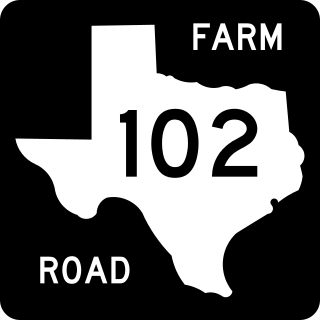
Farm to Market Road 102 (FM 102) is a state highway in the U.S. state of Texas. The highway begins at State Highway 60 (SH 60) in Wharton in Wharton County. It heads northwest through Eagle Lake in Colorado County and ends at Interstate 10 (I-10) near Alleyton, which is just east of Columbus in Colorado County.
Matthews is an unincorporated community on the southeastern edge of Colorado County, in the U.S. state of Texas. The community is located south of Eagle Lake near the junction of FM 102 and FM 950. The settlement was named for a man who owned a plantation in the area before the Civil War. By 2013, the school, post office, businesses and railroad line that once served Matthews were gone, but the number of silos in the neighborhood indicated that the land was still being intensively farmed.
Bernardo is an unincorporated community in northeastern Colorado County, in the U.S. state of Texas. The small community is located on FM 949 between Interstate 10 (I-10) and Cat Spring. The town was first settled by German immigrants in the 1840s and was on a main east-west road as early as the Civil War. Though the community once had its own post office and school, these had long disappeared by 2013. A United States Geological Survey (USGS) 7.5' x 7.5' Quadrangle Map is named Bernardo.
Provident City is a ghost town in the far southern panhandle of Colorado County in the U.S. state of Texas. The former settlement is located along County Road 190. The town was first settled through a land promotion scheme in 1909 and enjoyed a brief heyday. When the hoped-for railroad obviously would never come to town, people began moving away. The post office closed in 1953, and most of the land was bought up for ranching. The town no longer exists, though the original hotel survives in private hands. Reaching the site requires driving 4.3 miles (6.9 km) on a gravel road from the nearest highway.
Osage is a ghost town in northwestern Colorado County in the U.S. state of Texas. The one-time settlement was situated on Harvey Creek near the junction of County Roads 205 and 208 a few miles to the northeast of Weimar. At the time of the Civil War, the community was substantial enough to provide a company of soldiers to a Texas regiment in the Confederate States Army. A notable school flourished in Osage starting in the 1870s, but in that decade the railroad was built through Weimar instead. By 1900, the local commercial establishments had moved to Weimar and the town faded out of existence. In 2013, the area was sparsely settled.


