Bernardo, Texas

Last updated
Bernardo, Texas
Relief map of Texas.png
Red pog.svg
Bernardo
Location within the state of Texas
Usa edcp location map.svg
Red pog.svg
Bernardo
Bernardo (the United States)
Coordinates: 29°45′39″N96°23′32″W / 29.76083°N 96.39222°W / 29.76083; -96.39222
Country United States
State Texas
County Colorado
Elevation
[1]
253 ft (77 m)
Time zone UTC-6 (Central (CST))
  Summer (DST) UTC-5 (CDT)
ZIP code
78933
Area code 979
GNIS feature ID1330444 [1]

Bernardo is an unincorporated community in northeastern Colorado County, in the U.S. state of Texas. According to the Handbook of Texas, the community had a population of 155 in 2000.

Contents

History

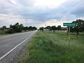
German immigrants arrived in Texas in 1845 as members of the Adelsverein and were followed by other German immigrants. Instead of moving to the authorized colonization area, the Fisher-Miller land grant in west central Texas, where many German settlers had already established themselves, decided to stay where the frontier circumstances were less difficult. Because of the topography in the area, Bernardo was formerly known as Bernardo Prairie. It was formerly known as Braden, and among the first inhabitants were several families bearing that name. The community was situated near a major highway connecting Houston to inland towns and settlements. It functioned as a dumping ground for transporting cotton to Mexico during the American Civil War. Nonetheless, it stayed an agricultural and ranching hamlet with sporadic houses and farms rather than growing into a sizable settlement. From 1898 until 1917, Bernardo had its own post office. Bernardo had a general store, a volunteer fire department, and 187 registered voters in its precinct in 1986. Even though individuals from Houston and the neighboring areas were buying land, some of the original settlers' descendants continued to reside in the area. The population was 155 in 1990. In 2000, the population did not change. [2]

Geography

Bernardo is located at the intersection of Farm to Market Road 949 and Bernardo Road between Interstate 10 and Cat Spring, 12 mi (19 km) northeast of Columbus in Colorado County. It is also on the south bank of the San Bernard River. [3]

Education

A Catholic school by the Sisters of Divine Providence was in Bernardo as early as 1872. This school joined the Mentz Catholic School in 1911, then joined the Columbus Independent School District after a public school was built in the area. [2]

Related Research Articles

<span class="mw-page-title-main">East Bernard, Texas</span> City in Texas, United States

East Bernard is a city in Wharton County, Texas, United States. The population was 2,218 at the 2020 census. U.S. Highway 90 Alternate (US 90A) and Texas State Highway 60 (SH 60) intersect within the city limits. East Bernard has its own school district, two auto dealerships and a number of other businesses. The San Bernard River flows past the city's eastern side.

<span class="mw-page-title-main">New Ulm, Texas</span> Unincorporated community in Texas, United States

New Ulm is an unincorporated community in Austin County, Texas, United States. According to the Handbook of Texas, the community had an estimated population of 650 in 2000.

Westfield is an unincorporated community in Harris County, Texas, United States, located along Interstate 45 and the Union Pacific Railroad nineteen miles (30 km) north of Downtown Houston.

<span class="mw-page-title-main">Booth, Texas</span> Unincorporated community in Texas, United States

Booth is a small unincorporated community in Fort Bend County, Texas, United States. According to the Handbook of Texas, the community had a population of 60 in 1990. It is located within the Greater Houston metropolitan area.

Frelsburg is an unincorporated community in Colorado County, Texas, United States. According to the Handbook of Texas, the community had a population of 75 in 2000.

Latium, is an unincorporated community in Washington County, Texas, United States. According to the Handbook of Texas, the community had a population of 30 in 2000. It is located within the Greater Houston metropolitan area.

Rosharon, is an unincorporated community and census-designated place (CDP) located entirely in Brazoria County, Texas, United States, at the intersection of Farm to Market Road 521 and Farm to Market Road 1462. As of the 2010 census, it had a population of 1,152. There are areas outside of the CDP, with Rosharon postal addresses, in Fort Bend County.

<span class="mw-page-title-main">Guy, Texas</span> Unincorporated community in Texas, United States

Guy is an unincorporated community in Fort Bend County, Texas, United States. According to the Handbook of Texas, the community had a population of 60 in 2000. It is located in the Greater Houston metropolitan area.

<span class="mw-page-title-main">Cat Spring, Texas</span> Unincorporated community in Texas, United States

Cat Spring is an unincorporated community in southern Austin County, Texas, United States. According to the Handbook of Texas, it had a population of 76 in 2000. Cat Spring was one of the first German/American settlements in Texas, and the location of Texas' first agricultural society.

<span class="mw-page-title-main">Egypt, Wharton County, Texas</span> Unincorporated community in Texas, United States

Egypt is an unincorporated community in northern Wharton County in the U.S. state of Texas. According to the Handbook of Texas, the community had a population of 26 in 2000. It is located within the Greater Houston metropolitan area.

<span class="mw-page-title-main">Umbarger, Texas</span> Census-designated place in Randall County, Texas, United States

Umbarger is a census-designated place in Randall County, Texas, United States. According to the Handbook of Texas, the community had an estimated population of 327 in 2000. The community is part of the Amarillo, Texas Metropolitan Statistical Area.

Glen Flora is an unincorporated community in Wharton County, Texas, United States. According to the Handbook of Texas, the community had an estimated population of 210 in 2000. It is located within the Greater Houston metropolitan area.

<span class="mw-page-title-main">Hillje, Texas</span> Unincorporated area in Texas, United States

Hillje is an unincorporated community in Wharton County, Texas, United States. According to the Handbook of Texas, the community had an estimated population of 51 in 2000. It is located within the Greater Houston metropolitan area.

Pisek is a ghost town in northern Colorado County, in the U.S. state of Texas. The former settlement, now a ghost town, was abandoned after 1941 when the inhabitants moved to Lone Oak on Farm to Market Road 1291. The site of Pisek is on a railroad between Fayetteville in Fayette County and New Ulm in Austin County.

Osage is a ghost town in northwestern Colorado County in the U.S. state of Texas. The one-time settlement was situated on Harvey Creek near the junction of County Roads 205 and 208 a few miles to the northeast of Weimar. At the time of the Civil War, the community was substantial enough to provide a company of soldiers to a Texas regiment in the Confederate States Army. A notable school flourished in Osage starting in the 1870s, but in that decade the railroad was built through Weimar instead. By 1900, the local commercial establishments had moved to Weimar and the town faded out of existence. In 2013, the area was sparsely settled.

Mentz is an unincorporated community in northeastern Colorado County, in the U.S. state of Texas. According to the Handbook of Texas, the community had a population of 100 in 2000.

Delhi is an unincorporated community in Caldwell County, in the U.S. state of Texas. According to the Handbook of Texas, the community had a population of 300 in 2000. It is located within the Greater Austin metropolitan area.

William Penn is an unincorporated community in Washington County, Texas, United States. According to the Handbook of Texas, the community had a population of 100 in 2000. It is located within the Greater Houston metropolitan area.

Wied is an unincorporated area in west central Lavaca County in the U.S. state of Texas. It is located near U.S. Route 90 Alternate (US 90A) west of the county seat at Hallettsville. The first Anglo-American settlers arrived here in the 1830s, but by the late 1800s they were replaced by Germans and Czechs. The population declined after the 1940s. In 2018 the Vysehrad Independent School District operated an area school and a community center existed on US 90A.

<span class="mw-page-title-main">Cooks Point, Texas</span> Unincorporated community in Texas, United States

Cooks Point is an unincorporated community in Burleson County, Texas, United States. According to the Handbook of Texas, the community had a population of 60 in 2000. It is located within the Bryan-College Station metropolitan area.

References

  1. 1 2 U.S. Geological Survey Geographic Names Information System: Bernardo, Texas. Retrieved on August 10, 2013.
  2. 1 2 Bernardo, TX from the Handbook of Texas Online
  3. "Bernardo, Texas". Texas Escapes Online Magazine. Retrieved 2024-06-24.