Borden, Texas

Last updated

Gail Borden, the namesake of the community Gail Borden.jpg
Gail Borden, the namesake of the community

Borden is an unincorporated community in southwestern Colorado County, Texas, located 4 miles northeast of Weimar. [1]

Contents

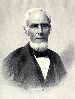
The community was known as Harvey's Creek Settlement before the U.S. Civil War. After the war ended, Gail Borden returned to Texas, and at what would become Borden, built houses for himself, his brother, and his sons. He renamed the settlement Bordenville. The Galveston, Harrisburg and San Antonio Railway opened its line through the Borden area in 1872. [1]

In 2000, Borden had 60 residents. [1]

Government and infrastructure

The area post office opened on January 19, 1874, and John P. Borden became the postmaster. In 1905 the post office closed and mail was rerouted through Weimar. [1]

In 1938, the Texas Highway Department announced plans to construct a lake and roadside park in Borden. They are the only visible infrastructure of years gone by in Borden. The lake was to be constructed along US 90, then called the Houston-San Antonio State Highway No. 3. The Feb. 18, 1938, Eagle Lake Headlight announced that the new seven-acre lake “destined to become one of the main attractions", along the Houston-San Antonio highway. Work began on the project by February, 1938, with "a modest beginning as a roadside park,” according to the Headlight. The lake was to be placed about a quarter mile from what was the existing highway and directly west of State Highway 3, which eventually became Interstate 10. State Highway 3 bypassed Borden at what is now Hatterman Lane. A creek then running through the site was to be dammed to fill the lake. "Workmen are busy now in damming up the creek, pulling down a hill in this vicinity, and utilizing [sic] dirt from this elsewhere to form banks for the new lake," M.B. Hodges, state highway division engineer from Yoakum told the Headlight in 1938. Initial plans for the lake included eventual stocking with fish, and a multiyear moratorium on fishing prior to opening the lake to sports enthusiasts. [2]

Education

During the boom times of the 1870s, Borden also built a school for white children and a freedmen's school for black children. The Weimar Independent School District serves Borden. In 1948, the Borden area schools were consolidated into the Weimar Independent School District. [1]

Related Research Articles

<span class="mw-page-title-main">Washington County, Texas</span> County in Texas, United States

Washington County is a county in Texas. As of the 2020 census, the population was 35,805. Its county seat is Brenham, which is located along U.S. Highway 290, 72 miles northwest of Houston. The county was created in 1835 as a municipality of Mexico and organized as a county in 1837. It is named for George Washington, the first president of the United States.

<span class="mw-page-title-main">Val Verde County, Texas</span> County in Texas, United States

Val Verde County is a county located on the southern Edwards Plateau in the U.S. state of Texas. The 2020 population is 47,586. Its county seat is Del Rio. The Del Rio micropolitan statistical area includes all of Val Verde County.

<span class="mw-page-title-main">Travis County, Texas</span> County in Texas, United States

Travis County is located in south central Texas. As of the 2020 census, the population was 1,290,188. It is the fifth-most populous county in Texas. Its county seat and largest city is Austin, the capital of Texas. The county was established in 1840 and is named in honor of William Barret Travis, the commander of the Republic of Texas forces at the Battle of the Alamo. Travis County is part of the Austin–Round Rock–Georgetown Metropolitan Statistical Area. It is located along the Balcones Fault, the boundary between the Edwards Plateau to the west and the Blackland Prairie to the east.

<span class="mw-page-title-main">Medina County, Texas</span> County in Texas, United States

Medina County is a county located in the U.S. state of Texas. As of the 2020 census, its population was 50,748. Its county seat is Hondo. The county is named for the Medina River. The extreme northern part of the county lies within the Edwards Plateau, which elevates into the Texas Hill Country. The Medina Dam, the fourth largest in the nation when completed in 1913, is listed on the National Register of Historic Places. The irrigation project, creating Medina Lake, was built by 1500 skilled workers who worked in shifts operating 24 hours a day to complete the dam in two years. Medina County is part of the San Antonio, TX Metropolitan Statistical Area.

<span class="mw-page-title-main">Houston County, Texas</span> County in Texas, United States

Houston County is a county located in the U.S. state of Texas. As of the 2020 census, its population was 22,066. Its county seat is Crockett. Houston County was one of 46 entirely dry counties in the state of Texas, until voters in a November 2007 special election legalized the sale of alcohol in the county.

<span class="mw-page-title-main">Colorado County, Texas</span> County in Texas, United States

Colorado County is a county located in the U.S. state of Texas. As of the 2020 census, its population was 20,557. Its county seat is Columbus. It is named for the Colorado River of Texas. The county was founded in 1836 and organized the next year.

<span class="mw-page-title-main">Wallis, Texas</span> City in Texas, United States

Wallis is a city in far southeastern Austin County, Texas, United States. The city is located along State Highway 36 (SH 36) and the BNSF Railway between Rosenberg and Sealy. The city's population was 1,292 at the 2020 census.

<span class="mw-page-title-main">Weimar, Texas</span> City in Texas, United States

Weimar is a city in Colorado County, Texas, United States. The population was 2,076 at the 2020 census. It is part of the Texas-German belt region and was founded and named by German emigrants after the city of Weimar, Germany.

<span class="mw-page-title-main">Midlothian, Texas</span> City in Texas, United States

Midlothian is a city in northwest Ellis County, Texas, United States. The city is 25 miles (40 km) southwest of Dallas. It is the hub for the cement industry in North Texas, as it is the home to three separate cement production facilities, as well as a steel mill. The population of Midlothian grew by 121% between 2000 and 2010, to a population of 18,037.

<span class="mw-page-title-main">Seguin, Texas</span> City in Texas, United States

Seguin is a city in and the county seat of Guadalupe County, Texas, United States; as of the 2020 census, its population was 29,433. Its economy is primarily supported by a regional hospital, as well as the Schertz-Seguin Local Government Corporation water-utility, that supplies the surrounding Greater San Antonio areas from nearby aquifers as far as Gonzales County. Several dams in the surrounding area are governed by the main offices of the Guadalupe-Blanco River Authority, headquartered in downtown Seguin.

<span class="mw-page-title-main">San Marcos, Texas</span> City in Hays County, Texas, US

San Marcos is a city and the county seat of Hays County, Texas, United States. The city is a part of the Greater Austin Metropolitan Area. San Marcos's limits extend into Caldwell and Guadalupe Counties, as well. San Marcos is on the Interstate 35 corridor between Austin and San Antonio. Its population was 44,894 at the 2010 census and 67,553 at the 2020 census. Founded on the banks of the San Marcos River, the area is thought to be among the oldest continuously inhabited sites in the Americas. San Marcos is home to Texas State University and the Meadows Center for Water and the Environment.

<span class="mw-page-title-main">Index of Texas-related articles</span>

The following is an alphabetical list of articles related to the U.S. state of Texas.

<span class="mw-page-title-main">Trinity River (Texas)</span> River in Texas, United States

The Trinity River is a 710-mile (1,140 km) river, the longest with a watershed entirely within the U.S. state of Texas. It rises in extreme northern Texas, a few miles south of the Red River. The headwaters are separated by the high bluffs on the southern side of the Red River.

<span class="mw-page-title-main">South Texas</span> Region of the U.S. state of Texas

South Texas is a region of the U.S. state of Texas that lies roughly south of—and includes—San Antonio. The southern and western boundary is the Rio Grande, and to the east it is the Gulf of Mexico. The population of this region is about 4.96 million according to the 2017 census estimates. The southern portion of this region is often referred to as the Rio Grande Valley. The eastern portion along the Gulf of Mexico is also referred to as the Coastal Bend.

<span class="mw-page-title-main">Cibolo Creek</span> Stream in South Central Texas

Cibolo Creek is a stream in South Central Texas that runs approximately 96 miles (154 km) from its source at Turkey Knob near Boerne, Texas, to its confluence with the San Antonio River in Karnes County. The creek is a tributary of the San Antonio River, at the easternmost part of its watershed.

<span class="mw-page-title-main">Greater Austin</span> Metropolitan area in Texas, United States

The Austin–Round Rock–San Marcos metropolitan statistical area, or Greater Austin, is a five-county metropolitan area in the U.S. state of Texas, as defined by the Office of Management and Budget. The metropolitan area is situated in Central Texas on the western edge of the American South and on the eastern edge of the American Southwest, and borders Greater San Antonio to the south.

<span class="mw-page-title-main">History of the Galveston Bay Area</span> Aspect of history surrounding the Galveston Bay Area

For a period of over 7000 years, humans have inhabited the Galveston Bay Area in what is now the United States. Through their history the communities in the region have been influenced by the once competing sister cities of Houston and Galveston, but still have their own distinct history. Though never truly a single, unified community, the histories of the Bay Area communities have had many common threads.

St. Charles Bay is an inlet of Aransas Bay in Aransas County, Texas. It is flanked by Lamar peninsula on the west and Blackjack peninsula on the east. The bay hosts a valued ecosystem for the endangered whooping crane, and is a prime location for birding and fishing. Goose Island State Park and the Aransas National Wildlife Refuge are located along the bay's shores, attracting nature enthusiasts year-round.

<span class="mw-page-title-main">Mission Tejas State Park</span> State park in Texas, United States

Mission Tejas State Park is a 660-acre (270 ha) state park located along Texas State Highway 21 in Houston County, Texas, originally constructed in 1935 and transferred to Texas Parks and Wildlife in 1957. The closest major town is Crockett, Texas. The park is open year-round.

Osage is a ghost town in northwestern Colorado County in the U.S. state of Texas. The one-time settlement was situated on Harvey Creek near the junction of County Roads 205 and 208 a few miles to the northeast of Weimar. At the time of the American Civil War, the community was substantial enough to provide a company of soldiers to a Texas regiment in the Confederate States Army. A notable school flourished in Osage starting in the 1870s, but in that decade the railroad was built through Weimar instead. By 1900 the local commercial establishments had moved to Weimar and the town faded out of existence. In 2013 the area was sparsely settled.

References

  1. 1 2 3 4 5 Borden, Texas from the Handbook of Texas Online
  2. "Eagle Lake Headlight". The Eagle Lake Headlight. February 18, 1938. Retrieved June 4, 2019.

29°41′29″N96°42′07″W / 29.69139°N 96.70194°W / 29.69139; -96.70194