Glenmoriston

Last updated

Glenmoriston Mistyglen.jpg
Glenmoriston

Glenmoriston or Glen Moriston (Scottish Gaelic : Gleann Moireasdan) is a river glen in the Scottish Highlands, that runs from Loch Ness, at the village of Invermoriston, westwards to Loch Cluanie, where it meets with Glen Shiel. The A887 and A87 roads pass through Glenmoriston.

Contents

The River Moriston Rivermoriston.jpg
The River Moriston

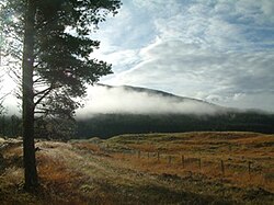
The Glen is dominated by the River Moriston, which in Gaelic might mean "river of the waterfalls". The river is a big attraction for fishers, but also for birdwatchers who come to see osprey and eagles fishing on the river. The river crashes over waterfalls at Invermoriston into Loch Ness, passing under an original Thomas Telford bridge, built in 1813.

About five miles along the glen from Invermoriston is Loch Dundreggan, "Dundreggan" being of Gaelic origin and meaning "Dragon Haugh". [1] Here the natural force of the river is tapped through a hydro-electric dam, which supplies power to the area. Water is let out of the dam on Tuesdays, making it a popular attraction for white water rafting and canoeing. After a feasibility study in Glen Affric, wild boar were re-introduced by the charity Trees for Life to a large fenced area of the Dundreggan Estate in November 2009. [2]

Glenmoriston Footprints

The cairn marks the site of the Glenmoriston Footprints. Glenmoriston2010a.jpg
The cairn marks the site of the Glenmoriston Footprints.
Close-up view of the Glenmoriston Footprints. Glenmorison2010.JPG
Close-up view of the Glenmoriston Footprints.

Not far east of Torgoyle Bridge are the Glenmoriston Footprints. From the bridge, head towards Invermoriston. About a quarter of a mile beyond a cluster of houses on the right is a short stone wall on the right where the verge widens enough to park a car. Opposite this is a small gate and a path leading in about thirty yards to a stone cairn. Immediately behind this are two "footprints", bare patches of earth about the size and shape of footprints.

They are said to be the footprints of Finlay Munro, otherwise known as the Highland Evangelist, a native of Tain. [3] After a productive ministry on the Isle of Lewis, he made a tour of the southern Highlands during which he preached in Glenmoriston in 1827. His sermon, on the text "Prepare to meet thy God, O Israel" (Amos 4:12), was generally well received but some Catholics from Glengarry heckled him, calling him "a cheat and a liar" [4] Munro is supposed to have closed his Bible and retorted that the ground on which he stood would bear witness to the truth of what he said until the Day of Judgement comes. Thus the marks on the ground are said to be his footprints, where nothing will grow.

Other history

The Roderick Mackenzie Cairn. RoderickMackenzie.jpg
The Roderick Mackenzie Cairn.

Saint Irchard founded a church in Glenoriston at a place where his bell rang of its own accord for the third time. The bell was preserved there for many centuries, and after the church was ruined in the 17th century it remained in the churchyard. [5]

The glen is also steeped in Jacobite history. After the Battle of Culloden in 1746, the pretender to the Scottish throne, Bonnie Prince Charlie escaped to safety through Glenmoriston. Here the Prince took refuge in a cave up in the hills where the River Doe flows down into the glen. He was famously protected by the Seven Men of Glenmoriston, in spite of a £30,000 reward (around £4.2 million or US$6 million in 2016 [6] ). By the side of the road is Roderick Mackenzie's cairn, a tribute to a loyal supporter of the Stuart Prince who pretended to be Charlie and allowed himself to be captured and killed by the soldiers pursuing the young pretender – giving the real man time to escape to safety. Glenmoriston is commonly misspelled as Glenmorriston especially in history books.

Census Data

Census data from 2001 as applied to the IV63 7 postcode district (Glenmoriston and Invermoriston)

See also

Further reading

Related Research Articles

<span class="mw-page-title-main">Inverness</span> City in the Highlands of Scotland

Inverness is a city in the Scottish Highlands, having been granted city status in 2000. It is the administrative centre for The Highland Council and is regarded as the capital of the Highlands.

<span class="mw-page-title-main">A82 road</span> Major road in Scotland from Glasgow to Inverness

The A82 is a major road in Scotland that runs from Glasgow to Inverness via Fort William. It is one of the principal north-south routes in Scotland and is mostly a trunk road managed by Transport Scotland, who view it as an important link from the Central Belt to the Scottish Highlands and beyond. The road passes close to numerous landmarks, including Loch Lomond, Rannoch Moor, Glen Coe, the Ballachulish Bridge, Ben Nevis, the Commando Memorial, Loch Ness, and Urquhart Castle. Along with the A9 and the A90 it is one of the three major north–south trunk roads connecting the Central Belt to the North.

<span class="mw-page-title-main">Great Glen</span> Scottish valley along geological fault line

The Great Glen, also known as Glen Albyn or Glen More, is a glen in Scotland running for 62 miles (100 km) from Inverness on the edge of the Moray Firth, in an approximately straight line to Fort William at the head of Loch Linnhe. It follows a geological fault known as the Great Glen Fault, and bisects the Scottish Highlands into the Grampian Mountains to the southeast and the Northwest Highlands to the northwest.

<span class="mw-page-title-main">Invermoriston</span> Human settlement in Scotland

Invermoriston is a small village 11 kilometres north of Fort Augustus, Highland, Scotland. The village is on the A82 road, at a junction with the A887.

<span class="mw-page-title-main">Càrn Eighe</span> Mountain in Scotland

Carn Eighe is a mountain in the Northwest Highlands of Scotland. Rising to 1,183 metres (3,881 ft) above sea level, it is the highest mountain in Scotland north of the Great Glen, the twelfth-highest in the British Isles, and, in terms of relative height, it is the second-tallest mountain in the British Isles after Ben Nevis. Carn Eighe lies between Glen Affric and Loch Mullardoch, and is at the heart of a massif along with its twin peak, the 1,181-metre (3,875 ft) Mam Sodhail.

<span class="mw-page-title-main">Loch Cluanie</span> Reservoir in Northwest Highlands, Scotland

Loch Cluanie is a loch in the Northwest Highlands of Scotland at the south-east end of Glen Shiel. It is a reservoir, contained behind the Cluanie Dam, constructed by Mitchell Construction and completed in 1957 as part of the North of Scotland Hydro-Electric Board's Glenmoriston project to generate hydroelectricity. Water feeds the dam from the west via two flows, from a tunnel from the dammed Loch Loyne and via the River Moriston.

Trees for Life is a registered charity working to rewild the Scottish Highlands.

<span class="mw-page-title-main">Achlain</span>

Achlain is a house in Glenmoriston in the Highland council area of Scotland. It is about 15 km west of Invermoriston, next to the A887 road and the River Moriston.

<span class="mw-page-title-main">Great Glen Way</span> Long distance trail in Scotland

The Great Glen Way is a long distance path in Scotland. It follows the Great Glen, running from Fort William in the southwest to Inverness in the northeast, covering 125 kilometres (78 mi). It was opened in 2002, and is designated as one of Scotland's Great Trails by NatureScot. The Great Glen Way is generally walked from southwest to northeast to follow the direction of the prevailing wind. It can be walked in 5–7 days, or cycled in 2–3 days. The trail is maintained and improved by the Great Glen Ways partnership, which consists of Highland Council, Scottish Canals and Forestry and Land Scotland. About 30,000 people use the path every year, of whom about 4,500 complete the entire route.

The Northwest Highlands are located in the northern third of Scotland that is separated from the Grampian Mountains by the Great Glen. The region comprises Wester Ross, Assynt, Sutherland and part of Caithness. The Caledonian Canal, which extends from Loch Linnhe in the south-west, via Loch Ness to the Moray Firth in the north-east splits this area from the rest of the country. The city of Inverness and the town of Fort William serve as gateways to the region from the south.

<span class="mw-page-title-main">Kintail</span> Mountainous area in the Scottish highlands

Kintail is a mountainous area sitting at the head of Loch Duich in the Northwest Highlands of Scotland, located in the Highland Council area.

<span class="mw-page-title-main">Ciste Dhubh</span>

Ciste Dhubh is a mountain in the Scottish Highlands, between Glen Shiel and Glen Affric. With a height of 979 metres (3,212 ft), it is classed as a Munro. It is almost surrounded by glens: Fionngleann (north), An Caorann Mòr (east) and Allt Cam-bàn (west), with the Bealach a' Chòinich pass (south) linking it to the mountain of Sgùrr an Fhuarail. Its name comes from Scottish Gaelic A' Chiste Dhubh, "the black chest", possibly referring to the dark rocky summit.

<span class="mw-page-title-main">Glen Shiel</span> Human settlement in Scotland

Glen Shiel is a glen in the Northwest Highlands of Scotland.

<span class="mw-page-title-main">Loch Ness</span> Lake in Scotland, United Kingdom

Loch Ness is a large freshwater loch in the Scottish Highlands extending for approximately 37 kilometres southwest of Inverness. It takes its name from the River Ness, which flows from the northern end. Loch Ness is best known for claimed sightings of the cryptozoological Loch Ness Monster, also known affectionately as "Nessie". It is one of a series of interconnected, murky bodies of water in Scotland; its water visibility is exceptionally low due to the high peat content of the surrounding soil. The southern end connects to Loch Oich by the River Oich and a section of the Caledonian Canal. The northern end connects to Loch Dochfour via the River Ness, which then ultimately leads to the North Sea via the Moray Firth.

<span class="mw-page-title-main">Corrimony</span> Village in Highland, Scotland

Corrimony is a small village at the western end of Glenurquhart, in Inverness-shire, in the Highlands of Scotland, now within Highland council area. It is 13 km west of Drumnadrochit, and 32 km south-west of Inverness.

<span class="mw-page-title-main">Dalchreichart</span> Human settlement in Scotland

Dalchreichart is a small hamlet in Glen Moriston, Inverness-shire, in the Highland council area of Scotland. It lies about 15 km west of Invermoriston.

<span class="mw-page-title-main">Glen Urquhart</span>

Glenurquhart or Glen Urquhart is a glen running to the west of the village of Drumnadrochit in the Highland council area of Scotland.

<span class="mw-page-title-main">Military roads of Scotland</span>

A network of military roads, sometimes called General Wade's Military Roads, was constructed in the Scottish Highlands during the middle part of the 18th century as part of an attempt by the British Government to bring order to a part of the country which had risen up in the Jacobite rebellion of 1715.

<span class="mw-page-title-main">River Moriston</span> River and power stations in Scotland

The River Moriston is a river in Inverness-shire, Scotland. It flows broadly east-north-east from the outfall of the dam at Loch Cluanie to Loch Ness. Its waters and those of its tributaries have been harnessed to generate hydro-electric power.

The Grants of Glenmoriston were a Scottish noble family and branch of Clan Grant. Based at Invermoriston, their lands revolved around the River Moriston, near Loch Ness. In Scottish Gaelic they were known as Clann Phàdraig.

References

  1. Iain Mac an Tàilleir. "Placenames" (PDF). Pàrlamaid na h-Alba. Archived from the original (PDF) on 17 March 2007. Retrieved 23 July 2007.
  2. Ross, David (26 November 2009) "Wild Boar: our new eco warriors" The Herald. Glasgow.
  3. Rev M. Mcaulay, "Aspects of the Religious History of Lewis" pp. 130-141
  4. 1827 saw the translation of Manuel Lacunza's book "The Coming of the Messiah" by another Scottish preacher, Edward Irving, which achieved instant popularity in evangelical circles. Is it possible that Munro referred to this work (which would have been apposite to his theme), thus provoking the ire of his Catholic auditors?
  5. Barrett, Dom Michael (18 July 2020), A Calendar of Scotish Saints, BoD – Books on Demand, p. 50, ISBN   978-3-7523-2290-3 , retrieved 15 July 2021
  6. Lawrence H. Officer and Samuel H. Williamson. "Five Ways to Compute the Relative Value of a UK Pound Amount, 1270 to Present". MeasuringWorth. Retrieved 23 November 2017.

57°10′23″N4°48′47″W / 57.173°N 4.813°W / 57.173; -4.813