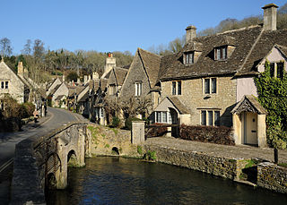
The Cotswolds is a region of central South West England, along a range of rolling hills that rise from the meadows of the upper River Thames to an escarpment above the Severn Valley and the Vale of Evesham. The area is defined by the bedrock of Jurassic limestone that creates a type of grassland habitat that is quarried for the golden-coloured Cotswold stone. It lies across the boundaries of several English counties; mainly Gloucestershire and Oxfordshire, and parts of Wiltshire, Somerset, Worcestershire, and Warwickshire. The highest point is Cleeve Hill at 1,083 ft (330 m), just east of Cheltenham. The predominantly rural landscape contains stone-built villages, towns, stately homes and gardens featuring the local stone.
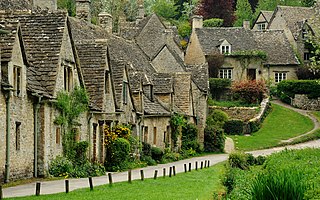
Gloucestershire is a ceremonial county in South West England. It is bordered by Herefordshire to the north-west, Worcestershire to the north, Warwickshire to the north-east, Oxfordshire to the east, Wiltshire to the south, Bristol and Somerset to the south-west, and the Welsh county of Monmouthshire to the west. The city of Gloucester is the largest settlement and the county town.
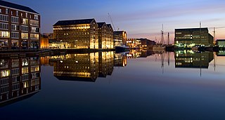
Gloucester is a cathedral city and the county town of Gloucestershire in the South West of England. Gloucester lies on the River Severn, between the Cotswolds to the east and the Forest of Dean to the west; it is sited 19 miles (31 km) east of Monmouth and 17 miles (27 km) east of the border with Wales. Gloucester has a population of around 132,000, including suburban areas. It is a port, linked via the Gloucester and Sharpness Canal to the Severn Estuary.
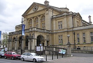
Cheltenham is a spa town and borough on the edge of the Cotswolds in Gloucestershire, England. Cheltenham became known as a health and holiday spa town resort following the discovery of mineral springs in 1716, and claims to be the most complete Regency town in Britain. It is directly northeast of Gloucester.

Tewkesbury is a market town and civil parish in the north of Gloucestershire, England. The town grew following the construction of Tewkesbury Abbey in the twelfth century and played a significant role in the Wars of the Roses. It stands at the confluence of the River Severn and the River Avon, and thus became an important trading point, which continued as railways and, later, the M5 and M50 motorway connections were established. The town gives its name to the Borough of Tewkesbury, a local government district of Gloucestershire. The town lies on the border with Worcestershire, marked largely by the Carrant Brook.
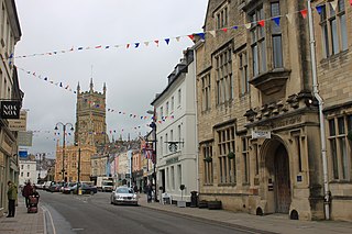
Cotswold is a local government district in Gloucestershire, England. It is named after the wider Cotswolds region and range of hills. The council is based in the district's largest town of Cirencester. The district also includes the towns of Chipping Campden, Fairford, Lechlade, Moreton-in-Marsh, Northleach, Stow-on-the-Wold and Tetbury, along with numerous villages and surrounding rural areas.

Stroud District is a local government district in Gloucestershire, England. The district is named after its largest town of Stroud. The council is based at Ebley Mill in Cainscross. The district also includes the towns of Berkeley, Dursley, Nailsworth, Stonehouse and Wotton-under-Edge, along with numerous villages and surrounding rural areas. Over half of the district lies within the Cotswolds Area of Outstanding Natural Beauty.
BBC Radio Gloucestershire is the BBC's local radio station serving the county of Gloucestershire.

Churchdown is a large village in Gloucestershire, England, situated between Gloucester and Cheltenham in the south of the Tewkesbury Borough.
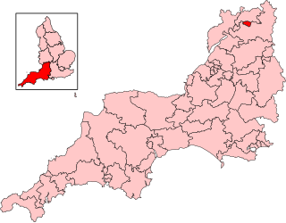
Cheltenham is a constituency in Gloucestershire represented in the House of Commons of the UK Parliament since 1832. As with all constituencies, it elects one Member of Parliament (MP) by the first past the post system of election at least every five years. Since 2024, its MP has been Max Wilkinson of the Liberal Democrats.
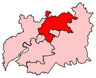
Tewkesbury is a constituency in Gloucestershire represented in the House of Commons of the UK Parliament since 2024 by Cameron Thomas, a Liberal Democrat.
Gloucestershire County Council is the upper-tier local authority for the non-metropolitan county of Gloucestershire, in England. The council was created in 1889. The council's principal functions are county roads and rights of way, social services, education and libraries, but it also provides many other local government services in the area it covers. The non-metropolitan county is smaller than the ceremonial county, the latter additionally including South Gloucestershire. The council went under no overall control following a change of allegiance in May 2024, having previously been under Conservative majority control. It is based at Shire Hall in Gloucester.

Crickley Hill and Barrow Wake is a 56.8-hectare (140-acre) biological and geological Site of Special Scientific Interest in Gloucestershire, notified in 1974.

Cheltenham Borough Council is the local authority for Cheltenham, a non-metropolitan district with borough status in Gloucestershire, England. The council is based at the Municipal Offices on the Promenade.
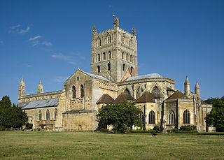
The Borough of Tewkesbury is a local government district with borough status in Gloucestershire, England. The borough is named after its largest town, Tewkesbury, which is where the council is based. The district also includes the town of Winchcombe and numerous villages including Bishops Cleeve, Ashchurch, Churchdown, Innsworth and Brockworth as well as other hamlets and surrounding rural areas. Parts of the district lie within the Cotswolds Area of Outstanding Natural Beauty.

The West Midlands Green Belt is a statutory green belt environmental and planning policy that regulates the rural space within the West Midlands region of England. It is contained within the counties of the West Midlands, Shropshire, Staffordshire, Warwickshire and Worcestershire. Essentially, the function of the green belt is to more rigorously manage development around the cities, towns and villages in the large West Midlands conurbations centred around Birmingham and Coventry, discouraging convergence. It is managed by local planning authorities on guidance from central government.
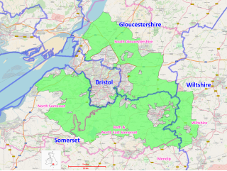
The Avon Green Belt, also known as the Bristol and Bath Green Belt, is a non-statutory green belt environmental and planning policy that regulates urban expansion and development in the countryside surrounding the cities of Bristol and Bath in the South West region of England. It covers areas in Bristol, South Gloucestershire, North Somerset, Bath and North East Somerset, Mendip, and Wiltshire. Essentially, the function of the green belt is to limit urban sprawl and maintain the open character of areas around the Bristol and Bath built up areas, and nearby towns and villages. The policy is implemented by local planning authorities on the basis of guidance from central government.

North Cotswolds is a newly created constituency of the House of Commons in the UK Parliament. Created as a result of the 2023 Periodic Review of Westminster constituencies, it was first contested at the 2024 general election.


