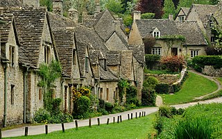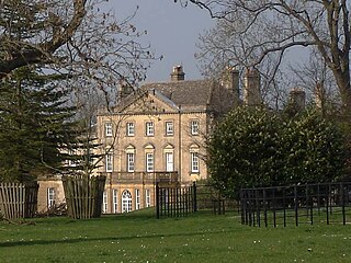
Gloucestershire is a ceremonial county in South West England. It is bordered by Herefordshire to the north-west, Worcestershire to the north, Warwickshire to the north-east, Oxfordshire to the east, Wiltshire to the south, Bristol and Somerset to the south-west, and the Welsh county of Monmouthshire to the west. The city of Gloucester is the largest settlement and the county town.

The Victoria History of the Counties of England, commonly known as the Victoria County History or the VCH, is an English history project which began in 1899 with the aim of creating an encyclopaedic history of each of the historic counties of England, and was dedicated to Queen Victoria. In 2012 the project was rededicated to Queen Elizabeth II in celebration of her Diamond Jubilee year. Since 1933 the project has been coordinated by the Institute of Historical Research in the University of London.

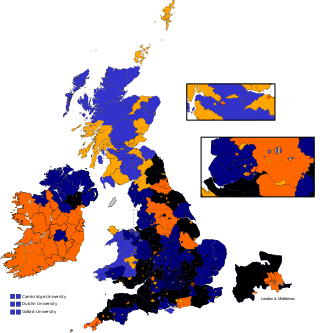
East Gloucestershire, formally the Eastern division of Gloucestershire and often referred to as Gloucestershire Eastern, was a parliamentary constituency in Gloucestershire, represented in the House of Commons of the Parliament of the United Kingdom. It elected two Members of Parliament (MPs) using the bloc vote system.

Whitminster is a village and civil parish in Gloucestershire, England, on the A38 trunk road approximately 6 miles (10 km) south of Gloucester and 6 miles (10 km) north-west of Stroud. The parish population at the 2011 census was 881. The hamlet of Wheatenhurst is signposted from the A38 at Whitminster. Whitminster is close to Junction 13 of the M5 motorway, with Bristol, South Wales and the south Midlands all within an hour's drive.

Ashchurch is a village and former civil parish, now in the parish of Ashchurch Rural, in the Tewkesbury district, in the county of Gloucestershire, England, 2 miles (3.2 km) east of the town of Tewkesbury, 11 mi (18 km) southwest of Evesham, 10 mi (16 km) north of Cheltenham, 13 mi (21 km) north-north-east of Gloucester and 10 mi (16 km) south of Pershore.

Frampton Mansell is a small English village 5 miles east-south-east of Stroud, Gloucestershire, in the parish of Sapperton. It lies off the A419 road between Stroud and Cirencester. It has a prominent mid-19th century, Grade II listed church with a set of five original stained-glass windows.

Saul is a village and former civil parish, now in the parish of Fretherne with Saul, in the Stroud district, in the county of Gloucestershire, England. In 1881 the parish had a population of 597. On 24 March 1884 the parish was abolished to form Fretherne with Saul; part also went to Moreton Valance and Standish.

Framilode is a village on the banks of the River Severn in Gloucestershire, England, in the parish of Fretherne with Saul. It consists of two settlements: the larger, Framilode, is at the mouth of the River Frome. The smaller settlement, Framilode Passage, lies about 0.5 mile downstream.

Sir Robert Atkyns, was a topographer, antiquary and Member of Parliament. He is best known for his county history, The Ancient and Present State of Glostershire, published in 1712.
Richard Capel (1586–1656) was an English nonconforming clergyman of Calvinist views, a member of the Westminster Assembly, and for a period of his life a practicing physician.

Christopher Robin Elrington FRHistS FSA was an English historian, known primarily for his work with the Victoria County History.

Salperton is a village and former civil parish, now in the parish of Hazleton, in the Cotswolds about 8 miles (13 km) east of Cheltenham in Gloucestershire, England. It is also known as Cold Salperton, owing to its exposed position. In 1931 the parish had a population of 92.

Fretherne with Saul is a civil parish in the Stroud district of Gloucestershire, England. It includes the villages of Framilode, Fretherne, Saul and Upper Framilode.

Whitstone was an ancient hundred of Gloucestershire, England. From the 13th century it comprised two adjacent divisions, which included the ancient parishes of:
Gloucester 1 is an English rugby union league which sits at the ninth level of league rugby union in England for teams based primarily in the county of Gloucestershire but also on occasion teams from Bristol. Promoted clubs move into Gloucester Premier and relegated clubs drop into either Gloucester 2 North or Gloucester 2 South depending on location. Each year clubs in this division also take part in the RFU Junior Vase - a level 9-12 national competition.

Tirley is a village and civil parish in Gloucestershire, England. It is located in the Borough of Tewkesbury district, 4 mi (6 km) south-west of Tewkesbury town and 6 mi (10 km) north of Gloucester. The village is situated on a low limestone ridge just above the flood plain of the River Severn. It is on the B4213 road, half a mile west of Haw Bridge, a crossing point on the Severn since the 13th century.

Bulley is a village and former civil parish, now in the parish of Churcham, in the Forest of Dean district, in Gloucestershire, almost 7 miles (11 km) west of the city of Gloucester and about 1 mile (1.6 km) north of the village of Churcham. In 1931 the parish had a population of 134.

Lasborough is a settlement in Gloucestershire, England, part of the Westonbirt with Lasborough civil parish. Lasborough lies to the west of the A46, about two miles north of Leighterton, two miles south of Kingscote and five miles west of Tetbury.

This is a bibliography of the City of Gloucester in the south-west of England. The city lies close to the Welsh border, on the River Severn, between the Cotswolds to the east and the Forest of Dean to the southwest. It was founded by the Romans under Emperor Nerva as Colonia Glevum Nervensis, and was granted its first charter in 1155 by King Henry II.


