Goedehoop | |
|---|---|
| Coordinates: 24°52′44″S26°38′38″E / 24.879°S 26.644°E Coordinates: 24°52′44″S26°38′38″E / 24.879°S 26.644°E | |
| Country | South Africa |
| Province | North West |
| District | Bojanala Platinum |
| Municipality | Moses Kotane |
| Area | |
| • Total | 0.50 km2 (0.19 sq mi) |
| Population (2011) [1] | |
| • Total | 331 |
| • Density | 660/km2 (1,700/sq mi) |
| Racial makeup (2011) | |
| • Black African | 100.0% |
| First languages (2011) | |
| • Tswana | 79.8% |
| • Xhosa | 11.2% |
| • Tsonga | 2.7% |
| • English | 2.4% |
| • Other | 3.9% |
| Time zone | UTC+2 (SAST) |
| Postal code (street) | 7140 |
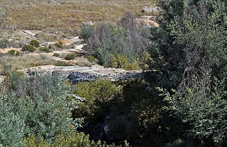
Goedehoop (Afrikaans for good hope) is a settlement in Bojanala District Municipality in the North West province of South Africa.

Afrikaans is a West Germanic language spoken in South Africa, Namibia and, to a lesser extent, Botswana and Zimbabwe. It evolved from the Dutch vernacular of South Holland spoken by the mainly Dutch settlers of what is now South Africa, where it gradually began to develop distinguishing characteristics in the course of the 18th century. Hence, it is a daughter language of Dutch, and was previously referred to as "Cape Dutch" or "kitchen Dutch". However, it is also variously described as a creole or as a partially creolised language. The term is ultimately derived from Dutch Afrikaans-Hollands meaning "African Dutch".

North West is a province of South Africa. Its capital is Mahikeng. Klerksdorp is the largest city in the province. The province is located to the west of the major population centre of Gauteng.

South Africa, officially the Republic of South Africa (RSA), is the southernmost country in Africa. It is bounded to the south by 2,798 kilometres (1,739 mi) of coastline of Southern Africa stretching along the South Atlantic and Indian Oceans; to the north by the neighbouring countries of Namibia, Botswana, and Zimbabwe; and to the east and northeast by Mozambique and Eswatini (Swaziland); and it surrounds the enclaved country of Lesotho. South Africa is the largest country in Southern Africa and the 25th-largest country in the world by land area and, with over 57 million people, is the world's 24th-most populous nation. It is the southernmost country on the mainland of the Old World or the Eastern Hemisphere. About 80 percent of South Africans are of Sub-Saharan African ancestry, divided among a variety of ethnic groups speaking different African languages, nine of which have official status. The remaining population consists of Africa's largest communities of European (White), Asian (Indian), and multiracial (Coloured) ancestry.


