
The Struve Geodetic Arc is a chain of survey triangulations stretching from Hammerfest in Norway to the Black Sea, through ten countries and over 2,820 km, which yielded the first accurate measurement of a meridian.
Biltine is one of three departments in Wadi Fira, a region of Chad. Its capital is Biltine.
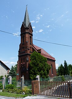
Šunychl (help·info) is a village in Karviná District, Moravian-Silesian Region, Czech Republic. It was a separate municipality but became administratively a part of Bohumín in 1974. It has a population of 540. The village lies in the historical region of Cieszyn Silesia.
Lubocheń is a village in the administrative district of Gmina Drzycim, within Świecie County, Kuyavian-Pomeranian Voivodeship, in north-central Poland.

Woziwoda is a village in the administrative district of Gmina Tuchola, within Tuchola County, Kuyavian-Pomeranian Voivodeship, in north-central Poland. It lies approximately 10 kilometres (6 mi) north-east of Tuchola and 62 km (39 mi) north of Bydgoszcz.
Mesiani is a village located in Servia municipal unit, Kozani regional unit, in the Greek region of Macedonia. It is situated at an altitude of 395 meters above sea level. The postal code is 50100, while the telephone code is +30 24610. At the 2011 census the population was 280.
Szpikołosy is a village in the administrative district of Gmina Hrubieszów, within Hrubieszów County, Lublin Voivodeship, in eastern Poland, close to the border with Ukraine. It lies approximately 7 kilometres (4 mi) north-east of Hrubieszów and 104 km (65 mi) south-east of the regional capital Lublin.

Məstalıbəyli is a village in the Jabrayil Rayon of Azerbaijan.
Doły Brzeskie is a village in the administrative district of Gmina Grabica, within Piotrków County, Łódź Voivodeship, in central Poland.
Stanisławice is a village in the administrative district of Gmina Kozienice, within Kozienice County, Masovian Voivodeship, in east-central Poland. It lies approximately 7 kilometres (4 mi) west of Kozienice and 79 km (49 mi) south-east of Warsaw.
Dosin is a village in the administrative district of Gmina Serock, within Legionowo County, Masovian Voivodeship, in east-central Poland. It lies approximately 6 kilometres (4 mi) south-west of Serock, 11 km (7 mi) north-east of Legionowo, and 30 km (19 mi) north of Warsaw.
Brzezinki is a village in the administrative district of Gmina Pionki, within Radom County, Masovian Voivodeship, in east-central Poland.

Sawice-Wieś is a village in the administrative district of Gmina Repki, within Sokołów County, Masovian Voivodeship, in east-central Poland.

Szybowice is a village in the administrative district of Gmina Prudnik, within Prudnik County, Opole Voivodeship, in south-western Poland, close to the Czech border. It lies approximately 8 kilometres (5 mi) north-west of Prudnik and 48 km (30 mi) south-west of the regional capital Opole.
Popowo is a village in the administrative district of Gmina Cewice, within Lębork County, Pomeranian Voivodeship, in northern Poland. It lies approximately 10 kilometres (6 mi) north-east of Cewice, 11 km (7 mi) south-east of Lębork, and 52 km (32 mi) west of the regional capital Gdańsk.
Salinko is a village in the administrative district of Gmina Gniewino, within Wejherowo County, Pomeranian Voivodeship, in northern Poland. It lies approximately 6 kilometres (4 mi) south-west of Gniewino, 24 km (15 mi) north-west of Wejherowo, and 59 km (37 mi) north-west of the regional capital Gdańsk.
Targowisko Górne is a village in the administrative district of Gmina Lubawa, within Iława County, Warmian-Masurian Voivodeship, in northern Poland. It lies approximately 17 km (11 mi) south-east of Iława and 62 km (39 mi) south-west of the regional capital Olsztyn.
Lužane is a village in the municipality of Aleksinac, Serbia. According to the 2002 census, the village has a population of 942 people.
Tohoué is an arrondissement in the Zou department of Benin. It is an administrative division under the jurisdiction of the commune of Ouinhi. According to the population census conducted by the Institut National de la Statistique Benin on February 15, 2002, the arrondissement had a total population of 5,000.

Włóczno is a village in the administrative district of Gmina Prudnik, within Prudnik County, Opole Voivodeship, in south-western Poland, close to the Czech border. It lies approximately 8 kilometres (5 mi) north-west of Prudnik and 48 km (30 mi) south-west of the regional capital Opole.
