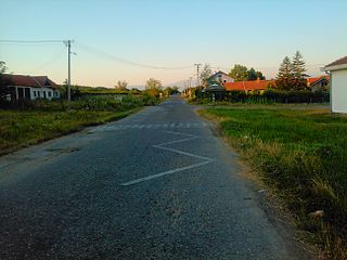
Podhořany u Ronova is a small village in the Pardubice Region of the Czech Republic. It has around 290 inhabitants.

Elsterwerdaer Platz is a Berlin U-Bahn station located on the . It is named after the town of Elsterwerda. The station opened in 1988 to serve the new development of Biesdorf and is near the village commons and the Biesdorf Center shopping mall. Until 1989, it was the eastern terminus of what is now line U5.

Sarapat is a village in the Shirak Province of Armenia.

Zəylik is a village in the Kalbajar Rayon of Azerbaijan.

Qumbaşı is a village in the Lankaran Rayon of Azerbaijan. The village forms part of the municipality of Liman.

Gutów Duży is a village in the administrative district of Gmina Grabica, within Piotrków County, Łódź Voivodeship, in central Poland. It lies approximately 6 kilometres (4 mi) west of Grabica, 19 km (12 mi) north-west of Piotrków Trybunalski, and 31 km (19 mi) south of the regional capital Łódź.

Dębniak is a village in the administrative district of Gmina Zgierz, within Zgierz County, Łódź Voivodeship, in central Poland. It lies approximately 11 kilometres (7 mi) north of Zgierz and 19 km (12 mi) north of the regional capital Łódź.
Kowalewo Opactwo-Parcele is a village in the administrative district of Gmina Słupca, within Słupca County, Greater Poland Voivodeship, in west-central Poland.

Otola Mała is a village in the administrative district of Gmina Żarnowiec, within Zawiercie County, Silesian Voivodeship, in southern Poland. It lies approximately 30 kilometres (19 mi) east of Zawiercie and 66 km (41 mi) north-east of the regional capital Katowice.

Skibin is a village in the administrative district of Gmina Damnica, within Słupsk County, Pomeranian Voivodeship, in northern Poland. It lies approximately 5 kilometres (3 mi) east of Damnica, 21 km (13 mi) east of Słupsk, and 86 km (53 mi) west of the regional capital Gdańsk.

Leśniki is a village in the administrative district of Gmina Świętajno, within Olecko County, Warmian-Masurian Voivodeship, in northern Poland. It lies approximately 13 kilometres (8 mi) south-west of Olecko and 126 km (78 mi) east of the regional capital Olsztyn.
The Canton of Saint-Amand-Montrond is a canton situated in the Cher département and in the Centre-Val de Loire region of France.
Kargiubangou is a village and rural commune in Niger.

Gornja Jajina is a village in the municipality of Leskovac, Serbia. According to the 2002 census, the village has a population of 637 people.

Šainovac is a village in the municipality of Leskovac, Serbia. According to the 2002 census, the village has a population of 216 people.
Ula is a village in Saaremaa Parish, Saare County in western Estonia.
Bulozi is a village in the municipality of Istočni Stari Grad, Republika Srpska, Bosnia and Herzegovina.

Ikusaka Dam is a dam in the village of Ikusaka, Nagano Prefecture, Japan, completed in 1964.

Srneći Dol is a village in the municipality of Vladičin Han, Serbia. According to the 2002 census, the village has a population of 58 people.
Võrkrahu is a small islet belonging to the country of Estonia off the west coast of the larger island of Saaremaa in the Kuusnõmme Gulf of the Baltic Sea. It is administered by Lääne-Saare Parish. Võrkrahu lies in an oblong North-South direction and is covered in pine and junipers. It covers an area of 6.07618 hectares and a circumference of 1.32628 kilometers and is part of Vilsandi National Park.


