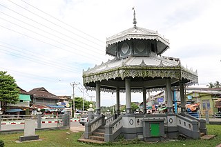
Rumenka is a suburban settlement of the city of Novi Sad, Serbia. The village has a Serb ethnic majority and a population of 6,495 people.
Shuqrah, also Shaqrāʾ or Shuqrāʾ, is a coastal town in southern Yemen. It was the capital of the Fadhli Sultanate until the capital moved to Zinjibar in 1962, although the royal residence remained in Shuqrah.

Bardia, also El Burdi or Bardiyah is a Mediterranean seaport in the Butnan District of eastern Libya, located near the border with Egypt. It is also occasionally called Bórdi Slemán.

Thanbyuzayat is a town in the Mon State of south-eastern Myanmar. It is the administrative center for Thanbyuzayat Township. Thanbyuzayat is about 64 kilometres (40 mi) south of Mawlamyine (Moulmein) and 24 kilometres (15 mi) south-east of Kyaikkami (Amherst) and Setse beach.
Günəşli is a village and municipality in the Shamkir District of Azerbaijan. Günəşli is in the Saler administrative subdivision of Shamkir District. It is located in the foothills of the Lesser Caucasus Mountains. It has a population of 471.

The Chiloango River is a river in western Central Africa. It forms the westernmost part of the border between the Democratic Republic of the Congo and the Republic of Congo, and then forms approximately half of the border between the DRC and Cabinda, Angola passing just south of the town of Necuto. The river then bisects Cabinda, making it the most important river in the province. It enters the Atlantic Ocean just north of the town of Cacongo.
Cacongo is a town, with a population of 15,000 (2014), in Cacongo municipality, Cabinda Province, in Angola. The former Lândana municipality is now known as Cacongo, and the town is sometimes still known as Lândana. It is located on Lândana Bay about a kilometer south of the mouth of the Chiloango River.
Karabiga (Karabuga) is a town (belde) in the Biga District, Çanakkale Province, Turkey. Its population is 2,962 (2021). It is located at the mouth of the Biga River, on a small east-facing bay, known as Karabiga Bay. Its ancient name was Priapus or Priapos.
Money Island or Ngwe Kyun is an island in the Mergui Archipelago of Taninthayi Region, Myanmar.
Sabi Island is an island in the Mergui Archipelago of Taninthayi Region, Burma (Myanmar). It lies between Money Island to the south and Parker Island to the north. The narrow channel between Sabi island and Money Island is rather shallow, but the half-mile wide channel between Sabi Island and Parker Island is quite deep. The island is heavily forested and has small bays with sandy beaches on the west side. The highest point is 326 m above the sea. Whaleback Reef, which lies about three-quarters of mile off the northeast part of the island, is exposed about 8 ft. at low tide.
Qayqab is a town in the Derna District in northeastern Libya. The town is located on the northeast side of the Akhdar Mountains, south of Al Abraq and Al Abraq Airport and Faydiya lies to the southwest, connected by road.

Mašo Vrbica was a Montenegrin vojvoda and military commander.
Hamāyūn is a village in Kapisa Province of Afghanistan. Hamayun lies on the eastern slope of Mt. Nēshar.
Lumë is a village in the former Shtiqën Municipality, Kukës County, Albania. At the 2015 local government reform it became part of the municipality Kukës.
The Simiyu River is a river located in Simiyu Region and Arusha Region, Tanzania. It flows into Lake Victoria in the African Great Lakes region. As one of the six main inlets to Lake Victoria, it forms part of the upper headwaters of the Nile. The Simiyu Region is named after the river.
Kilosa (Kilossa) is a town in the Morogoro Region of Tanzania, East Africa. It is the administrative seat for Kilosa District. As of 2022, the population of the town was 43,418.

Makovo is a village in the mountains of the municipality of Novaci, in the Mariovo region of North Macedonia. It used to be part of the former municipality of Staravina.

Tagundaing or Ta Khun Taing is a large village in the Kayin State of south-eastern Myanmar, located near the west bank of the Winyaw River and the west of the Kyain Seikgyi Township, Kawkareik District. The population as of the 2014 census was 4,994. Most of the residents are of the Karen (Kayin) ethnic group.
Barin Township, also spelled Baren Township, is a township of Akto County (Aketao), Kizilsu Kyrgyz Autonomous Prefecture (Kezilesu), Xinjiang Uygur Autonomous Region, China. The township is located on the western edge of the Taklamakan Desert, at the foot of the Pamir Mountains. Located in the middle west of the northeastern part of the county, the township covers an area of 1,087 square kilometers with a population of 38,706. It has 19 administrative villages under its jurisdiction. Its seat is at Barin Village (巴仁村).
Alaqagha, Alakaga is a town in Kuqa, Aksu Prefecture, Xinjiang, China.


