Vilppula was a former municipality of Finland. Neighbouring Mänttä was merged into it on 1 January 2009 to form the municipality of Mänttä-Vilppula. The municipality was unilingually Finnish.

North Creek is a census-designated place and hamlet in the Adirondack Park, in the town of Johnsburg, in Warren County, New York, United States. It is an area known for skiing, hiking and other outdoor recreational activities. It is located at 43°41′52″N73°59′11″W.

Niedów is a village in the administrative district of Gmina Zgorzelec, within Zgorzelec County, Lower Silesian Voivodeship, in south-western Poland, close to the German border.

Tingstadstunneln is a motorway tunnel under the Göta älv, connecting Hisingen with mainland Gothenburg. The tunnel was constructed with two parallel immersed tubes with three lanes of traffic in each tube. It is part of the E6 route linking Norway with south-west Sweden.

Józefkowo is a village in the administrative district of Gmina Kcynia, within Nakło County, Kuyavian-Pomeranian Voivodeship, in north-central Poland. It lies approximately 12 kilometres (7 mi) north of Kcynia, 8 km (5 mi) south-west of Nakło nad Notecią, and 33 km (21 mi) west of Bydgoszcz.

Cekcynek is a village in the administrative district of Gmina Cekcyn, within Tuchola County, Kuyavian-Pomeranian Voivodeship, in north-central Poland. It lies approximately 2 kilometres (1 mi) west of Cekcyn, 10 km (6 mi) east of Tuchola, and 51 km (32 mi) north of Bydgoszcz.
Szymany-Kolonie is a village in the administrative district of Gmina Grajewo, within Grajewo County, Podlaskie Voivodeship, in north-eastern Poland.

Kuźnica, formerly Kuźnica Białostocka, is a village in Sokółka County, Podlaskie Voivodeship, in north-eastern Poland, close to the border with Belarus. It is the seat of the gmina called Gmina Kuźnica. It lies approximately 16 kilometres (10 mi) north-east of Sokółka and 54 km (34 mi) north-east of the regional capital Białystok.

Dərə Zarat is a village in the Siazan Rayon of Azerbaijan. The village forms part of the municipality of Beşdam.

Zalesie is a village in the administrative district of Gmina Stanisławów, within Mińsk County, Masovian Voivodeship, in east-central Poland. It lies approximately 3 kilometres (2 mi) west of Stanisławów, 11 km (7 mi) north of Mińsk Mazowiecki, and 36 km (22 mi) east of Warsaw.

Kuligów is a village in the administrative district of Gmina Dąbrówka, within Wołomin County, Masovian Voivodeship, in east-central Poland. It lies approximately 19 km (12 mi) north of Wołomin and 35 km (22 mi) north of Warsaw.
Koszary is a village in the administrative district of Gmina Sompolno, within Konin County, Greater Poland Voivodeship, in west-central Poland.

Jeziorki is a village in the administrative district of Gmina Gołańcz, within Wągrowiec County, Greater Poland Voivodeship, in west-central Poland. It lies approximately 6 kilometres (4 mi) north-west of Gołańcz, 22 km (14 mi) north of Wągrowiec, and 70 km (43 mi) north of the regional capital Poznań.
Augustowo is a village in the administrative district of Gmina Dźwierzuty, within Szczytno County, Warmian-Masurian Voivodeship, in northern Poland.

Studena is a village in the municipality of Babušnica, Serbia. According to the 2002 census, the village has a population of 200 people.

Kupinovo is a village in the municipality of Kuršumlija, Serbia. According to the 2002 census, the village has a population of 67 people.

Božići is a village in the municipality of Srebrenica, Bosnia and Herzegovina.

Klotjevac is a village in the municipality of Srebrenica, Bosnia and Herzegovina.

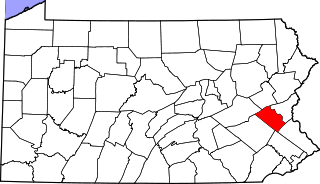
Scherersville is an unincorporated community in Lehigh County, Pennsylvania located on the Jordan Creek mainly in South Whitehall Township and also in Whitehall Township. It is located on Mauch Chunk Road just north of the 15th Street exit of U.S. Route 22. The Whitehall portion is located in the Fullerton CDP, which includes the entire southern portion of the township. The village is split between the Allentown and Whitehall post offices with the zip codes of 18104 and 18052, respectively. South Whitehall students are served by Parkland School District while Whitehall students are served by Whitehall-Coplay School District.

Lasesarre is a stadium in Barakaldo, Spain. It is currently used for football matches and is the home stadium of Barakaldo CF. The stadium holds 7,960 spectators.


