
Ncaang is a village in Kgalagadi District of Botswana. It is located in the northern part of the district, in Kalahari Desert. The population was 228 in 2011 census.
Kalwińszczyna is a village in the administrative district of Gmina Sidra, within Sokółka County, Podlaskie Voivodeship, in north-eastern Poland.

Bala Kəngərli is a village and municipality in the Kurdamir Rayon of Azerbaijan.
Nadrożne is a village in the administrative district of Gmina Kobiele Wielkie, within Radomsko County, Łódź Voivodeship, in central Poland.
Nagodów is a village in the administrative district of Gmina Gostynin, within Gostynin County, Masovian Voivodeship, in east-central Poland.
Sulicha is a village in the administrative district of Gmina Krasnosielc, within Maków County, Masovian Voivodeship, in east-central Poland.
Stara Wieś Druga is a village in the administrative district of Gmina Kołbiel, within Otwock County, Masovian Voivodeship, in east-central Poland.
Wola Taczowska is a village in the administrative district of Gmina Zakrzew, within Radom County, Masovian Voivodeship, in east-central Poland.
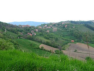
Šljivica is a small village in Šumadija and Western Serbia (Šumadija), in the municipality of Rekovac. The village has around 157 residents. It lies at 43°45′26″N20°59′55″E, at the altitude of 680 m.

Rataje is a village in the administrative district of Gmina Chodzież, within Chodzież County, Greater Poland Voivodeship, in west-central Poland. It lies approximately 4 kilometres (2 mi) north-east of Chodzież and 67 km (42 mi) north of the regional capital Poznań.
Dunajki is a settlement in the administrative district of Gmina Dziemiany, within Kościerzyna County, Pomeranian Voivodeship, in northern Poland. It lies approximately 3 kilometres (2 mi) west of Dziemiany, 21 km (13 mi) south-west of Kościerzyna, and 72 km (45 mi) south-west of the regional capital Gdańsk.
Łoza is a village in the administrative district of Gmina Stary Targ, within Sztum County, Pomeranian Voivodeship, in northern Poland. It lies approximately 9 kilometres (6 mi) north of Stary Targ, 11 km (7 mi) north-east of Sztum, and 53 km (33 mi) south-east of the regional capital Gdańsk.

Ivanje is a village in the municipality of Bojnik, Serbia. According to the 2002 census, the village has a population of 88 people.

Karađorđevac is a village in the municipality of Leskovac, Serbia. According to the 2002 census, the village has a population of 417 people.
Kučajna is a village in the municipality of Kučevo, Serbia. According to the 2002 census, the village has a population of 468 people.
Kuru is a village in Alutaguse Parish, Ida-Viru County in northeastern Estonia.

Tammispää is a village in Mustvee Parish, Jõgeva County in northeastern Estonia.
Karkuse is a village in Tapa Parish, Lääne-Viru County, in northeastern Estonia.
Vlasi is a village in the municipality of Pirot, Serbia. According to the 2002 census, the village has a population of 71 people.
Reigilaid is a small islet in the Baltic Sea belonging to the country of Estonia.
