
Goli Vrh is a dispersed settlement in the Municipality of Gorenja Vas–Poljane in the Upper Carniola region of Slovenia. It includes part of the hamlet of Suhi Dol in the eastern part of the settlement.

Anovec is a settlement in the hills northeast of Krško in eastern Slovenia. The area was traditionally part of Lower Carniola. It is now included with the rest of the Municipality of Krško in the Lower Sava Statistical Region.
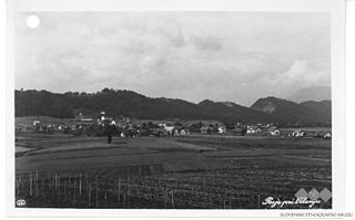
Ženje is a small settlement in the hills above the right bank of the Sava River in the Municipality of Krško in eastern Slovenia. The area was traditionally part of Lower Carniola. It is now included in the Lower Sava Statistical Region.

Vrh pri Površju is a settlement west of Raka in the Municipality of Krško in eastern Slovenia. The area was traditionally part of Lower Carniola. It is now included with the rest of the municipality in the Lower Sava Statistical Region.
Vrbina is a settlement on the right bank of the Sava River in the Municipality of Krško in eastern Slovenia. The Krško Nuclear Power Plant is built on the southern side of the settlement. The area was traditionally part of Lower Carniola. It is now included with the rest of the municipality in the Lower Sava Statistical Region.
Videm is a small settlement southwest of Raka in the Municipality of Krško in eastern Slovenia. The area was traditionally part of Lower Carniola. It is now included with the rest of the municipality in the Lower Sava Statistical Region.
Lomno is a small settlement in the hills above the right bank of the Sava River in the Municipality of Krško in eastern Slovenia. The area was traditionally part of Lower Carniola. It is now included in the Lower Sava Statistical Region.
Cesta is a settlement in the hills above the right bank of the Sava River in the Municipality of Krško in eastern Slovenia. The area was traditionally part of Lower Carniola. It is now included with the rest of the municipality in the Lower Sava Statistical Region.
Cirje is a settlement south of Raka in the Municipality of Krško in eastern Slovenia. The area was traditionally part of Lower Carniola. It is now included with the rest of the municipality in the Lower Sava Statistical Region.
Dedni Vrh is a small dispersed settlement in the hills east of Raka in the Municipality of Krško in eastern Slovenia. The area was traditionally part of Lower Carniola. It is now included with the rest of the municipality in the Lower Sava Statistical Region.
Hrastek is a small settlement in the Gorjanci Hills in the Municipality of Krško in eastern Slovenia. The area was traditionally part of Lower Carniola. It is now included with the rest of the municipality in the Lower Sava Statistical Region.
Mladje is a small village south of Podbočje in the Gorjanci Hills in the Municipality of Krško in eastern Slovenia. The area was traditionally part of Lower Carniola. It is now included with the rest of the municipality in the Lower Sava Statistical Region.
Pesje is a settlement on the left bank of the Sava River in the Municipality of Krško in eastern Slovenia. The area was traditionally part of Lower Carniola. It is now included with the rest of the municipality in the Lower Sava Statistical Region.
Premagovce is a settlement in the Gorjanci Hills in the Municipality of Krško in eastern Slovenia, right on the border with Croatia. The area was traditionally part of Lower Carniola. It is now included in the Lower Sava Statistical Region.
Selo is a small settlement on the right bank of the Krka River west of Podbočje in the Municipality of Krško in eastern Slovenia. The area was traditionally part of Lower Carniola. It is now included in the Lower Sava Statistical Region.
Slivje is a small settlement on the right bank of the Krka River southwest of Podbočje in the Municipality of Krško in eastern Slovenia. The area was traditionally part of Lower Carniola. It is now included with the rest of the municipality in the Lower Sava Statistical Region.
Smednik is a small settlement south of Raka in the Municipality of Krško in eastern Slovenia. It lies just north of the A2 motorway from Ljubljana to Zagreb. The area was traditionally part of Lower Carniola. It is now included with the rest of the municipality in the Lower Sava Statistical Region.
Šutna is a settlement east of Podbočje in the Municipality of Krško in eastern Slovenia. The area was traditionally part of Lower Carniola. It is now included with the rest of the municipality in the Lower Sava Statistical Region.

Mali Vrh pri Prežganju is a small settlement in the hills east of Ljubljana, the capital of Slovenia. It belongs to the City Municipality of Ljubljana. The area was part of the traditional region of Lower Carniola and is now included with the rest of the municipality in the Central Slovenia Statistical Region.


