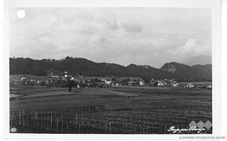
Anovec is a settlement in the hills northeast of Krško in eastern Slovenia. The area was traditionally part of Lower Carniola. It is now included with the rest of the Municipality of Krško in the Lower Sava Statistical Region.

Ženje is a small settlement in the hills above the right bank of the Sava River in the Municipality of Krško in eastern Slovenia. The area was traditionally part of Lower Carniola. It is now included in the Lower Sava Statistical Region.

Srednje Arto is a small settlement in the hills above the right bank of the Sava River in the Municipality of Krško in eastern Slovenia. The area was traditionally part of Lower Carniola. It is now included in the Lower Sava Statistical Region.

Spodnji Stari Grad is a settlement on the left bank of the Sava River in the Municipality of Krško in eastern Slovenia. The area was traditionally part of Styria. It is now included with the rest of the municipality in the Lower Sava Statistical Region.

Vrbina is a settlement on the right bank of the Sava River in the Municipality of Krško in eastern Slovenia. The Krško Nuclear Power Plant is built on the southern side of the settlement. The area was traditionally part of Lower Carniola. It is now included with the rest of the municipality in the Lower Sava Statistical Region.

Cesta is a settlement in the hills above the right bank of the Sava River in the Municipality of Krško in eastern Slovenia. The area was traditionally part of Lower Carniola. It is now included with the rest of the municipality in the Lower Sava Statistical Region.

Dalce is a small settlement in the hills above the right bank of the Sava River in the Municipality of Krško in eastern Slovenia. The area was traditionally part of Lower Carniola. It is now included with the rest of the municipality in the Lower Sava Statistical Region.

Gunte is a small settlement in the hills above the right bank of the Sava River in the Municipality of Krško in eastern Slovenia. The area was traditionally part of Lower Carniola. It is now included with the rest of the municipality in the Lower Sava Statistical Region.

Hrastek is a small settlement in the Gorjanci Hills in the Municipality of Krško in eastern Slovenia. The area was traditionally part of Lower Carniola. It is now included with the rest of the municipality in the Lower Sava Statistical Region.

Kalce–Naklo is a village in the flat plains between the Sava and Krka rivers, south of Leskovec pri Krškem in the Municipality of Krško in eastern Slovenia. As its compound name suggests, it is made up of two parts: Kalce to the north and Naklo to the south. The area was traditionally part of Lower Carniola. It is now included with the rest of the municipality in the Lower Sava Statistical Region.

Mladje is a small village south of Podbočje in the Gorjanci Hills in the Municipality of Krško in eastern Slovenia. The area was traditionally part of Lower Carniola. It is now included with the rest of the municipality in the Lower Sava Statistical Region.

Pesje is a settlement on the left bank of the Sava River in the Municipality of Krško in eastern Slovenia. The area was traditionally part of Lower Carniola. It is now included with the rest of the municipality in the Lower Sava Statistical Region.

Premagovce is a settlement in the Gorjanci Hills in the Municipality of Krško in eastern Slovenia, right on the border with Croatia. The area was traditionally part of Lower Carniola. It is now included in the Lower Sava Statistical Region.

Spodnje Pijavško is a settlement on the right bank of the Sava River in the Municipality of Krško in eastern Slovenia. The area was traditionally part of Lower Carniola and is now included with the rest of the municipality in the Lower Sava Statistical Region.

Srednje Pijavško is a small settlement on the right bank of the Sava River in the Municipality of Krško in eastern Slovenia. The area was traditionally part of Lower Carniola and is now included with the rest of the municipality in the Lower Sava Statistical Region.

Strmo Rebro is a small settlement in the hills above the right bank of the Sava River, northwest of Gora in the Municipality of Krško in eastern Slovenia. The area was traditionally part of Lower Carniola. It is now included with the rest of the municipality in the Lower Sava Statistical Region.

Šutna is a settlement east of Podbočje in the Municipality of Krško in eastern Slovenia. The area was traditionally part of Lower Carniola. It is now included with the rest of the municipality in the Lower Sava Statistical Region.

Trška Gora is a settlement in the hills above the right bank of the Sava River, opposite Krško in eastern Slovenia. The area was traditionally part of Lower Carniola. It is now included with the rest of the municipality in the Lower Sava Statistical Region.

Hudo Brezje is a settlement in the hills above the right bank of the Sava River in the western Krško Hills in east-central Slovenia. It belongs to the Municipality of Sevnica. The area is part of the historical region of Lower Carniola and is now included in the Lower Sava Statistical Region.


