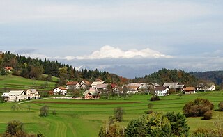
Bojsno is a village in the Municipality of Brežice in eastern Slovenia. The area was traditionally part of Styria. It is now included in the Lower Sava Statistical Region. The settlement includes the hamlets of Spodnje Bojsno, Zgornje Bojsno, Pesjak, Makovce, and Vogence.

Gorenja Lepa Vas is a small settlement in the hills above the right bank of the Sava River in the Municipality of Krško in eastern Slovenia. The area was traditionally part of Lower Carniola. It is now included with the rest of the municipality in the Lower Sava Statistical Region.

Žadovinek is a settlement on the right bank of the Sava River, east of Leskovec in the Municipality of Krško in eastern Slovenia. The area was traditionally part of Lower Carniola. It is now included with the rest of the municipality in the Lower Sava Statistical Region.

Leskovec pri Krškem is a settlement on the right bank of the Sava River in the Municipality of Krško in eastern Slovenia. The area was traditionally part of Lower Carniola. It is now included with the rest of the municipality in the Lower Sava Statistical Region. It includes the hamlets of Grad, Beli Breg, Veliki Marof, and Žadovinka. Older sources also mention the appertaining hamlet of Bajer.

Mali Koren is a small settlement in the Municipality of Krško in eastern Slovenia. The area was traditionally part of Lower Carniola. It is now included with the rest of the municipality in the Lower Sava Statistical Region.

Gora is a small village in the hills northwest of Leskovec in the Municipality of Krško in eastern Slovenia. The area was traditionally part of Lower Carniola. It is now included with the rest of the municipality in the Lower Sava Statistical Region.

Ravni is a village in the Municipality of Krško in eastern Slovenia. The area was traditionally part of Lower Carniola. It is now included with the rest of the municipality in the Lower Sava Statistical Region.

Mali Trn is a small village in the Municipality of Krško in eastern Slovenia. The area was traditionally part of Lower Carniola. It is now included with the rest of the municipality in the Lower Sava Statistical Region.

Podbočje is a village on the right bank of the Krka River in the foothills of the Gorjanci range in the Municipality of Krško in eastern Slovenia. The area was traditionally part of Lower Carniola. It is now included with the rest of the municipality in the Lower Sava Statistical Region.

Veliki Trn is a small settlement in the Municipality of Krško in eastern Slovenia. The area was traditionally part of Lower Carniola. It is now included with the rest of the municipality in the Lower Sava Statistical Region.

Veliki Podlog is a village in the Municipality of Krško in eastern Slovenia. It lies south of the main motorway from Ljubljana to Zagreb south of Leskovec. The area was traditionally part of Lower Carniola. It is now included with the rest of the municipality in the Lower Sava Statistical Region.

Gržeča Vas is a village west of Veliki Podlog in the Municipality of Krško in eastern Slovenia. The area was traditionally part of Lower Carniola. It is now included with the rest of the municipality in the Lower Sava Statistical Region.

Loke is a small settlement in the hills immediately northwest of Leskovec pri Krškem in the Municipality of Krško in eastern Slovenia. The area was traditionally part of Lower Carniola. It is now included with the rest of the municipality in the Lower Sava Statistical Region. It includes an isolated vacation estate on Saint Florian Hill east of the settlement, known as Florijanovo.

Straža pri Krškem is a small village in the hills above the left bank of the Sava River northwest of the town of Krško in eastern Slovenia. The area was traditionally part of Lower Carniola. It is now included with the rest of the municipality in the Lower Sava Statistical Region.

Veliki Lipoglav is a small settlement in the hills southeast of Ljubljana in central Slovenia. It belongs to the City Municipality of Ljubljana and is part of the traditional region of Lower Carniola. It is now included with the rest of the municipality in the Central Slovenia Statistical Region.

Gombišče is a small settlement in the Municipality of Trebnje in eastern Slovenia. The area is part of the historical region of Lower Carniola. The municipality is now included in the Southeast Slovenia Statistical Region. It includes the hamlet of Vrh.

Trstenik is a settlement in the Municipality of Šentrupert in southeastern Slovenia. It lies just northeast of Mirna in the historical region of Lower Carniola. The municipality is now included in the Southeast Slovenia Statistical Region. It includes the hamlets of Butara, Gorenji Konec, Veliki Konec, Kurja Dolina, Dolenji Konec, Kot, and Sotlo.

Cerovec is a dispersed settlement in the hills northeast of Šentjanž in the Municipality of Sevnica in central Slovenia. The area is part of the historical region of Styria. The municipality is now included in the Lower Sava Statistical Region. The settlement includes the hamlets of Podglina, Trebelno, Bajnof, Grič, Lesičjek, Veliki Vrh, Hom, and Pekel.

Hreljin is an uninhabited settlement on the left bank of the Kolpa River in the Municipality of Kočevje in southern Slovenia. The area is part of the traditional region of Lower Carniola and is now included in the Southeast Slovenia Statistical Region.

Kuželič is a small uninhabited settlement west of Vas in the Municipality of Kostel in southern Slovenia. The area is part of the traditional region of Lower Carniola and is now included in the Southeast Slovenia Statistical Region.


