Gunte

Last updated
Gunte
Slovenia location map.svg
Red pog.svg
Gunte
Location in Slovenia
Coordinates: 45°58′48.5″N15°28′2.37″E / 45.980139°N 15.4673250°E / 45.980139; 15.4673250 Coordinates: 45°58′48.5″N15°28′2.37″E / 45.980139°N 15.4673250°E / 45.980139; 15.4673250
Country Flag of Slovenia.svg Slovenia
Traditional region Lower Carniola
Statistical region Lower Sava
Municipality Krško
Area
  Total 0.73 km2 (0.28 sq mi)
Elevation 318.4 m (1,044.6 ft)
Population (2002)
  Total 31
[1]

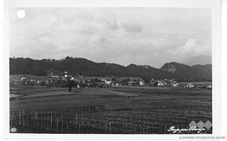
Gunte (pronounced  [ˈɡuːntɛ] ) is a small settlement in the hills above the right bank of the Sava River in the Municipality of Krško in eastern Slovenia. The area was traditionally part of Lower Carniola. It is now included with the rest of the municipality in the Lower Sava Statistical Region. [2]

Sava river in Southeast Europe

The Sava is a river in Central and Southeastern Europe, a right tributary of the Danube. It flows through Slovenia, Croatia, along the northern border of Bosnia and Herzegovina, and through Serbia, discharging into the Danube in Belgrade. Its central part is a natural border of Bosnia-Herzegovina and Croatia. The Sava forms the northern border of the Balkan Peninsula, and the southern edge of the Pannonian Plain.

Municipality of Krško Municipality in Slovenia

The Municipality of Krško is a municipality in eastern Slovenia. Its seat is the town of Krško. The area is traditionally divided between Lower Styria and Lower Carniola. The entire municipality is now included in the Lower Sava statistical region.

Slovenia republic in Central Europe

Slovenia, officially the Republic of Slovenia, is a sovereign state located in southern Central Europe at a crossroads of important European cultural and trade routes. It is bordered by Italy to the west, Austria to the north, Hungary to the northeast, Croatia to the southeast, and the Adriatic Sea to the southwest. It covers 20,273 square kilometers (7,827 sq mi) and has a population of 2.07 million. One of the successor states of the former Yugoslavia, Slovenia is a parliamentary republic and a member of the United Nations, of the European Union, and of NATO. The capital and largest city is Ljubljana.

Archaeological finds from the area indicate that the Roman road from Neviodunum to Celeia and the bridge over the Sava River were on the banks below the settlement. [3]

Artifact (archaeology) Something made by humans and of archaeological interest

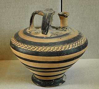
An artifact, or artefact, is something made or given shape by humans, such as a tool or a work of art, especially an object of archaeological interest.

Roman roads roads built in service of the Roman Empire

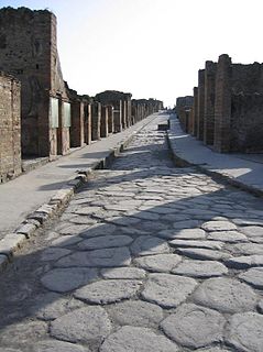
Roman roads were physical infrastructure vital to the maintenance and development of the Roman state, and were built from about 300 BC through the expansion and consolidation of the Roman Republic and the Roman Empire. They provided efficient means for the overland movement of armies, officials, and civilians, and the inland carriage of official communications and trade goods. Roman roads were of several kinds, ranging from small local roads to broad, long-distance highways built to connect cities, major towns and military bases. These major roads were often stone-paved and metaled, cambered for drainage, and were flanked by footpaths, bridleways and drainage ditches. They were laid along accurately surveyed courses, and some were cut through hills, or conducted over rivers and ravines on bridgework. Sections could be supported over marshy ground on rafted or piled foundations.

Drnovo Place in Lower Carniola, Slovenia

Drnovo is a village south of Leskovec in the Municipality of Krško in eastern Slovenia. It lies just north of the motorway from Ljubljana to Zagreb. The area was traditionally part of Lower Carniola. It is now included with the rest of the municipality in the Lower Sava Statistical Region.

Related Research Articles

Ženje in Lower Carniola, Slovenia

Ženje is a small settlement in the hills above the right bank of the Sava River in the Municipality of Krško in eastern Slovenia. The area was traditionally part of Lower Carniola. It is now included in the Lower Sava Statistical Region.

Srednje Arto in Lower Carniola, Slovenia

Srednje Arto is a small settlement in the hills above the right bank of the Sava River in the Municipality of Krško in eastern Slovenia. The area was traditionally part of Lower Carniola. It is now included in the Lower Sava Statistical Region.

Gorenja Lepa Vas in Lower Carniola, Slovenia

Gorenja Lepa Vas is a small settlement in the hills above the right bank of the Sava River in the Municipality of Krško in eastern Slovenia. The area was traditionally part of Lower Carniola. It is now included with the rest of the municipality in the Lower Sava Statistical Region.

Spodnji Stari Grad in Styria, Slovenia

Spodnji Stari Grad is a settlement on the left bank of the Sava River in the Municipality of Krško in eastern Slovenia. The area was traditionally part of Styria. It is now included with the rest of the municipality in the Lower Sava Statistical Region.

Vrbina Place in Lower Carniola, Slovenia

Vrbina is a settlement on the right bank of the Sava River in the Municipality of Krško in eastern Slovenia. The Krško Nuclear Power Plant is built on the southern side of the settlement. The area was traditionally part of Lower Carniola. It is now included with the rest of the municipality in the Lower Sava Statistical Region.

Lomno, Krško in Lower Carniola, Slovenia

Lomno is a small settlement in the hills above the right bank of the Sava River in the Municipality of Krško in eastern Slovenia. The area was traditionally part of Lower Carniola. It is now included in the Lower Sava Statistical Region.

Cesta, Krško in Lower Carniola, Slovenia

Cesta is a settlement in the hills above the right bank of the Sava River in the Municipality of Krško in eastern Slovenia. The area was traditionally part of Lower Carniola. It is now included with the rest of the municipality in the Lower Sava Statistical Region.

Črešnjice nad Pijavškim in Lower Carniola, Slovenia

Črešnjice nad Pijavškim is a small settlement in the hills above Gornje Pijavško on the right bank of the Sava River in the Municipality of Krško in eastern Slovenia. The area was traditionally part of Lower Carniola. It is now included with the rest of the municipality in the Lower Sava Statistical Region.

Dalce in Lower Carniola, Slovenia

Dalce is a small settlement in the hills above the right bank of the Sava River in the Municipality of Krško in eastern Slovenia. The area was traditionally part of Lower Carniola. It is now included with the rest of the municipality in the Lower Sava Statistical Region.

Dobrava ob Krki in Lower Carniola, Slovenia

Dobrava ob Krki is a small village on the right bank of the Krka River east of Podbočje in the Municipality of Krško in eastern Slovenia. The area was traditionally part of Lower Carniola. It is now included with the rest of the municipality in the Lower Sava Statistical Region.

Gornje Pijavško in Lower Carniola, Slovenia

Gornje Pijavško is a village on the right bank of the Sava River in the Municipality of Krško in eastern Slovenia. The area was traditionally part of Lower Carniola. It is now included in the Lower Sava Statistical Region.

Osredek pri Trški Gori in Lower Carniola, Slovenia

Osredek pri Trški Gori is a small settlement in the hills above the right bank of the Sava River, beyond Trška Gora in the Municipality of Krško in eastern Slovenia. The area was traditionally part of Lower Carniola. It is now included with the rest of the municipality in the Lower Sava Statistical Region.

Pesje Village in Styria, Slovenia

Pesje is a settlement on the left bank of the Sava River in the Municipality of Krško in eastern Slovenia. The area was traditionally part of Lower Carniola. It is now included with the rest of the municipality in the Lower Sava Statistical Region.

Selo, Krško in Lower Carniola, Slovenia

Selo is a small settlement on the right bank of the Krka River west of Podbočje in the Municipality of Krško in eastern Slovenia. The area was traditionally part of Lower Carniola. It is now included in the Lower Sava Statistical Region.

Slivje, Krško in Lower Carniola, Slovenia

Slivje is a small settlement on the right bank of the Krka River southwest of Podbočje in the Municipality of Krško in eastern Slovenia. The area was traditionally part of Lower Carniola. It is now included with the rest of the municipality in the Lower Sava Statistical Region.

Spodnje Pijavško in Lower Carniola, Slovenia

Spodnje Pijavško is a settlement on the right bank of the Sava River in the Municipality of Krško in eastern Slovenia. The area was traditionally part of Lower Carniola and is now included with the rest of the municipality in the Lower Sava Statistical Region.

Srednje Pijavško Place in Lower Carniola, Slovenia

Srednje Pijavško is a small settlement on the right bank of the Sava River in the Municipality of Krško in eastern Slovenia. The area was traditionally part of Lower Carniola and is now included with the rest of the municipality in the Lower Sava Statistical Region.

Strmo Rebro in Lower Carniola, Slovenia

Strmo Rebro is a small settlement in the hills above the right bank of the Sava River, northwest of Gora in the Municipality of Krško in eastern Slovenia. The area was traditionally part of Lower Carniola. It is now included with the rest of the municipality in the Lower Sava Statistical Region.

Hudo Brezje in Lower Carniola, Slovenia

Hudo Brezje is a settlement in the hills above the right bank of the Sava River in the western Krško Hills in east-central Slovenia. It belongs to the Municipality of Sevnica. The area is part of the historical region of Lower Carniola and is now included in the Lower Sava Statistical Region.

References