External links
Coordinates: 44°26′N67°58′W / 44.44°N 67.97°W / 44.44; -67.97
| Authority control |
|
|---|
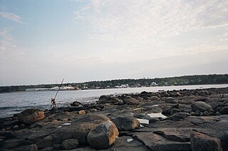
Gouldsboro Bay is a bay on the coast of the U.S. state of Maine.
The bay is located between the towns of Gouldsboro and Steuben. It is separated from Dyer Bay to the west by Dyer Neck, from Prospect Harbor to the southwest by Cranberry Point, and from the Gulf of Maine by the Sally Islands.
The bay extends roughly 7 mi. (11 km) and is 2 mi. (3 km) at its widest.
Coordinates: 44°26′N67°58′W / 44.44°N 67.97°W

Gouldsboro is a town and municipality in Hancock County, Maine, United States on the Schoodic Peninsula. The town was named for Robert Gould, a landholder in the town. The town has many historically separate fishing villages, summer colonies and communities, including Birch Harbor, Prospect Harbor, South Gouldsboro, West Gouldsboro, Summer Harbor, Wonsqueak Harbor, Bunker's Harbor, Chicken Mill, Jones' Pond, Westbay, and Corea. The population was 1,737 at the 2010 census.
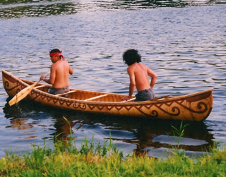
Passamaquoddy Indian Township Reservation,Motahkomikuk in Malecite-Passamaquoddy, is one of two Indian reservations of the federally recognized Passamaquoddy tribe in Washington County, Maine, United States. The population was 718 at the 2010 census. Most of the 2500 members of the tribe in the United States live in other parts of Maine. The reservation is located about 13 miles west-northwest of the city of Calais.

The Passamaquoddy are an American Indian/First Nations people who live in northeastern North America, primarily in Maine, United States, and New Brunswick, Canada.

The St. Croix River is a river in northeastern North America, 71 miles (114 km) in length, that forms part of the Canada–United States border between Maine (U.S.) and New Brunswick (Canada). The river rises in the Chiputneticook Lakes and flows south and southeast, between Calais and St. Stephen. It discharges into Passamaquoddy Bay, in the Bay of Fundy.

Machias Seal Island is an island in disputed water between the Gulf of Maine and the Bay of Fundy, about 16 km (10 mi) southeast from Cutler, Maine, and 19 km (12 mi) southwest of Grand Manan Island, New Brunswick. Sovereignty of the island is disputed by the US and Canada. The Canadian Coast Guard continues to staff a lighthouse on the island; the first lighthouse was constructed there in 1832.
Little Kennebec Bay is a bay on the coast of Maine. Located in Washington County, between Roque Bluffs and Machiasport, it extends roughly 5 mi. (8 km) inland and is 1.5 mi. (3 km) at its widest.
Dennys Bay is a bay in Washington County, Maine. Located between the towns of Pembroke, Dennysville, and Whiting, it extends roughly 5 mi. (8 km) from Dennysville to Cobscook Bay and is 2 mi. (3 km) at its widest.
Pleasant Bay is a bay in Washington County, Maine, at the mouth of the Pleasant River.
Harrington Bay is a bay in Washington County, Maine.
Narraguagus Bay is a bay in Washington County, Maine.
Dyer Bay is a bay in Steuben, Maine.
Englishman Bay is a bay in Washington County, Maine.
Chandler Bay is a bay in Jonesport, Maine.

Prospect Harbor is a bay in Gouldsboro, Maine. It is separated from Gouldsboro Bay to the northeast by Cranberry Point and from Winter Harbor to the west by the Schoodic Peninsula.
Pigeon Hill Bay is a bay in Washington County, Maine.

Great Wass Island lies in the Atlantic Ocean off the coast of the State of Maine, United States. On the mainland is Jonesport in Washington County. The island is 5 mi (8 km) long, 1.5 mi (2.5 km) wide and it is the biggest island in the Great Wass Archipelago, which contains over 43 islands extending off the coast from Jonesport. Great Wass Island is connected with a bridge to Beals Island, which is then connected to the mainland. Head Harbor Island and Steels Harbor Island lie close to the east. The 1,450-acre (5.9 km2) Great Wass Island Preserve is in the island. The interior of Great Wass Island supports coastal Maine's largest stand of jack pine, other typical plants are bakeapple, deer-hair sedge, and dragon's mouth orchid. The island is part of the Town of Beals, in Washington County.
The Chandler River is a 24.5-mile-long (39.4 km) river in Washington County, Maine. It flows from its source on Cottontail Hill in Centerville to Jonesboro, where it empties into Englishman Bay.
The Sandy River is a very short river in Jonesport, Maine. From its source, the river runs about 1 mile southeast to the coast of Chandler Bay.

Mistake Island is an island in Washington County, in the U.S. state of Maine. The island contains little vegetation. Mistake Island has been noted for its unusual place name.