The Ohio River is a 981-mile-long (1,579 km) river in the United States. It is located at the boundary of the Midwestern and Southern United States, flowing in a southwesterly direction from western Pennsylvania to its mouth on the Mississippi River at the southern tip of Illinois. It is the third largest river by discharge volume in the United States and the largest tributary by volume of the north-south flowing Mississippi River, which divides the eastern from western United States. It is also the sixth oldest river on the North American continent. The river flows through or along the border of six states, and its drainage basin includes parts of 14 states. Through its largest tributary, the Tennessee River, the basin includes several states of the southeastern U.S. It is the source of drinking water for five million people.

Grand Rivers is a home rule-class city in Livingston County, Kentucky, in the United States. The population was 382 at the 2010 census, up from 343 in 2000. It is part of the Paducah, KY-IL Metropolitan Statistical Area.

The Tennessee River is the largest tributary of the Ohio River. It is approximately 652 miles (1,049 km) long and is located in the southeastern United States in the Tennessee Valley. The river was once popularly known as the Cherokee River, among other names, as the Cherokee people had their homelands along its banks, especially in what are now East Tennessee and northern Alabama. Additionally, its tributary, the Little Tennessee River, flows into it from Western North Carolina and northeastern Georgia, where the river also was bordered by numerous Cherokee towns. Its current name is derived from the Cherokee town, Tanasi, which was located on the Tennessee side of the Appalachian Mountains.

The Cumberland River is a major waterway of the Southern United States. The 688-mile-long (1,107 km) river drains almost 18,000 square miles (47,000 km2) of southern Kentucky and north-central Tennessee. The river flows generally west from a source in the Appalachian Mountains to its confluence with the Ohio River near Paducah, Kentucky, and the mouth of the Tennessee River. Major tributaries include the Obey, Caney Fork, Stones, and Red Rivers.

The Kentucky River is a tributary of the Ohio River in Kentucky, United States. The 260-mile (420 km) river and its tributaries drain much of eastern and central Kentucky, passing through the Eastern Coalfield, the Cumberland Mountains, and the Bluegrass region. Its watershed encompasses about 7,000 square miles (18,000 km2), and it supplies drinking water to about one-sixth of the population of the state.

The Illinois Central Railroad, sometimes called the Main Line of Mid-America, was a railroad in the Central United States. Its primary routes connected Chicago, Illinois, with New Orleans, Louisiana, and Mobile, Alabama, and thus, the Great Lakes to the Gulf of Mexico. Another line connected Chicago west to Sioux City, Iowa (1870), while smaller branches reached Omaha, Nebraska (1899) from Fort Dodge, Iowa, and Sioux Falls, South Dakota (1877), from Cherokee, Iowa. The IC also ran service to Miami, Florida, on trackage owned by other railroads.

The Nashville, Chattanooga and St. Louis Railway was a railway company that operated in the U.S. states of Kentucky, Tennessee, Alabama, and Georgia. It began as the Nashville and Chattanooga Railroad, chartered in Nashville on December 11, 1845, built to 5 ft gauge and was the first railway to operate in the state of Tennessee. By the turn of the twentieth century, the NC&StL grew into one of the most important railway systems in the southern United States.

Lake Barkley, a 58,000-acre (230 km2) reservoir in Livingston County, Lyon County and Trigg County in Kentucky and extending into Stewart County and Houston County in Tennessee, was impounded by the U.S. Army Corps of Engineers in 1966 upon the completion of Barkley Dam. Both the lake and the dam are named for Vice President Alben Barkley, a Kentucky native.

The National Register of Historic Places in the United States is a register including buildings, sites, structures, districts, and objects. The Register automatically includes all National Historic Landmarks as well as all historic areas administered by the U.S. National Park Service. Since its introduction in 1966, more than 97,000 separate listings have been added to the register.

The Paducah & Louisville Railway is a Class II railroad that operates freight service between Paducah and Louisville, Kentucky. The line is located entirely within the Commonwealth of Kentucky.

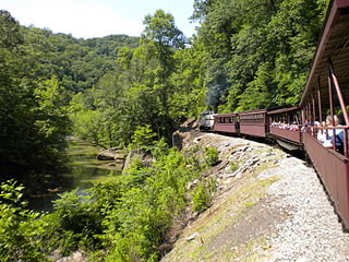
The Big South Fork Scenic Railway is a heritage railroad in Stearns, Kentucky.

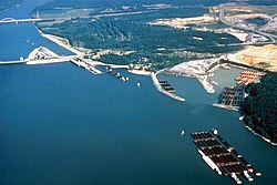
Kentucky Dam is a hydroelectric dam on the Tennessee River on the county line between Livingston and Marshall counties in the U.S. state of Kentucky. The dam is the lowermost of nine dams on the river owned and operated by the Tennessee Valley Authority, which built the dam in the late 1930s and early 1940s to improve navigation on the lower part of the river and reduce flooding on the lower Ohio and Mississippi rivers. It was a major project initiated during the New Deal of President Franklin D. Roosevelt's administration, to invest in infrastructure to benefit the country. The dam impounds the Kentucky Lake of 160,000 acres (65,000 ha), which is the largest of TVA's reservoirs and the largest artificial lake by area in the Eastern United States. It was designated as an National Historic Civil Engineering Landmark by the American Society of Civil Engineers in 1996 and listed on the National Register of Historic Places in 2017.

The Ohio River flood of 1937 took place in late January and February 1937. With damage stretching from Pittsburgh, Pennsylvania, to Cairo, Illinois, 385 people died, one million people were left homeless and property losses reached $500 million. Federal and state resources were strained to aid recovery as the disaster occurred during the depths of the Great Depression and a few years after the beginning of the Dust Bowl.

Calvert City is a home rule-class city in Marshall County, Kentucky, United States. The population was 2,514 at the 2020 census.

The Lincoln Heritage Council (LHC) is a local council of the Boy Scouts of America serving 64 counties in four states: Kentucky, Indiana, Illinois, and Tennessee.
The former Louisville and Nashville Railroad Lebanon Branch was 77 miles long and ran from Lebanon Junction in Bullitt County to near Mt. Vernon in Rockcastle County. Construction of the branch began in 1857, reaching Lebanon in that year. The line was extended to Crab Orchard in 1866 and completed in 1868. Most of the line was abandoned in 1987. The portion from Stanford to Mt. Vernon was abandoned during the 1990s.


