Brookfield is a town in Fairfield County, Connecticut, United States, situated within the southern foothills of the Berkshire Mountains. The population was 17,528 at the 2020 census. The town is located 55 miles (89 km) northeast of New York City, making it part of the New York-Newark, NY-NJ-CT-PA combined statistical area. The town is part of the Western Connecticut Planning Region. In July 2013, Money magazine ranked Brookfield the 26th-best place to live in the United States, and the best place to live in Connecticut.
Fairfield County is a county in the southwestern corner of the U.S. state of Connecticut. It is the most populous county in the state and was also its fastest-growing from 2010 to 2020. As of the 2020 census, the county's population was 957,419, representing 26.6% of Connecticut's overall population. The closest to the center of the New York metropolitan area, the county contains four of the state's seven largest cities—Bridgeport (first), Stamford (second), Norwalk (sixth) and Danbury (seventh)—whose combined population of 433,368 is nearly half the county's total population.
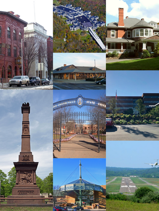
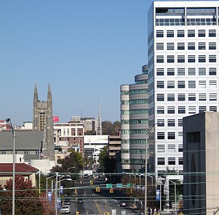
Danbury is a city in Fairfield County, Connecticut, United States, located approximately 50 miles (80 km) northeast of New York City. Danbury's population as of 2020 was 86,518. It is the third-largest city in Western Connecticut, and the seventh-largest city in Connecticut. Located within the heart of the Housatonic Valley region, the city is a commercial hub of western Connecticut, an outer-ring commuter suburb of New York City, and an historic summer colony of the New York metropolitan area and New England.
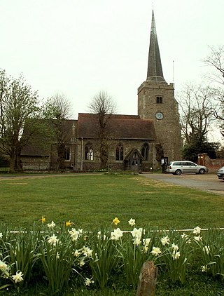
Danbury is a village in the City of Chelmsford district, in the county of Essex, England. It is located 33.5 miles (53.9 km) northeast of Charing Cross, London and has a population of approximately 6,500. It is situated on a hill 367 feet (112 m) above sea level.

Ridgefield is a town in Fairfield County, Connecticut, United States. Situated in the foothills of the Berkshire Mountains and on the New York state border, Ridgefield had a population of 25,033 as of the 2020 census. The town is part of the Western Connecticut Planning Region. The town center, which was formerly a borough, is defined by the U.S. Census Bureau as a census-designated place. The town was settled then quickly incorporated by 1709.

Route 34 is a primary state highway in the U.S. state of Connecticut. Route 34 is 21.88 miles (35.21 km) long, and extends from Newtown near I-84 to Route 10 in New Haven. The highways connects the New Haven and Danbury areas via the Lower Naugatuck River Valley. The portion of the route between New Haven and Derby was an early toll road known as the Derby Turnpike. It formerly ran through downtown New Haven on the Oak Street Connector until the early 2020s.

New Milford is a town in Litchfield County, Connecticut, United States. The town, part of Greater Danbury, as well as the New York Metropolitan Area, has a population of 28,115 as of the 2020 census. New Milford lies 14 miles (23 km) north of Danbury on the banks of the Housatonic River, and shares its border with the northeastern shore of Candlewood Lake. It is the largest town in the state of Connecticut in terms of land area at nearly 63.7 mi2 (164.9822 km2). The town center is listed as a census-designated place (CDP).

The Danbury Museum and Historical Society is a museum located in Danbury, Connecticut, the purpose of which is to acquire, preserve, exhibit, and interpret the heritage of the Greater Danbury area for education, information, and research. The main campus of the museum is located on 43 Main Street. It is home to five historic buildings: Huntington Hall, the 1785 Rider House, the 1790 John Dodd Hat Shop, the Little Red Schoolhouse, and the Marian Anderson Studio. The museum also operates a sixth building: the Charles Ives Birthplace, located on Mountainville Avenue.

Branchville is a neighborhood of the town of Ridgefield in Fairfield County, Connecticut, United States, and is also the name of a Metro North railroad station. Branchville was listed as a census-designated place (CDP) prior to the 2020 census.

Cannondale is a census-designated place (CDP) within the town of Wilton in Fairfield County, Connecticut, United States. It had a population of 141 at the 2010 census. The neighborhood consists of many old homes on large, almost rural lots now largely wooded. The English first settled the land in the 17th century. At the center of Cannondale is Cannon Crossing, a small shopping village of boutiques and restaurants made up of 19th-century buildings restored by actress June Havoc in the late 1970s on the east side of Cannondale Railroad Station. Both are part of Cannondale Historic District, which encompasses the central part of Cannondale and most of its significant historical buildings.

The Main Street Historic District in Danbury, Connecticut, United States, is the oldest section of that city, at its geographical center. It has long been the city's commercial core and downtown. Its 132 buildings, 97 of which are considered contributing properties, include government buildings, churches, commercial establishments and residences, all in a variety of architectural styles from the late 18th century to the early 20th. It is the only major industrial downtown of its size in Connecticut not to have developed around either port facilities or a water power site.

The John Rider House is located on Main Street in Danbury, Connecticut, United States. It is a wooden frame house dating to the late 18th century.
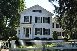
Hattertown is a village in the town of Newtown, Connecticut, United States that is listed on the National Register of Historic Places as the Hattertown Historic District and includes a smaller local historic district.
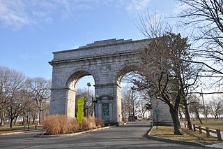
Bridgeport is the most populous city in the U.S. state of Connecticut and the fifth-most populous city in New England, with a population of 148,654 in 2020. Located in eastern Fairfield County at the mouth of the Pequonnock River on Long Island Sound, it is a port city 60 miles (97 km) from Manhattan and 40 miles (64 km) from The Bronx. It borders the towns of Trumbull to the north, Fairfield to the west, and Stratford to the east. Bridgeport and other towns in Fairfield County make up the Greater Bridgeport Planning Region, as well as the Bridgeport–Stamford–Norwalk–Danbury metropolitan statistical area, the second largest metropolitan area in Connecticut. The Bridgeport–Stamford–Norwalk–Danbury metropolis forms part of the New York metropolitan area.

The Joseph W. Pepin Memorial Building formally known as Alternative Center for Excellence (ACE) and the Alternative Center for Education, is located in the former Locust Avenue School at 26 Locust Avenue in Danbury, Connecticut, United States. It is an alternative high school within Danbury Public Schools, meant for at-risk students.

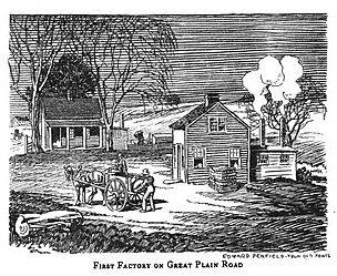
Mill Plain is an unincorporated area in the City of Danbury, Connecticut, United States. It is located in the westernmost part of the city, bordering the town of Southeast, New York.

Miry Brook is an unincorporated area in the City of Danbury in Fairfield County, Connecticut. It is located in the western part of the city, bordering Mill Plain to the north and west at Lake Kenosia and the town of Ridgefield, Connecticut, to the southwest. The Danbury Airport is located in Miry Brook.

Northville is a unincorporated area in the town of New Milford, Litchfield County, Connecticut, United States. It is located approximately 4 miles (6.4 km) northeast of New Milford Town Center along U.S. Route 202.

Beaverbrook or Beaver Brook, is an unincorporated area in the City of Danbury, Fairfield County, Connecticut.

King Street is a residential neighborhood and former district in Danbury, Connecticut. Located in the northwest corner of the city, it borders the Milltown section of Southeast, New York to the west and the town of New Fairfield, Connecticut, to the north.


