Miry Brook, Connecticut

Last updated
Miry Brook, Connecticut
Unincorporated
Miry-Brook-Volunteer-Fire-Co 13.jpg
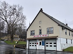
Miry Brook Volunteer Fire Department in 2022
USA Connecticut location map.svg
Red pog.svg
Miry Brook
Location in Connecticut
Usa edcp location map.svg
Red pog.svg
Miry Brook
Location in the United States
Coordinates: 41°21′59.34″N73°28′56.44″W / 41.3664833°N 73.4823444°W / 41.3664833; -73.4823444 Coordinates: 41°21′59.34″N73°28′56.44″W / 41.3664833°N 73.4823444°W / 41.3664833; -73.4823444 [1]
CountryUnited States
U.S. state Connecticut
County Fairfield
Region Western CT
City Danbury

Miry Brook is an unincorporated area in the City of Danbury in Fairfield County, Connecticut. [1] It is located in the western part of the city, bordering Mill Plain to the north and west at Lake Kenosia and the town of Ridgefield, Connecticut, to the southwest. The Danbury Airport is located in Miry Brook.

Contents

History

The name Miry Brook is derived from the presence of swampland or “mire,” which makes up the landscape of the area, as well as the aptly named stream or “brook” that runs through it. According to local tradition however, it was named after an incident that occurred during the 1777 British retreat from Danbury (see Battle of Ridgefield), in which the Americans destroyed the bridge at Wolf Pond Run to impede the British, causing them a delay and mired artillery. Although this story may be true, it is not what gave rise to the name of the waterway and area, as there are recorded mentions of Miry Brook from as early as 1712. [2]

Miry-Brook-Cemetery-1777.jpg

Miry Brook School

Although almost unrecognizable today, the Miry Brook Schoolhouse is one of four original district schools remaining in Danbury. In the early 1900s it was considered a "model rural school," and was part of a training program, [3] where Danbury Normal School (now WestConn) students completed their student teaching labs. [4] It would later become the auxiliary police headquarters & Civil Defense Building, [5] and has since undergone major modifications.

Watershed

As its name suggests, Miry Brook consists of a primary waterway surrounded by swampy wetlands. The Miry Brook itself begins in Ridgefield and runs throughout Danbury [6] until it reaches the Still River and feeds into it as one of its major tributaries. [7] This connects Miry Brook to the Housatonic River and Long Island Sound. [6]

Parks and recreation

Related Research Articles

<span class="mw-page-title-main">Fairfield County, Connecticut</span> County in Connecticut, United States

Fairfield County is a county in the southwestern corner of the U.S. state of Connecticut. It is the most populous county in the state and was also its fastest-growing from 2010 to 2020. As of the 2020 census, the county's population was 957,419, representing 26.6% of Connecticut's overall population. The closest to the center of the New York metropolitan area, the county contains four of the state's top 7 largest cities—Bridgeport (1st), Stamford (2nd), Norwalk (6th), and Danbury (7th)—whose combined population of 433,368 is nearly half the county's total population.

<span class="mw-page-title-main">Redding, Connecticut</span> Town in Connecticut, United States

Redding is a town in Fairfield County, Connecticut, United States. The population was 8,765 at the 2020 census.

<span class="mw-page-title-main">Bridgewater, Connecticut</span> Town in Connecticut, United States

Bridgewater is a town in Litchfield County, Connecticut, United States. The population was 1,662 at the 2020 census, down from 1,727 at the 2010 census.

<span class="mw-page-title-main">Danbury, Connecticut</span> City in Connecticut, United States

Danbury is a city in Fairfield County, Connecticut, United States, located approximately 50 miles (80 km) northeast of New York City. Danbury's population as of 2022 was 87,642. It is the seventh largest city in Connecticut.

<span class="mw-page-title-main">Ridgefield, Connecticut</span> Town in Connecticut, United States

Ridgefield is a town in Fairfield County, Connecticut, United States. Situated in the foothills of the Berkshire Mountains, the 300-year-old community had a population of 25,033 at the 2020 census. The town center, which was formerly a borough, is defined by the U.S. Census Bureau as a census-designated place.

<span class="mw-page-title-main">Housatonic River</span> River in the northeastern U.S.

The Housatonic River is a river, approximately 149 miles (240 km) long, in western Massachusetts and western Connecticut in the United States. It flows south to southeast, and drains about 1,950 square miles (5,100 km2) of southwestern Connecticut into Long Island Sound. Its watershed is just to the west of the watershed of the lower Connecticut River.

<span class="mw-page-title-main">New Milford, Connecticut</span> Town in Connecticut, United States

New Milford is a town in Litchfield County, Connecticut, United States. The town, part of the Greater Danbury metropolitan area, lies in western Connecticut, 14 miles (23 km) north of Danbury, on the banks of the Housatonic River, and shares its border with the northeastern shore of Candlewood Lake. It is the largest town in the state of Connecticut in terms of land area at nearly 63.7 mi². The population as of 2020 was 28,115 according to the 2020 census. The town center is listed as a census-designated place (CDP). The northern portion of the town is part of the region of northwestern Connecticut, and the far eastern portions are part of the Litchfield Hills region.

<span class="mw-page-title-main">Housatonic Railroad</span> Railroad operating in New England, U.S.

The Housatonic Railroad is a Class III railroad operating in southwestern New England and eastern New York. It was chartered in 1983 to operate a short section of ex-New York, New Haven and Hartford Railroad in northwestern Connecticut, and has since expanded north and south, as well as west into New York State.

<span class="mw-page-title-main">Danbury Branch</span> Metro-North Railroad branch in Connecticut

The Danbury Branch is a diesel branch of the Metro-North Railroad New Haven Line from downtown Norwalk, Connecticut north to Danbury, mostly single-tracked. It opened in 1852 as the Danbury and Norwalk Railroad. Until the early 1970s, passenger service continued north from Danbury to Canaan, Connecticut and Pittsfield, Massachusetts. Metro-North took over operation of the line from Conrail in 1983.

<span class="mw-page-title-main">Danbury and Norwalk Railroad</span> American railroad

The Danbury and Norwalk Railroad, chartered in 1835 as the Fairfield County Railroad, was an independent American railroad that operated between the cities of Danbury and Norwalk, Connecticut from 1852 until its absorption by the Housatonic Railroad in 1886. The right of way established by the D&N continues in operation and is now the Danbury Branch of the New Haven Line of the Metro-North Railroad.

<span class="mw-page-title-main">Still River (Housatonic River tributary)</span>

The Still River is a 25.4-mile-long (40.9 km) tributary to the Housatonic River in western Connecticut.

<span class="mw-page-title-main">Housatonic Area Regional Transit</span> Transportation provider in Danbury, Connecticut

Housatonic Area Regional Transit, known popularly as HARTransit, is the provider of public transportation for Danbury, Connecticut and surrounding communities. HARTransit was founded in 1972 as the Danbury-Bethel Transit District by the two municipalities. The name was changed to Housatonic Area Regional Transit in 1979 after the addition of other municipal members. The agency receives funding from municipal contracts, the Connecticut Department of Transportation, Federal Transit Administration and the New York State Department of Transportation. Prior to HARTransit's establishment, Danbury had gone without transit service since 1967 when the privately owned ABC Bus Company which had replaced the Candlewood Bus Company a few months before, ceased operations. The first local bus transit operator in the area, Danbury Power & Transportation Company, operated bus services in Danbury and Bethel from 1926 to 1965. HARTransit provides service to a greater number of towns than its predecessors.

<span class="mw-page-title-main">Greater Bridgeport</span> Metropolitan statistical area in Connecticut, United States

Greater Bridgeport is the metropolitan area centered on the city of Bridgeport in the U.S. state of Connecticut. The area is located in Southwestern Connecticut. In its most conservative form the area consists of the city of Bridgeport and five surrounding towns—Easton, Fairfield, Monroe, Stratford, and Trumbull. This definition of the Bridgeport area has a population of more than 305,000 and is within the Bridgeport-Stamford-Norwalk-Danbury metropolitan statistical area, which consists of all of Fairfield County, Connecticut. The estimated 2015 county population was 948,053. The area is numbered as part of the New York-Newark Combined Statistical Area NY-NJ-CT-PA by the United States Census Bureau.

Connecticut's 5th congressional district is a congressional district in the U.S. state of Connecticut. Located in the western part of the state and spanning across parts of Fairfield, Litchfield, New Haven, and Hartford Counties, the district runs from Meriden and New Britain in central Connecticut, westward to Danbury and the surrounding Housatonic Valley, encompassing the Farmington Valley, Upper Naugatuck River Valley, and the Litchfield Hills. The district also includes most of Waterbury.

<span class="mw-page-title-main">Naugatuck River</span> River in Connecticut, United States

The Naugatuck River is a 40.2-mile-long (64.7 km) river in the U.S. state of Connecticut. Its waters carve out the Naugatuck River Valley in the western reaches of the state, flowing generally due south and eventually emptying into the Housatonic River at Derby, Connecticut and thence 11 miles (18 km) to Long Island Sound. The Plume and Atwood Dam in Thomaston, completed in 1960 following the Great Flood of 1955, creates a reservoir on the river and is the last barrier to salmon and trout migrating up from the sea.

<span class="mw-page-title-main">Branchville, Connecticut</span> Census-designated place in Connecticut, United States

Branchville is a neighborhood of the town of Ridgefield in Fairfield County, Connecticut, United States, and is also the name of a Metro North railroad station. Branchville was listed as a census-designated place (CDP) prior to the 2020 census.

<span class="mw-page-title-main">Kent Falls State Park</span> Waterfall in Connecticut, United States

Kent Falls State Park is a public recreation area located in the town of Kent, Connecticut, within the Litchfield Hills region of the southern Berkshires. The state park is home to Kent Falls, a series of waterfalls on Falls Brook, a tributary of the Housatonic River. The falls drop 250 feet (76 m) in under a quarter mile. The largest cascade drops more than 70 feet (21 m) into a reflecting pool, before traveling over the lesser falls.

<span class="mw-page-title-main">Greater Danbury</span> Metropolitan area in Connecticut, United States

Greater Danbury, also known as the Housatonic Valley Region, is a region in the state of Connecticut centered on the city of Danbury. It consists of the city of Danbury and adjacent towns in the areas around the Housatonic River and the Still River. The area is also home to Candlewood Lake, the largest lake in the New York metropolitan area.

<span class="mw-page-title-main">Mill Plain, Danbury, Connecticut</span> Locality in Danbury, Connecticut, United States

Mill Plain is an unincorporated area in the City of Danbury, Connecticut, United States. It is located in the westernmost part of the city, bordering the town of Southeast, New York.

<span class="mw-page-title-main">Sanford station (Connecticut)</span> Train station in Redding, Connecticut, USA

Sanford station was a passenger rail station on the Danbury and Norwalk Railroad and later the Danbury Branch of both the Housatonic Railroad and the New York, New Haven, and Hartford Railroad. The station was located on the border between Ridgefield and Redding, Connecticut, and was located on Topstone Road. Opened in 1852 as a flag stop and located in the Topstone section of Redding, Connecticut, the original station building was destroyed in 1891 by a speeding freight train. A new station building was erected the following year and would serve until the station's closure in 1938. The station was called so because of the numerous families named Sanford in the area surrounding the station.

References

  1. 1 2 "Miry Brook". Geographic Names Information System . United States Geological Survey, United States Department of the Interior.
  2. Imogene Heireth (1985). Names-Places: How Danbury Got Some Unusual Ones (PDF). Danbury: Danbury Tricentennial Committee. p. 12. Retrieved April 4, 2022.
  3. "Was Teacher's Day". Connecticut Western News. Salisbury, Connecticut. January 19, 1911. Retrieved January 17, 2023.
  4. "Miry Brook School Students outside". Western CT State University Archives' Digital Collections. Retrieved January 16, 2023.
  5. "Auxiliary Police Meet In Danbury". The Bridgeport Post. Bridgeport, Connecticut. August 26, 1959. Retrieved January 17, 2023.
  6. 1 2 Sanders, Jack (August 30, 2021). "The Ridgefield Encyclopedia" (PDF). Ridgefieldlibrary.org. Ridgefield Library. Retrieved April 19, 2022.
  7. "Still River Watershed Management Plan" (PDF). Housatonic Valley Association. Retrieved April 19, 2022.