Greater Galesburg, Michigan

Last updated
Greater Galesburg, Michigan
Greater Galesburg, MI location.png
Former location within Kalamazoo County
USA Michigan location map.svg
Red pog.svg
Greater Galesburg
Location within the state of Michigan
Usa edcp location map.svg
Red pog.svg
Greater Galesburg
Location within the United States
Coordinates: 42°17′5″N85°25′46″W / 42.28472°N 85.42944°W / 42.28472; -85.42944
CountryUnited States
State Michigan
County Kalamazoo
Townships Charleston and Comstock
Area
  Total7.6 sq mi (19.8 km2)
  Land6.7 sq mi (17.2 km2)
  Water1.0 sq mi (2.6 km2)
Population
 (2000)
  Total1,631
  Density245.2/sq mi (94.7/km2)
Time zone UTC-5 (Eastern (EST))
  Summer (DST) UTC-4 (EDT)
FIPS code 26-34670 [1]
GNIS feature ID2393026 [2]

Greater Galesburg was a census-designated place (CDP) in Kalamazoo County in the U.S. state of Michigan, surrounding the city of Galesburg. As a CDP, it used for statistical purposes and does not have any legal status as a municipality. The population was 1,631 at the 2000 census. The CDP was deleted and not reported in the 2010 census

Contents

The CDP area included land in Comstock Charter Township on the west and Charleston Township on the east. The area was closely identified with the city of Galesburg, but was outside of the city's municipal boundaries.

Geography

According to the United States Census Bureau, the CDP had a total area of 7.7 square miles (20 km2), of which, 6.7 square miles (17 km2) of it was land and 1.0 square mile (2.6 km2) of it (13.07%) was water.

Demographics

As of the census [1] of 2000, there were 1,631 people, 633 households, and 450 families residing in the CDP. The population density was 245.2 inhabitants per square mile (94.7/km2). There were 658 housing units at an average density of 98.9 per square mile (38.2/km2). The racial makeup of the CDP was 96.38% White, 0.86% Black or African American, 0.06% Native American, 0.37% Asian, 0.43% from other races, and 1.90% from two or more races. Hispanic or Latino of any race were 1.04% of the population.

There were 633 households, out of which 34.0% had children under the age of 18 living with them, 59.6% were married couples living together, 9.0% had a female householder with no husband present, and 28.8% were non-families. 22.4% of all households were made up of individuals, and 8.7% had someone living alone who was 65 years of age or older. The average household size was 2.56 and the average family size was 3.02.

In the CDP, the population was spread out, with 27.0% under the age of 18, 5.5% from 18 to 24, 33.5% from 25 to 44, 21.9% from 45 to 64, and 12.0% who were 65 years of age or older. The median age was 36 years. For every 100 females, there were 91.2 males. For every 100 females age 18 and over, there were 90.6 males.

The median income for a household in the CDP was $47,125, and the median income for a family was $55,172. Males had a median income of $35,417 versus $30,179 for females. The per capita income for the CDP was $19,368. About 7.4% of families and 9.6% of the population were below the poverty line, including 12.4% of those under age 18 and 3.2% of those age 65 or over.

Related Research Articles

West End-Cobb Town is a census-designated place (CDP) and unincorporated community in Calhoun County, Alabama, United States. At the 2020 census, the population was 3,128. It is included in the Anniston-Oxford Metropolitan Statistical Area.

<span class="mw-page-title-main">Mount Olive, Jefferson County, Alabama</span> Unincorporated community in Alabama, United States

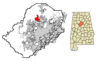
Mount Olive, also spelled Mt. Olive is an unincorporated community and a census-designated place (CDP) in Jefferson County, Alabama. Its location is in the suburbs of Birmingham. As of the 2010 census, the population of the community is 4,079. Mount Olive is bordered on the south and the east by the town of Gardendale, and in fact, some areas that had previously been in Mount Olive have been annexed into Gardendale over the years. Running along part of the border between Mt. Olive and Gardendale is the major expressway, Interstate 65. Eventually, part of Birmingham's Northern Beltline will cut through northwestern sections of Mt. Olive. Mt. Olive has its own elementary school, and was formerly the home of a junior high school.

<span class="mw-page-title-main">Desert View Highlands, California</span> Census designated place in California, United States

Desert View Highlands is a census-designated place (CDP) in Los Angeles County, California, United States. The population was 2,360 at the 2010 census, up from 2,337 at the 2000 census. It is surrounded by the City of Palmdale.

<span class="mw-page-title-main">East Foothills, San Jose</span> Census designated place in California, United States

East Foothills is a census-designated place (CDP) in Santa Clara County, California, United States and a neighborhood of San Jose. The population was 8,269 at the 2010 census and it is located about 4 miles east of downtown San Jose.

<span class="mw-page-title-main">Fruitdale, San Jose</span> Place in California, United States

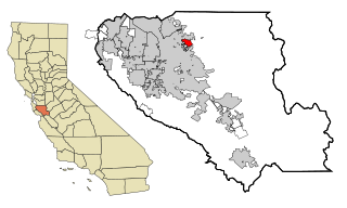
Fruitdale is a district of San Jose, California, located in West San Jose, though some portions are still unincorporated as a census-designated place. The population of the CDP was 935 at the 2010 census.

<span class="mw-page-title-main">Long Hill, Groton, Connecticut</span> Census-designated place in Connecticut, United States

Long Hill is a census-designated place (CDP) in the town of Groton in New London County, Connecticut, United States. The population was 4,205 at the 2010 census.

<span class="mw-page-title-main">Holden Heights, Florida</span> Census-designated place in Florida, United States

Holden Heights is a census-designated place and unincorporated area in Orange County, Florida, United States. The population was 3,679 at the 2010 census. The ZIP code serving the CDP is 32839. It is part of the Orlando–Kissimmee Metropolitan Statistical Area.

<span class="mw-page-title-main">East Galesburg, Illinois</span> Village in Illinois, United States

East Galesburg is a village in Knox County, Illinois, United States. The population was 812 as of the 2010 census, down from 839 in 2000. It is part of the Galesburg Micropolitan Statistical Area.

Chisholm is a census-designated place (CDP) in the town of Jay in Franklin County, Maine, United States. The population was 1,380 at the 2010 census. It is an industrial village named for Hugh J. Chisholm, who built the Otis Falls Pulp & Paper Company here in 1888 to use Androscoggin River water power.

<span class="mw-page-title-main">Galesburg, Michigan</span> City in Michigan, United States

Galesburg is a city in Kalamazoo County in the U.S. state of Michigan. The population was 2,049 at the 2020 census.
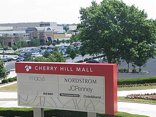
<span class="mw-page-title-main">Pemberton Heights, New Jersey</span> Populated place in Burlington County, New Jersey, US

Pemberton Heights is an unincorporated community and census-designated place (CDP) located within Pemberton Township, in Burlington County, in the U.S. state of New Jersey. As of the 2010 United States Census, the CDP's population was 2,423.

<span class="mw-page-title-main">Cherry Hill Mall, New Jersey</span> Populated place in Camden County, New Jersey, US

Cherry Hill Mall is a unincorporated community and census-designated place (CDP) located in Cherry Hill, in Camden County, in the U.S. state of New Jersey. As of the 2020 United States census, the CDP’s population was 14,805, its highest decennial count ever and an increase of 634 (+4.5%) from the 14,171 residents recorded at the 2010 census count, which in turn reflected an increase of 933 (+7.0%) from the 13,238 counted in the 2000 census. The CDP is home to the namesake Cherry Hill Mall shopping complex.

<span class="mw-page-title-main">Madison Park, New Jersey</span> Populated place in Middlesex County, New Jersey, US

Madison Park is an unincorporated community and census-designated place (CDP) located within Old Bridge Township, in Middlesex County, in the U.S. state of New Jersey. As of the 2010 United States Census, the CDP's population was 7,144. The name "Madison Park" reflects Old Bridge's original name of "Madison Township" which it had when it was formed on March 2, 1869 from portions of South Amboy Township, until November 5, 1975, when voters approved a referendum changing the township's name to Old Bridge Township.

<span class="mw-page-title-main">Pumpkin Center, North Carolina</span> CDP in North Carolina, United States

Pumpkin Center is a census-designated place (CDP) in Onslow County, North Carolina, United States. The population was 2,228 at the 2000 census. It is part of the Jacksonville, North Carolina Metropolitan Statistical Area.

<span class="mw-page-title-main">Tenkiller, Oklahoma</span> Census-designated place in Oklahoma, United States

Tenkiller is an unincorporated community and census-designated place (CDP) in Cherokee County, Oklahoma, United States. The population was 633 at the 2010 census.

<span class="mw-page-title-main">Bunker Hill, Oregon</span> CDP in Oregon, United States

Bunker Hill is a census-designated place (CDP) in Coos County, Oregon, United States. As of the 2010 census the population was 1,444.

<span class="mw-page-title-main">Metzger, Oregon</span> Unincorporated community in the state of Oregon, United States

Metzger is a census-designated place and unincorporated community, in Washington County, Oregon, United States. As of the 2010 census, the CDP population was 3,765. It is named for Herman Metzger, who platted the community. It is a suburb located within Portland, Oregon.

Whitfield is a census-designated place (CDP) in Berks County, Pennsylvania, United States. The population was 4,733 at the 2010 census.

<span class="mw-page-title-main">Wickerham Manor-Fisher, Pennsylvania</span> Census-designated place in Pennsylvania, United States

Wickerham Manor-Fisher is a census-designated place (CDP) in Washington County, Pennsylvania, United States. The population was 1,728 at the 2010 census.

<span class="mw-page-title-main">Piney View, West Virginia</span> Census-designated place in West Virginia, United States

Piney View is a census-designated place (CDP) in Raleigh County, West Virginia, United States. The population was 989 at the 2010 census.

References

  1. 1 2 "U.S. Census website". United States Census Bureau . Retrieved 2008-01-31.
  2. U.S. Geological Survey Geographic Names Information System: Greater Galesburg, Michigan