Prairie Ronde Township, Michigan

Last updated

Prairie Ronde Township, Michigan
Prairie Ronde Township, MI location.png
Location within Kalamazoo County
USA Michigan location map.svg
Red pog.svg
Prairie Ronde Township
Location within the state of Michigan
Usa edcp location map.svg
Red pog.svg
Prairie Ronde Township
Location within the United States
Coordinates: 42°6′31″N85°42′9″W / 42.10861°N 85.70250°W / 42.10861; -85.70250
Country United States
State Michigan
County Kalamazoo
Area
  Total36.4 sq mi (94.4 km2)
  Land35.8 sq mi (92.8 km2)
  Water0.6 sq mi (1.6 km2)
Elevation
879 ft (268 m)
Population
 (2020)
  Total2,369
  Density65/sq mi (25/km2)
Time zone UTC-5 (Eastern (EST))
  Summer (DST) UTC-4 (EDT)
FIPS code 26-077-66200 [1]
GNIS feature ID1626941 [2]
Website prairierondetwp.net

Prairie Ronde Township is a civil township located in the southwestern corner of Kalamazoo County in the U.S. state of Michigan. The population was 2,369 at the 2020 census. [3]

Contents

Prairie Ronde is the birthplace of the women's suffragist Olympia Brown.

Geography

The township is bordered by Van Buren County to the west, Cass County at the southwest corner, and St. Joseph County to the south. Kalamazoo, the county seat, is 18 miles (29 km) to the northeast.

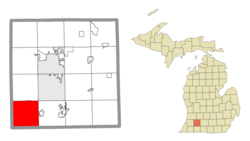
According to the United States Census Bureau, the township has a total area of 36.4 square miles (94.4 km2), of which 35.8 square miles (92.8 km2) are land and 0.62 square miles (1.6 km2), or 1.73%, are water. [4]

There are no incorporated or unincorporated communities within the boundaries of the township. A village named Shirland, to be located on Section 25 (near the present-day Olde Mill Golf Course), was platted and recorded in 1831, but it never developed. [5] [6] The village of Schoolcraft is just to the east in Schoolcraft Township, and all of Prairie Ronde Township is served by the Schoolcraft ZIP code (49087). [7]

Surface water features include Harrison and Paw Paw Lakes in the northern part of the township. Much of the township lies within the drainage area of Flowerfield Creek, which is part of the Rocky River sub-watershed, itself part of the larger St. Joseph River watershed. [8] The Michigan Nature Association maintains a 20-acre (81,000 m2) nature sanctuary along Flowerfield Creek in Prairie Ronde Township. [9]

History

The township is named for its distinctive geographic feature, the Prairie Ronde, a 14,000-acre (57 km2) grassland and the largest of the eight prairies in what would become Kalamazoo County. [10] The name Prairie Ronde (French for "round meadow") is said to have been given by French explorer Robert Sieur de la Salle during an overland crossing of the region in 1680. [11] (Some scholars, however, place LaSalle's route across northern Kalamazoo County, a journey which would not have brought him across the Prairie Ronde. [12] )

Present-day Prairie Ronde Township was the first part of Kalamazoo County to be settled by European-Americans. [10] The first white settler was Bazel Harrison, a nephew of revolutionary leader Benjamin Harrison and first cousin of U.S. President William Henry Harrison. Originally of Virginia, Harrison arrived with his family from Ohio on November 5, 1828. [13]

At the time of settlement, Prairie Ronde was a part of St. Joseph County and in the township of Brady, which included all of future Kalamazoo and Barry counties and a large part of Michigan's Lower Peninsula to the north. Kalamazoo County was set off with its present boundaries in 1829, and the southern half organized as Brady Township in 1830. [14] Prairie Ronde was set off from Brady Township as a separate township with its present limits in May 1836. [15]

At the time of European settlement, the area was inhabited by the Potawatomi people. The Potawatomi were forcibly removed from Kalamazoo County in October 1840. [16]

A Methodist congregation was organized in Prairie Ronde in 1832. In 1836 they built a small chapel near Harrison Lake called the Ebenezer Episcopal Church of Prairie Ronde. This was the first church building of any denomination built north of the St. Joseph River. Around 1850, the congregation moved to Schoolcraft, where it continues today as the Schoolcraft United Methodist Church. [17]

Demographics

As of the census [1] of 2000, there were 2,086 people, 707 households, and 601 families residing in the township. The population density was 58.3 inhabitants per square mile (22.5/km2). There were 733 housing units at an average density of 20.5 per square mile (7.9/km2). The racial makeup of the township was 97.84% White, 0.29% African American, 0.38% Native American, 0.29% Asian, 0.19% from other races, and 1.01% from two or more races. Hispanic or Latino of any race were 0.48% of the population. The most common reported ancestries for township residents are German (26.8%), Dutch (12.8%), and Irish (11.8%). [18]

There were 707 households, out of which 46.0% had children under the age of 18 living with them, 78.5% were married couples living together, 4.7% had a female householder with no husband present, and 14.9% were non-families. 12.4% of all households were made up of individuals, and 3.4% had someone living alone who was 65 years of age or older. The average household size was 2.95 and the average family size was 3.21.

In the township the population was spread out, with 32.2% under the age of 18, 4.1% from 18 to 24, 32.1% from 25 to 44, 25.5% from 45 to 64, and 6.1% who were 65 years of age or older. The median age was 35 years. For every 100 females, there were 104.1 males. For every 100 females age 18 and over, there were 101.1 males.

The median income for a household in the township was $65,385, and the median income for a family was $67,458. Males had a median income of $48,074 versus $27,038 for females. The per capita income for the township was $23,431. About 2.6% of families and 4.2% of the population were below the poverty line, including 1.9% of those under age 18 and 7.0% of those age 65 or over.

Education

Most of the township belongs to the Schoolcraft Community Schools school district. The northwestern part of the township is within the Mattawan Consolidated School District and a smaller section along the western edge of the township is within the Lawton Community School District. [19]

Listed historic sites

Prairie Ronde Township has one site listed on the National Register of Historic Places. The Fanckboner-Nichols Farmstead (5992 W. VW Avenue) was established in 1838 by William and Elizabeth Crose Fanckboner, who had arrived with their five children from near Belvidere, New Jersey, the previous year. Still owned by Fanckboner descendants, the family's Greek Revival farmhouse, built c. 1840, along with later outbuildings, stands in a small farmstead area at one corner of the 30-acre (120,000 m2) farm property on the corner of West VW Avenue and S 10th Street. The farmstead, added to the Register in 2007, is preserved as an illustration of the lives of the early settlers on the Prairie Ronde. [20] [21]

Related Research Articles

<span class="mw-page-title-main">St. Joseph County, Michigan</span> County in Michigan, United States

St. Joseph County is a county located in the U.S. state of Michigan, on the central southern border with Indiana. As of the 2020 United States Census, the population was 60,939. The county seat is Centreville.

<span class="mw-page-title-main">Schoolcraft County, Michigan</span> County in Michigan, United States

Schoolcraft County is a county located in the Upper Peninsula of the U.S. state of Michigan. As of the 2020 census, the population was 8,047, making it Michigan's fourth-least populous county. The county seat is Manistique, which lies along the northern shore of Lake Michigan. The county is named in honor of Henry Schoolcraft, who explored the area with the expedition of Lewis Cass. The county was founded in 1843 and organized in 1876. The county is largely rural and forested, with much of its western portion within Hiawatha National Forest.

<span class="mw-page-title-main">Oscoda County, Michigan</span> County in Michigan, United States

Oscoda County is a county in the U.S. state of Michigan. As of the 2020 census, the population was 8,219, making it the least populous county in the Lower Peninsula, and the sixth-least populous county in the entire state. The county seat is Mio, an unincorporated community near the center of the county.

<span class="mw-page-title-main">Kalamazoo County, Michigan</span> County in Michigan, United States

Kalamazoo County is a county located in the U.S. state of Michigan. As of 2020, the population was 261,670. The county seat is Kalamazoo.

<span class="mw-page-title-main">Eaton County, Michigan</span> County in Michigan, United States

Eaton County is a county in the U.S. state of Michigan. As of the 2020 United States Census, the population was 109,175. The county seat is Charlotte. The county was organized in 1837 and was named for John Eaton, who was Secretary of War under U.S. President Andrew Jackson, making it one of Michigan's Cabinet counties. Eaton County is included in the Lansing-East Lansing, Metropolitan Statistical area in Central Michigan.

<span class="mw-page-title-main">Cass County, Michigan</span> County in Michigan, United States

Cass County is a county in the U.S. state of Michigan. As of the 2020 Census, the population was 51,589. Its county seat is Cassopolis.

<span class="mw-page-title-main">Arenac County, Michigan</span> County in Michigan, United States

Arenac County is a county located in the U.S. state of Michigan. As of the 2020 Census, the population was 15,002. The county seat is Standish.

Hope Township is a civil township of Barry County in the U.S. state of Michigan. The population was 3,154 at the 2020 census.

Marshall Township is a civil township of Calhoun County in the U.S. state of Michigan. It is part of the Battle Creek, Michigan Metropolitan Statistical Area. The population was 3,157 at the 2020 census. The city of Marshall is adjacent to the township, but is administratively autonomous.

<span class="mw-page-title-main">Volinia Township, Michigan</span> Civil township in Michigan, United States

Volinia Township is a civil township of Cass County in the U.S. state of Michigan. The population was 1,096 at the 2020 census. When the township was organized in 1833, it was at first named Volhynia, after the province in Poland. It is believed to have been given to honor General Tadeusz Kościuszko, the Polish patriot who helped the United States during the American Revolutionary War. The name was altered first to "Volenia" and then by 1901 or earlier to "Volinia".

<span class="mw-page-title-main">Alamo Township, Michigan</span> Civil township in Michigan, United States

Alamo Township is a civil township of Kalamazoo County in the U.S. state of Michigan. As of the 2020 census, the township population was 3,805.

<span class="mw-page-title-main">Charleston Township, Kalamazoo County, Michigan</span> Civil township in Michigan, United States

Charleston Township is a civil township of Kalamazoo County in the U.S. state of Michigan. The 2020 census recorded a population of 1,904, slightly down from 1,975 at the 2010 census.

<span class="mw-page-title-main">Richland, Michigan</span> Village in Michigan, United States

Richland is a village in Kalamazoo County in the U.S. state of Michigan. The population was 751 at the 2010 census, up from 593 at the 2000 census.

<span class="mw-page-title-main">Ross Township, Michigan</span> Civil township in Michigan, United States

Ross Township is a township in Kalamazoo County in the U.S. state of Michigan. The population was 4,851 at the 2020 census, up from 4,664 at the 2010 census.

<span class="mw-page-title-main">Schoolcraft, Michigan</span> Village in Michigan, United States

Schoolcraft is a village in Kalamazoo County, Michigan, United States. The village is located in Schoolcraft Township approximately 13 miles (21 km) south of Kalamazoo on U.S. Route 131. The population was 1,525 at the 2010 census. The village is named in honor of geographer, geologist, and ethnologist Henry Schoolcraft.

<span class="mw-page-title-main">Texas Charter Township, Michigan</span> Charter township in Michigan, United States

Texas Charter Township, officially named the Charter Township of Texas, is a charter township of Kalamazoo County, in the U.S. state of Michigan. As of the 2020 census, the township population was 17,691, up from 14,697 at the 2010 census. It encompasses the entire portion of the survey township T3S R12W.

<span class="mw-page-title-main">Wakeshma Township, Michigan</span> Civil township in Michigan, United States

Wakeshma Township is a civil township of Kalamazoo County in the U.S. state of Michigan. The 2020 census recorded a population of 1,341, up from 1,301 at the 2010 census.

Flowerfield Township is a civil township of St. Joseph County in the U.S. state of Michigan. The population was 1,592 at the 2000 census.

<span class="mw-page-title-main">Richland Township, Kalamazoo County, Michigan</span> Civil township in Michigan, United States

Richland Township is a civil township of Kalamazoo County in the U.S. state of Michigan. The population was 8,693 at the 2020 census, up from 7,580 at the 2010 census.

<span class="mw-page-title-main">Schoolcraft Township, Kalamazoo County, Michigan</span> Civil township in Michigan, United States

Schoolcraft Township is a civil township of Kalamazoo County in the U.S. state of Michigan. The population was 9,183 at the 2020 census, up from 8,214 at the 2010 census. The township is named for Henry Schoolcraft, noted for conducting many early land surveys throughout Michigan.

References

  1. 1 2 "U.S. Census website". United States Census Bureau . Retrieved January 31, 2008.
  2. U.S. Geological Survey Geographic Names Information System: Prairie Ronde Township, Michigan
  3. "Explore Census Data". data.census.gov. Retrieved April 21, 2024.
  4. "Geographic Identifiers: 2010 Census Summary File 1 (G001), Prairie Ronde township, Kalamazoo County, Michigan". American FactFinder. U.S. Census Bureau. Archived from the original on February 13, 2020. Retrieved April 1, 2019.
  5. Romig, Walter (1986), Michigan Place Names: The History of the Founding and the Naming of More Than Five Thousand Past and Present Michigan Communities. Wayne State University Press, ISBN   0-8143-1838-X, 9780814318386
  6. Swartz (1990), p. 43.
  7. TIGERweb, U.S. Census Bureau, 2019.
  8. Flowerfield Creek water quality data, Kalamazoo County Environmental Health Bureau.
  9. Flowerfield Creek Nature Sanctuary Archived 2010-09-25 at the Wayback Machine , Michigan Nature Association.
  10. 1 2 The History of Kalamazoo County, Michigan, Michigan History Magazine, Sept/Oct 1984.
  11. Swartz (1990), p. 8.
  12. James C. Woodruff. "LaSalle's Walk on the Wild Side", Michigan History, vol. 83, no. 2 (1999), p. 6-15.
  13. Swartz (1990), p. 18.
  14. Genevieve Vail Vosburgh, "Kalamazoo County, Michigan, and its Early Settlers," "Old Northwest" Genealogical Society 10, no. 2 (April 1907), pp. 102-103.
  15. Swartz (1990), p. 37.
  16. Swartz (1990), p. 78.
  17. Swartz (1990), pp. 84-86.
  18. Ancestry: 2000, Prairie Ronde township, Kalamazoo County, Michigan Archived 2020-02-12 at archive.today , U.S. Census Bureau.
  19. Kalamazoo County, Michigan school district maps by county, State of Michigan Department of Information Technology Center for Geographic Information.
  20. Downtown Niles and Tourist Attractions in the Irish Hills Among 10 Properties Nominated to the National Register of Historic Places, Michigan Department of History, Arts, and Libraries press release, 25 January 2007.
  21. Fanckboner--Nichols Farmstead Archived 2011-07-26 at the Wayback Machine , Historic Places Database.

Sources