
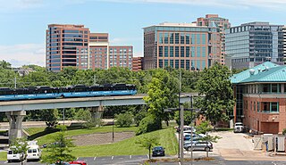
MetroLink is a light rail system with semi-metro features that serves the Greater St. Louis area. Operated by Metro Transit in a shared fare system with MetroBus, the two-line, 38-station system runs from St. Louis Lambert International Airport and Shrewsbury in Missouri to Scott Air Force Base in Illinois. Intermediate destinations include downtown Clayton, Forest Park, and downtown St. Louis. It is the only U.S. light rail system to cross state lines.
The Metro East is an urban area in Southern Illinois, United States that contains the eastern and northern urban, suburban, and exurban areas on the Mississippi River in Greater St Louis. It encompasses eight Illinois counties and constitutes the second-most populous metropolitan area in Illinois.
Metro Transit is an enterprise of the Bi-State Development Agency and operates public transportation services in the St. Louis region. In 2023, the system had an annual ridership of 19,528,200, or about 64,600 per weekday as of the second quarter of 2024.

Delmar Loop station is a light rail station on the Red Line of the St. Louis MetroLink system. This below-grade station is adjacent to Delmar Boulevard and Des Peres and Hodiamont avenues and serves the popular Delmar Loop area.

Forest Park–DeBaliviere station is a light rail station on the Red and Blue lines of the St. Louis MetroLink system. This below-grade station is located at the northeast corner of Forest Park Parkway and DeBaliviere Avenue in St. Louis and is designated as the primary transfer point between the two lines.

Civic Center station is a light rail station on the Red and Blue lines of the St. Louis MetroLink system. This below-grade station is located near 14th and Spruce streets near Interstate 64. It is also the primary transfer station for MetroBus and serves bus routes operated by Madison County Transit. Additionally, the station adjoins the Gateway Multimodal Transportation Center which has intercity services provided by Amtrak, Greyhound, and others.

Transportation in Greater St. Louis, Missouri includes road, rail, ship, and air transportation modes connecting the bi-state St. Louis metropolitan area with surrounding communities throughout the Midwest, national transportation networks, and international locations. The Greater St. Louis region also supports a multi-modal transportation network that includes bus, paratransit, and light rail service in addition to shared-use paths, bike lanes and greenways.

Shrewsbury–Lansdowne I-44 station is a light rail station on the Blue Line of the St. Louis MetroLink system. This station is located on an embankment near Lansdowne Avenue and River Des Peres Boulevard in St. Louis near its boundary with Shrewsbury in St. Louis County. The city limits between the two communities runs through the northern portion of the 800 space park and ride lot.
Emerson Park station is a light rail station on the Red and Blue lines of the St. Louis MetroLink system. This at-grade station is located near 15th Street and Bowman Avenue in East St. Louis, Illinois. It also serves as a transfer for MetroBus and Madison County Transit and features 841 park and ride spaces.
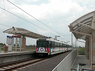
Shiloh–Scott station is a light rail station and current terminus of the Red Line of the St. Louis MetroLink system. This at-grade station is located in Shiloh, Illinois, adjacent to Scott Air Force Base.

College Hill is a neighborhood of the City of St. Louis, Missouri. The name College Hill was given to this area because it was the location of the Saint Louis University College Farm. This area, bounded generally by Warne Ave., O'Fallon Park, I-70, Grand Boulevard, and W. Florissant Ave., was acquired by the University for garden and recreation purposes in 1836. It was subdivided in the early 1870s.

The Red Line is the older and longer line of the MetroLink light rail system in Greater St. Louis. It serves 29 stations across three counties and two states.
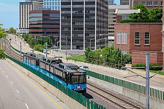
The Blue Line is the newer and shorter line of the MetroLink light rail service in Greater St. Louis. It serves 25 stations across three counties and two states.

The Loop Trolley is a 2.2-mile (3.5 km), 10-station heritage streetcar line in and near the Delmar Loop area of greater St. Louis, Missouri. It opened for service in 2018, then shut down in 2019 after revenue fell far short of projections. Service resumed in 2022 under the Metro Transit division of the Bi-State Development Agency.

Streetcars in St. Louis, Missouri, operated as part of the transportation network of St. Louis from the middle of the 19th century through the early 1960s.

Metro Call-A-Ride is a paratransit service operated by Metro Transit that serves parts of Greater St. Louis. In 2023, the service had an annual ridership of 278,900, or about 1,400 per weekday as of the second quarter of 2024.

MetroBus is a public bus service operated by Metro Transit that serves the Greater St. Louis area. In 2023, the service had an annual ridership of 12,531,400, or about 41,400 per weekday as of the second quarter of 2024.

The Bi-State Development Agency is an interstate compact established between Missouri and Illinois in 1949. This compact created an organization that has broad powers in seven county-level jurisdictions. Bi-State operates five enterprises, including the Gateway Arch Riverfront, Metro Transit, the St. Louis Downtown Airport, the St. Louis Regional Freightway and the Bi-State Development Research Institute.
