Grey Highlands

Last updated

Grey Highlands
Municipality of Grey Highlands
Grey Highlands ON.JPG
Grey locator map 2021.svg
Red pog.svg
Grey Highlands
Canada Southern Ontario location map 2.png
Red pog.svg
Grey Highlands
Coordinates: 44°20′N80°30′W / 44.333°N 80.500°W / 44.333; -80.500
CountryFlag of Canada (Pantone).svg  Canada
ProvinceFlag of Ontario.svg  Ontario
County Grey
FormedJanuary 1, 2001
Government
  MayorPaul McQueen
  Deputy MayorDane Nielsen
  Federal riding Bruce—Grey—Owen Sound
  Prov. riding Bruce—Grey—Owen Sound
Area
[1]
  Land882.51 km2 (340.74 sq mi)
Population
 (2016) [1]
  Total9,804 (+3.0 %)
  Density11.1/km2 (29/sq mi)
Time zone UTC-5 (EST)
  Summer (DST) UTC-4 (EDT)
Postal Code
N0C 1H0
Area code(s) 519 and 226
Website www.greyhighlands.ca
Eugenia Falls Eugenia Falls.JPG
Eugenia Falls

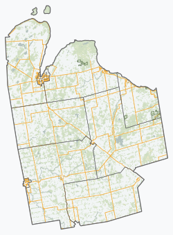
Grey Highlands is a municipality in the southeast corner of Grey County, Ontario, Canada. It was formed on January 1, 2001, by the amalgamation of the village of Markdale and the townships of Artemesia, Euphrasia and Osprey, which included the unincorporated hamlets of Eugenia, Ceylon, Maxwell, Singhampton, Priceville, Kimberley, Badjeros, and Feversham. The former village of Flesherton is also located within the municipality and was amalgamated with Artemesia Township in 1998.

Contents

According to the 2016 census, the municipality covers a land area of 882 square kilometres and has a population of 9,804. The municipality has a healthy population growth, and its average age (43 years old) is close to that of the provincial average (41 years old). The average household size is 2.5, and the average total income of all households is $94,000. The average after-tax income of households in the municipality is $77,000.

Communities

Geography

The dominant natural feature of the area is the Niagara Escarpment, which passes through the municipality and has several ancillary features:

Demographics

Historical population
YearPop.±%
1996 8,620    
2001 9,196+6.7%
2006 9,480+3.1%
2011 9,520+0.4%
2016 9,804+3.0%
[4] [5] [1]

In the 2021 Census of Population conducted by Statistics Canada, Grey Highlands had a population of 10,424 living in 4,091 of its 5,337 total private dwellings, a change of

Education

Elementary students (kindergarten to grade 8) are divided into three catchment areas:

All of those students go to Grey Highlands Secondary School, in Flesherton, for Grades 9 to 12.

See also

Related Research Articles

<span class="mw-page-title-main">Mono, Ontario</span> Town in Ontario, Canada

Mono is a town situated in south-central Ontario, Canada, at the south-east corner of Dufferin County. It stretches from Highway 9 along its southern border to Highway 89 along its northern border. Its border to the west is with the Township of Amaranth and in the east, it is bordered by the Township of Adjala-Tosorontio. It was previously known as the Township of Mono.

<span class="mw-page-title-main">Grey County</span> County in Ontario, Canada

Grey County is a county of the Canadian province of Ontario. The county seat is in Owen Sound. It is located in the subregion of Southern Ontario named Southwestern Ontario. Grey County is also a part of the Georgian Triangle. At the time of the Canada 2016 Census the population of the county was 93,830.

<span class="mw-page-title-main">Clearview, Ontario</span> Township in Ontario, Canada

Clearview is a rural incorporated township in Simcoe County in Central Ontario, Canada, west of Barrie and south of Collingwood and Wasaga Beach in Simcoe County.

<span class="mw-page-title-main">Simcoe—Grey (federal electoral district)</span> Federal electoral district in Ontario, Canada

Simcoe—Grey is a federal electoral district in Ontario, Canada, that has been represented in the House of Commons of Canada since 1997.

Grey Southeast was a federal electoral district represented in the House of Commons of Canada from 1917 to 1935. It was located in the province of Ontario. This riding was created in 1914 from parts of Grey East and Grey South ridings when the county of Grey was re-divided into two ridings, Grey North and Grey Southeast.

Grey—Simcoe was a federal electoral district represented in the House of Commons of Canada from 1968 to 1988. It was located in the province of Ontario. This riding was created in 1966 from parts of Grey North, Grey—Bruce and Simcoe East ridings.

<span class="mw-page-title-main">Markdale</span> Unincorporated community in Ontario, Canada

Markdale is a community in the Municipality of Grey Highlands, in Grey County, Ontario, Canada. The population was 1,216 in 2016, an increase of 3.5% from 1,175 in 2011. In 2016, the average age of the population was approximately 43 years old.

<span class="mw-page-title-main">Flesherton</span> Former Village in Ontario, Canada

Flesherton is a community in the Municipality of Grey Highlands, in Grey County, Ontario, Canada, located at the junction of Highway 10 and Grey County Road 4. Although the area initially showed a high rate of growth in the 1850s and its founder believed that it would become an important centre of economic activity, growth stagnated when an all-important rail link bypassed it, and the community never grew larger than a small village. The self-proclaimed "Gateway to the Beaver Valley" recently lost its autonomy as a village when it was amalgamated with the surrounding Artemesia Township.

<span class="mw-page-title-main">Priceville, Ontario</span> Village in Ontario, Canada

Priceville is a village in the southwest corner of the Municipality of Grey Highlands, Grey County, Ontario, Canada. It is on the Saugeen River on Grey Road 4, east of Durham and southwest of Flesherton.

<span class="mw-page-title-main">The Blue Mountains, Ontario</span> Town in Ontario, Canada

The Blue Mountains is a town in Grey County, southwestern Ontario, Canada, located where the Beaver River flows into Nottawasaga Bay. It is named for the Blue Mountain, and hence the economy of the town is centred on tourism, particularly on the Blue Mountain ski resort and the private Georgian Peaks, Osler, Craigleith and Alpine Ski Clubs.

The Central Ontario Hockey League (COHL) was a highly competitive Intermediate ice hockey league in the central Grey County area of Ontario, Canada until the late 1970s. The league was originally sanctioned by the Ontario Hockey Association, but later the Western Ontario Athletic Association incorporated it into their WOAA Senior Hockey League.

<span class="mw-page-title-main">William Kingston Flesher</span> Canadian politician

William Kingston Flesher was a settler of southwestern Ontario, a militia officer, businessman and political figure. As well as founding the village of Flesherton, he represented the riding of Grey East in the House of Commons of Canada as a Conservative member from 1872 to 1878.

<span class="mw-page-title-main">Eugenia, Ontario</span> Place in Ontario, Canada

Eugenia is a small community in the municipality of Grey Highlands, Grey County, in Southwestern Ontario, Canada, located just north of the community of Flesherton. An unincorporated hamlet of Artemesia Township for most of its history, Eugenia was amalgamated into the Grey Highlands in 2001. Due to nearby Lake Eugenia, Eugenia Falls, the Bruce Trail and the ski resorts of the Beaver Valley, it has become a popular tourist and cottage destination. The nearby Eugenia Power Station has the highest head of water of any hydroelectric generator in Ontario, and has provided a significant amount of electricity to the provincial grid for a century.

Osprey was a township community in Grey County, Ontario. In 2001 it was amalgamated with the village of Markdale and the townships of Euphrasia and Artemesia to form the Municipality of Grey Highlands.

<span class="mw-page-title-main">Beaver Valley (Ontario)</span> Valley in southern Ontario, Canada

The Beaver Valley is a valley in southern Ontario, Canada, at the southern tip of Georgian Bay. The Beaver River flows north through the valley, emptying into Georgian Bay in the town of Thornbury. It is a productive agricultural area, producing a significant portion of Canada's apple crop. It also contains one of Ontario's best-preserved hardwood swamp ecosystems. The Bruce Trail follows the perimeter of the valley passing several natural landmarks including Old Baldy, the Duncan Crevice Caves, and Eugenia Falls. The main towns in the valley are Flesherton at the south end, Kimberley, and Thornbury.

<span class="mw-page-title-main">Simcoe—Grey (provincial electoral district)</span> Provincial electoral district in Ontario, Canada

Simcoe—Grey is a provincial electoral district in Ontario, Canada, that has been represented in the Legislative Assembly of Ontario since 1999.

<span class="mw-page-title-main">Boyne River (Grey County)</span> River in Ontario, Canada

The Boyne River is a river in the municipality of Grey Highlands, Grey County in Southwestern Ontario, Canada. It is part of the Great Lakes Basin, and lies entirely within geographic Artemesia Township.

<span class="mw-page-title-main">Beaver River (Grey County)</span> River in Ontario, Canada

The Beaver River is a river in Grey County and Simcoe County in Southern Ontario, Canada. It is part of the Great Lakes Basin, and is a tributary of Lake Huron. The river's drainage basin is under the auspices of Grey Sauble Conservation.

<span class="mw-page-title-main">Beaver Valley Ski Club</span> Private ski club in Ontario

Beaver Valley Ski Club is a private skiing and snowboarding club located in Beaver Valley, Ontario, Canada.

<i>The Flesherton Advance</i>

The Flesherton Advance is a weekly newspaper published in tandem with the Dundalk Herald based in Dundalk, Ontario, serving Grey Highlands. Founded in 1881, the paper was published in Flesherton until 1968 when purchased by the current publishers, the Walls family.

References

  1. 1 2 3 "Census Profile, 2016 Census: Grey Highlands, Municipality". Statistics Canada . Retrieved June 13, 2019.
  2. "List of Biosphere Reserves 2009" (PDF). UNESCO. 2009. Retrieved 2010-03-01.
  3. "In 1852, when the country was very new and wild, somebody thought he had discovered gold in the rocks below the falls... One adventurous waggonmaker, from the County of York, happening to be in the region, made a rush with the rest to the diggings, and soon departed homeward, several days journey through woods and bushroads, with a backbreaking load in a bag... He got home, and before he slept kindled up his forge fire to melt down a little of the precious stuff.... The sulphurious fumes and horrible stench of the vile stuff choked him, and well nigh drove him out of the premises. He had carried home a backload of worthless iron pyrites!"Smith, William Wye (1866). Gazetteer and Directory of the County of Grey for 1865-66. Toronto: Global Steam Press.
  4. Statistics Canada: 1996, 2001, 2006 census
  5. "Grey Highlands census profile". 2011 Census of Population . Statistics Canada. 8 February 2012. Retrieved 2012-08-09.
  6. "Population and dwelling counts: Canada, provinces and territories, census divisions and census subdivisions (municipalities), Ontario". Statistics Canada. February 9, 2022. Retrieved March 31, 2022.

Further reading