Grumbald's Ash Hundred

Last updated

Gloucestershire Hundreds in 1832 Gloucestershire 1832 Map.png
Gloucestershire Hundreds in 1832

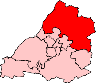
Grumbald's Ash Hundred (also spelled Grumbold's Ash) [1] was a subdivision of the county of Gloucestershire, England. Hundreds originated in the late Saxon period and lasted as administrative divisions until the 19th century. [2] It has been reported that the court was originally held under an Ash tree situated in Doddington parish, although this location would not be consistent with the previous split of hundred. [3] Its name survives in the Grumbolds Ash with Avening electoral ward of Cotswold district council. [4]

The hundred was divided into Upper and Lower divisions and comprised a total of 20 ancient parishes in the southeastern corner of the county. The Lower division comprised Acton Turville, Chipping Sodbury, Little Sodbury, Old Sodbury, Tormarton, West Littleton, Dyrham & Hinton, Wapley & Codrington and Dodington; the Upper division comprised Alderley, Badminton, Boxwell & Leighterton, Charfield, Didmarton, Hawkesbury, Hillesley, Horton, Oldbury-on-the-Hill, Tortworth and Wickwar. [5] [6] [7]

At the time of the Domesday Book, there were three hundreds in this area: Eddredestane, Bagstone and Hagmead, the last also known as Grimboldstow. Eddredestane later formed most of the Lower division of Grumbald's Ash Hundred and the other two the Upper division. [8]

Eddredestone Hundred also included the parish of Marshfield, which later became a detached part of Thornbury Hundred. The survey named four places in this hundred: Marshfield, Sodbury, Dodington and Tormarton. [9] Note West Littleton was formerly a tything of Tormarton. [10] Eddredestone was named after Eadred, King of the English 946-955, who established the "Three Shires Stone" in Marshfield, marking the boundary between Gloucestershire, Somerset and Wiltshire. [11]

Bagstone Hundred included Tortworth, Charfield, Wickwar, Tytherington and Iron Acton, the last two parishes later transferred to Thornbury Hundred. [12] Bagstone is the name of a hamlet in Wickwar parish which was the meeting place of the hundred. [10]

Hagmead Hundred included Hawkesbury, Horton, Badminton, Boxwell, Hillesley, Alderley, Oldbury-on-the-Hill, Little Sodbury and Didmarton, which became part of the Upper Division, plus Acton Turville and Dyrham & Hinton which formed, with Eddredestane, the Lower Division. [13] At the time of Domesday, Wapley was part of Swineshead Hundred, later transferring into the Upper division of Grumbold's Ash. [14]

Related Research Articles

<span class="mw-page-title-main">South Gloucestershire</span> District in England

South Gloucestershire is a unitary authority area in the ceremonial county of Gloucestershire, South West England. Towns in the area include Yate, Chipping Sodbury, Thornbury, Filton, Patchway and Bradley Stoke. The southern part of its area falls within the Greater Bristol urban area surrounding the city of Bristol.

<span class="mw-page-title-main">Yate</span> Town in South Gloucestershire, England

Yate is a town and civil parish in South Gloucestershire, England. It lies just to the southwest of the Cotswold Hills and is 12 miles northeast of Bristol city centre and 12 miles from the centre of Bath, with regular rail services to Bristol and Gloucester.

<span class="mw-page-title-main">Wickwar</span> Human settlement in England

Wickwar is a village and civil parish in Gloucestershire, England, located between Yate and Charfield. At the 2001 census, the parish had a population of 1,943.

<span class="mw-page-title-main">Northavon (UK Parliament constituency)</span>

<span class="mw-page-title-main">Acton Turville</span> Human settlement in England

Acton Turville is a parish in the Cotswold Edge ward within South Gloucestershire, England. It lies 17 miles (27 km) east-northeast of Bristol and 93 miles (150 km) due west of London, with the M4 south of the parish. Acton Turville consists of a cluster of households across 1,009 acres, with a total population of 370 people. Acton Turville is also listed as "Achetone" in the Domesday Book.

<span class="mw-page-title-main">Hawkesbury Upton</span> Human settlement in England

Hawkesbury Upton is a village in South Gloucestershire, England, east of the much smaller Hawkesbury. It lies north of Horton, east of Dunkirk and south of Alderley and Hillesley.

<span class="mw-page-title-main">West Littleton</span> Human settlement in England

West Littleton is a village and former civil parish, now in the parish of Tormarton, in the South Gloucestershire district, in the ceremonial county of Gloucestershire, England. It is located between the M4 and the A420. The closest amenities are in Marshfield and the historic city of Bath is a short distance to the south. The stately home, Dyrham Park, is located a few hundred metres from the village. In 1931 the parish had a population of 65.

Alderley is a village and civil parish in the Stroud district of Gloucestershire, England, about fourteen miles southwest of Stroud and two miles south of Wotton-under-Edge. It is situated on the Cotswold Way near to the hamlets of Hillesley and Tresham and lies underneath Winner Hill between two brooks, the Ozleworth and Kilcott.

Alkington is a civil parish in the district of Stroud, Gloucestershire. It had a population of 638 in the 2001 census, increasing to 688 at the 2011 census. There is no Alkington village, the parish consists of various hamlets, including Woodford, Newport and Lower Wick.

<span class="mw-page-title-main">Leighterton</span> Human settlement in England

Leighterton is a village in rural Gloucestershire off the A46. It sits within the civil parish of Boxwell with Leighterton, 4.25 miles west-southwest of Tetbury, towards the southern end of the Cotswolds AONB. Situated in the Cotswold hills, it is 175 metres above sea level. Historically, it was situated within the hundred of Grumbald's Ash.

<span class="mw-page-title-main">Thornbury and Yate (UK Parliament constituency)</span>

Thornbury and Yate is a constituency represented in the House of Commons of the UK Parliament since the 2015 election by Luke Hall, a member of the Conservative Party. Encompassing an area to the north-east of Bristol, it is one of three constituencies that make up the South Gloucestershire Unitary Authority Area, along with Filton and Bradley Stoke and Kingswood.

<span class="mw-page-title-main">Codrington, Gloucestershire</span>

<span class="mw-page-title-main">Didmarton</span> Human settlement in England

Didmarton is a village and civil parish in Gloucestershire, England. It lies in the Cotswold District, about 6 miles (10 km) southwest of Tetbury. The parish is on the county borders with South Gloucestershire and Wiltshire.

<span class="mw-page-title-main">Oldbury-on-the-Hill</span> Human settlement in England

Oldbury-on-the-Hill is a small village and former civil parish in Gloucestershire, England, ninety-three miles west of London and less than one-mile (1.6 km) north of the village of Didmarton.

<span class="mw-page-title-main">Langley and Swinehead Hundred</span>

Langley and Swinehead was an ancient hundred of Gloucestershire, England. Hundreds originated in the late Saxon period as a subdivision of a county and lasted as administrative divisions until the 19th century.

<span class="mw-page-title-main">Henbury Hundred</span>

Henbury Hundred was a subdivision of the county of Gloucestershire, England. Hundreds originated in the late Saxon period and lasted as administrative divisions until the 19th century.

References

  1. "National Archives - Grumbold's Ash, hundred of, Glos: court books, presentments, constables' returns, minutes and precepts".
  2. Webb, Sidney; Webb, Beatrice (1906). English Local Government from the Revolution to the Municipal Corporations Act: the parish and the county. London: Longmans Green and Company. pp.  284–285.
  3. Thomas Dudley Fosbroke (1807). Abstracts of records and manuscripts respecting the county of Gloucester; formed into a history. Oxford University.
  4. "Cotswold District Council, 2019 ward election results" (PDF).
  5. Abstract of the Answers and Returns Made Pursuant to an Act, Passed in the 43d Year of His Majesty King George III, Intituled "An Act for Procuring Returns Relative to the Expence and Maintenance of the Poor in England". 1803.
  6. The National Gazetteer of Great Britain and Ireland, 1868, via GENUKI
  7. Moule, Thomas (1837). The English Counties Delineated. Virtue.
  8. English, University of Nottingham - Institute of Name Studies School of. "Key to English Place-names". kepn.nottingham.ac.uk. Retrieved 28 December 2017.
  9. "Eddredestane, Gloucestershire | Domesday Book". opendomesday.org. Retrieved 1 January 2018.
  10. 1 2 Rudge, Thomas (1803). The History of the County of Gloucester: Compressed and Brought Down to the Year 1803. Harris. p.  278.
  11. Thorn, F.R. (2009). "'THAT MOST FAMOUS MONASTERIUM AT BATH', ITS HUNDRED HIDES AND ITS ESTATES, VIEWED FROM SOUTH STOKE" (PDF). Somerset Archaeology and Natural History: 46.
  12. "Bagstone, Gloucestershire | Domesday Book". opendomesday.org. Retrieved 1 January 2018.
  13. "Grimboldestou, Gloucestershire | Domesday Book". opendomesday.org. Retrieved 1 January 2018.
  14. "Wapley, Gloucestershire | Domesday Book". opendomesday.org. Retrieved 1 January 2018.