You can help expand this article with text translated from the corresponding article in French. Click [show] for important translation instructions.
|
Guillonville | |
|---|---|
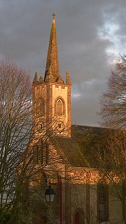 The Protestant church in Guillonville | |
Location of Guillonville  | |
 Guillonville  Guillonville | |
| Coordinates: 48°05′30″N1°39′47″E / 48.0917°N 1.6631°E | |
| Country | France |
| Region | Centre-Val de Loire |
| Department | Eure-et-Loir |
| Arrondissement | Châteaudun |
| Canton | Les Villages Vovéens |
| Intercommunality | Cœur de Beauce |
| Government | |
| • Mayor (2020–2026) | François Cottin [1] |
Area 1 | 27.15 km2 (10.48 sq mi) |
| Population (2022) [2] | 463 |
| • Density | 17/km2 (44/sq mi) |
| Time zone | UTC+01:00 (CET) |
| • Summer (DST) | UTC+02:00 (CEST) |
| INSEE/Postal code | 28190 /28140 |
| Elevation | 113–140 m (371–459 ft) (avg. 136 m or 446 ft) |
| 1 French Land Register data, which excludes lakes, ponds, glaciers > 1 km2 (0.386 sq mi or 247 acres) and river estuaries. | |
Guillonville is a commune in the Eure-et-Loir department in northern France.