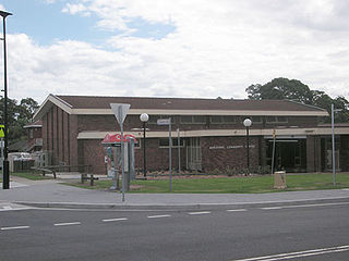
Marayong is a suburb of Sydney, in the state of New South Wales, Australia. Marayong is located 32 kilometres north west of the Sydney central business district, in the local government area of the City of Blacktown and is part of the Greater Western Sydney region.

Grong Grong is a small town that is located in the Riverina region of New South Wales, Australia. The town is situated on the Newell Highway, 23 kilometres (14 mi) east of Narrandera in the Shire of Narrandera.

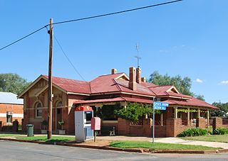
Culcairn is a town in the south-east Riverina region of New South Wales, Australia. Culcairn is located in the Greater Hume Shire local government area on the Olympic Highway between Albury and Wagga Wagga. The town is 514 kilometres (319 mi) south-west of the state capital, Sydney and at the 2006 census had a population of 1,120.

Oaklands is a town in the Riverina district of southern New South Wales, Australia. The town is located 615 kilometres south west of the state capital, Sydney and 105 kilometres north west of Albury. Oaklands is in the Federation Council local government area and at the 2011 census, had a population of 238.

City of Wagga Wagga is a local government area in the Riverina region of south-western New South Wales, Australia.

Boree Creek is a town in the Riverina district of New South Wales, Australia. The town is located 539 kilometres (335 mi) south west of the state capital, Sydney and 82 kilometres (51 mi) west of the regional centre, Wagga Wagga. Boree Creek is situated in the Federation Council local government area but is closer to the town of Lockhart. At the 2016 census, Boree Creek had a population of 64.
Beckom is a village in the central part of the Riverina. It is situated about 5 kilometres north-east of Ardlethan, and situated about 90 kilometres (56 mi) east of Griffith. It had a population of 170 people on the 2006 Census night. The town was established with the opening of the railway line in 1908. Passenger services ceased in 1983 and the station closed in 1985 however the line remains open for goods trains.

Kamarah, is a village community in the central north part of the Riverina. It is situated by road, about 11 kilometres west of Ardlethan and 12 kilometres east of Moombooldool. At the 2006 census, Kamarah had a population of 130 people.

Mirrool is a town in the northern part of the Riverina region of south-west New South Wales, Australia. The town is in the Bland Shire local government area and adjacent to the Newell Highway, 473 kilometres (294 mi) south west of the state capital, Sydney. At the 2011 census, Mirrool and the surrounding area had a population of 234.

Combaning is a rural community in the north east part of the Riverina. It is situated by road, about 3 kilometres west of Springdale and 13 kilometres east of Temora. At the 2006 census, Combaning had a population of 214 people.

Willbriggie is a community in the central part of the Riverina nearby to the city of Griffith. It is situated by road, about 16 kilometres north from Darlington Point and 17 kilometres south from Hanwood. At the 2006 census, Willbriggie had a population of 376.

Repton is a small town in New South Wales, Australia, located near the mouth of the Bellinger River. At the 2006 census, Repton had a population of 620 people.

Koolanooka is a small town in the MidWest region of Western Australia. It is situated between Morawa and Perenjori just off the Mullewa-Wubin road. At the 2006 census, Koolanooka had a population of 46.
Nubba is a locality and former railway station on the Main South railway line in New South Wales, Australia, located midway between Wallendbeen and Harden. The station was open between 1882 and 1975 and has now been demolished. At the 2006 census, Nubba had a population of 281 people.
Kundabung is a locality on the North Coast of New South Wales, Australia.

Warialda Rail is a town in the New England region of New South Wales, Australia. The town is located 3 km southwest of Warialda in the Gwydir Shire local government area, 581 kilometres (361 mi) north of the state capital, Sydney. At the 2006 census, Warialda Rail and the surrounding area had a population of 345.

For other uses see of the name see Carisbrook
Coonana is a small Indigenous Australian community in Western Australia located 775 kilometres (482 mi) east of Perth between Kalgoorlie and Laverton in the Goldfields-Esperance region of Western Australia. At the 2006 census, Coonana had a population of 83.

Korrelocking is a small town situated between Wyalkatchem and Trayning in the Wheatbelt region of Western Australia. At the 2006 census, Korrelocking had a population of 76.
