
Molong is a small town in the Central West region of New South Wales, Australia, in Cabonne Shire.

Casino is a town in the Northern Rivers area of New South Wales, Australia, with a population of 10,914 people at the 2016 census. It lies on the banks of the Richmond River and is situated at the junction of the Bruxner Highway and the Summerland Way.

Valla is a suburb in the Nambucca Valley, on the Mid North Coast of New South Wales, Australia. The name was chosen to match that of the British residence of nineteenth century diplomat Andrew Buchanan.

Mount Victoria is a small township in the Blue Mountains of New South Wales, Australia. It is the westernmost village in the City of Blue Mountains, located about 120 kilometres (75 mi) by road from the Sydney central business district and at an altitude of about 1,052 metres (3,451 ft) AHD . The settlement had a population of 823 people at the 2011 Census.

Henty is a town in southwestern New South Wales close to the boundaries of the South West Slopes and the Riverina districts, almost midway between the regional cities of Albury and Wagga Wagga. At the 2006 census, Henty had a population of 863 people.

Ariah Park is a small town in the Riverina region of New South Wales, Australia, 35 kilometres (22 mi) west of Temora and 65 kilometres (40 mi) south of West Wyalong. The town is within the Temora Shire near Burley Griffin Way. On Census night 2011, Ariah Park had a population of 268 people. The town is listed by the National Trust as a Conservation Area.
Coolamon is a town in the Riverina region of south-west New South Wales, Australia. Coolamon is 40 kilometres (25 mi) north-west of Wagga Wagga and 506 kilometres (314 mi) south-west of Sydney via the Hume and Sturt Highways. The town is situated on the railway line between Junee and Narrandera. Coolamon had a population of 2,199 at the 2016 census and is 290 metres (950 ft) above sea level. It is the administrative and service centre for the local government area which bears its name—Coolamon Shire.

Nambucca Heads is a town on the Mid North Coast of New South Wales, Australia in the Nambucca Valley. It is located on a ridge, north of the estuary of the Nambucca River near the Pacific Highway. Its 2011 population was 6,137, including 602 (9.7%) indigenous persons and 5,180 (83.3%) Australian-born persons in the Shire. The place name is derived from an Gumbaynggirr word Ngambagabaga. Clement Hodgkinson asked two Ngamba men what the name of the area was they responded to Nyambagabaga as the spot they were standing was a bend in the river where a Ngamba giant was speared in the leg in the Dreaming. This location is the Foreshore Caravan Park now. Ngamba is a subsection of Gumbaynggirr Nation & Baga Baga means Knee. This was later interpreted as Nambucca. It is a popular holiday and retirement destination.
Lockhart is a town in the Riverina Region of New South Wales, Australia. It is the location of the Lockhart Shire Council offices. At the 2016 census, Lockhart had a population of 818 people.

Mulwala is a town in the Federation Council local government area in the Riverina district of New South Wales, Australia. The town is situated on Lake Mulwala, an artificial lake formed by the damming of the Murray River. At the 2006 census, Mulwala had a population of 1,986 people. The town's name is derived from an aboriginal word for 'rain'.
Bonville is a small town located on the Mid North Coast of New South Wales, Australia, 11 kilometres south of Coffs Harbour and in the local government area of City of Coffs Harbour. It has a population of 1,891 as of 2006. The town's name supposedly derives from "Bongol Bongol/Bongil Bongil", which in Gumbaingirr, means a place where one stays a long time.

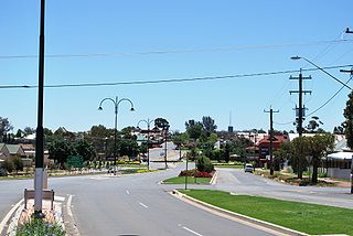
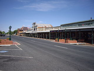
Murrumburrah is a township in New South Wales, Australia, part of a twin town with Harden. The town is in Hilltops Council local government area in the South West Slopes area of NSW. It is on the Burley Griffin Way, the major link from the Riverina to the Hume Highway near Yass, and ultimately Sydney, Canberra and the coast. At the 2011 census, Murrumburrah had a population of 479.

Kamarah, is a village community in the central north part of the Riverina. It is situated by road, about 11 kilometres west of Ardlethan and 12 kilometres east of Moombooldool. At the 2006 census, Kamarah had a population of 130 people.

Mirrool is a town in the northern part of the Riverina region of south-west New South Wales, Australia. The town is in the Bland Shire local government area and adjacent to the Newell Highway, 473 kilometres (294 mi) south west of the state capital, Sydney. At the 2011 census, Mirrool and the surrounding area had a population of 234.

Combaning is a rural community in the north east part of the Riverina. It is situated by road, about 3 kilometres west of Springdale and 13 kilometres east of Temora. At the 2006 census, Combaning had a population of 214 people.

Milbrulong is a locality in the central east part of the Riverina region of New South Wales, Australia. The locality is 515 kilometres (320 mi) south west of the state capital, Sydney and 59 kilometres (37 mi) south west of the regional centre Wagga Wagga in the Lockhart Shire local government area. The standard gauge Oaklands railway line passes through the locality.
Nubba is a locality and former railway station on the Main South railway line in New South Wales, Australia, located midway between Wallendbeen and Harden. The station was open between 1882 and 1975 and has now been demolished. At the 2006 census, Nubba had a population of 281 people.
Ardglen is a village on the Main North railway line and close to the New England Highway on the North West Slopes region of New South Wales, Australia.
Kundabung is a locality on the North Coast of New South Wales, Australia.
Lowanna is a village in the Coffs Harbour hinterland, officially a suburb of the City of Coffs Harbour. It has a Community Hall, Primary School, Tennis Court and General Store. The name Lowanna is an Aboriginal language word meaning "girl". Lowanna had a train station on the now-closed Dorrigo railway line.
