Franklin County is a county located in the eastern portion of the U.S. state of Kansas. Its county seat and most populous city is Ottawa. As of the 2020 census, the county population was 25,996. The county was named for Benjamin Franklin, a founding father of the United States. Formerly it was considered part of the Kansas City metropolitan area, but was removed in 2013.

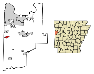
Hackett is a city in Sebastian County, Arkansas, United States. It is part of the Fort Smith, Arkansas-Oklahoma Metropolitan Statistical Area. The population was 812 at the 2010 census.

Wilson Shannon was a Democratic politician from Ohio and Kansas. He served as the 14th and 16th governor of Ohio, and was the first Ohio governor born in the state. He was the second governor of the Kansas Territory.

Home is an unincorporated community in southern Franklin Township, Marshall County, Kansas, United States. As of the 2020 census, the population of the community and nearby areas was 154. It lies along U.S. Route 36 – the Pony Express Highway – and a Union Pacific rail line, east of the city of Marysville.
East-Central Kansas is a region of Kansas. It is located between the Kansas City metropolitan area and Southeast Kansas, and on the border with Missouri. The region extends westward towards the Flint Hills to Lyon County. East-Central Kansas geographically features rolling hills and deep forested river valleys. The main crop of this predominantly agricultural region is corn. The area is more forested and more moist compared to the rest of the state. East-Central Kansas is rich with state history, as many locations of this region saw battles in Bleeding Kansas, and the infamous abolitionist John Brown and his men battled in Osawatomie. Much of the area is powered by Wolf Creek Nuclear Generating Station which is located near Burlington. The most populous cities of the region include Emporia, Ottawa, Paola, Osawatomie, Garnett, Osage City, Burlington, and Louisburg.

Xenia is an unincorporated area in Franklin Township, Bourbon County, Kansas, United States.

This is a list of the National Register of Historic Places listings in Wright County, Minnesota. It is intended to be a complete list of the properties and districts on the National Register of Historic Places in Wright County, Minnesota, United States. The locations of National Register properties and districts for which the latitude and longitude coordinates are included below, may be seen in an online map.

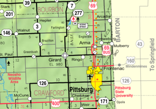
Franklin is an unincorporated community in Crawford County, Kansas, United States. As of the 2020 census, the population of the community and nearby areas was 473. Franklin is located along U.S. Route 69, 1 mile (1.6 km) south of Arma, or 5.9 miles (9.5 km) north of Frontenac.

Richter is an unincorporated community in Franklin County, Kansas, United States.
Michael Houser is a Republican member of the Kansas House of Representatives, representing the 1st district. He has served since 2013. He lost the 2010 election after calling for a recount. He was given a lifetime evaluation of 88% by the American Conservative Union.
Peoria is an unincorporated community in Franklin County, Kansas, United States.
Imes is an unincorporated community in Franklin County, Kansas, United States. It is located southeast of Ottawa at about 4 miles south of K-68 on Tennessee Road

Norwood is a ghost town in north Franklin County, Kansas, United States. It is located approximately 1.25 miles (2.01 km) east of U.S. Route 59 on Stafford Rd, and 2 miles (3.2 km) south of the Franklin-Douglas county line.
Ransomville is an unincorporated community in Franklin County, Kansas, United States. It is located approximately 2 miles northeast of Williamsburg at the intersection of U.S. 50 highway and Hamilton Road.
Homewood is an unincorporated community in Franklin County, Kansas, United States.

Centropolis is an unincorporated community in Franklin County, Kansas, United States. As of the 2020 census, the population of the community and nearby areas was 100. It is located about 11 miles northwest of Ottawa. In the 1850s, Centropolis had the distinction of briefly vying for territorial capital of Kansas.
Birmingham is an unincorporated community in Franklin Township, Jackson County, Kansas, United States.
Franklin is a ghost town in Douglas County, Kansas, United States. Established as a proslavery stronghold, the town played a key role in the "Bleeding Kansas" conflict that troubled the territory in the 1850s.
Neptune is an unincorporated community in Mercer County, in the U.S. state of Ohio.

Terra Cotta is a ghost town in Ellsworth County, Kansas, United States.


