This article needs additional citations for verification .(November 2023) |
Haeju Airport 해주비행장 | |||||||||||
|---|---|---|---|---|---|---|---|---|---|---|---|
| Summary | |||||||||||
| Airport type | Military/Public | ||||||||||
| Operator | Korean People's Army and Air Koryo | ||||||||||
| Location | Haeju, South Hwanghae, North Korea | ||||||||||
| Elevation AMSL | 40 ft / 12 m | ||||||||||
| Coordinates | 38°00′23.60″N125°46′43.80″E / 38.0065556°N 125.7788333°E | ||||||||||
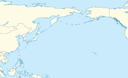
| Map | |||||||||||
| Runways | |||||||||||
| |||||||||||
| Haeju Airport | |
| Hangul | 해주비행장 |
|---|---|
| Hanja | 海州飛行場 |
| RR | Haeju bihaengjang |
| MR | Haeju pihaengjang |
Haeju Airport is an airport located in Haeju,South Hwanghae,North Korea. Haeju Airport is controlled by the Korean People's Army. The airport mainly operates military flights but also has a limited number of civilian flights. This airport is notorious to South Korean intelligence authorities,because former North Korean Intelligence agents frequently use it as a transfer point [ citation needed ]. The single runway 12/30 is 6562x289 ft (2000x88 m).


