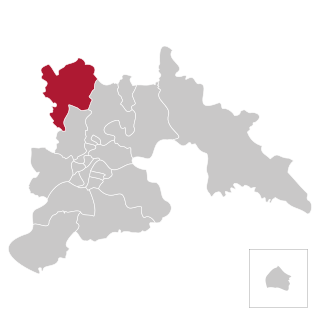
North Hwanghae Province is a province of North Korea. The province was formed in 1954 when the former Hwanghae Province was split into North and South Hwanghae. The provincial capital is Sariwon. The province is bordered by Pyongyang and South Pyongan to the north, Kangwon to the east, Kaesong Industrial Region and South Korea's Gyeonggi Province to the south, and South Hwanghae southwest. In 2003, Kaesong Directly Governed City became part of North Hwanghae as Kaepung County. Later on in 2019, it was promoted as Special City. Thus, it was separated from North Hwanghae.
Air Koryo is North Korea’s flag carrier and only commercial airline. It is state-owned and controlled by the North Korean air force. Headquartered in Sunan-guyŏk, Pyongyang, it operates domestic and international routes – on a regular schedule only to Beijing, Shenyang, and Vladivostok – from its hub at Pyongyang’s Sunan International Airport. It also operates flights on behalf of the North Korean government, with one of its aircraft serving as North Korean supreme leader Kim Jong Un's personal plane. Its fleet consists of Ilyushin and Tupolev aircraft from the Soviet Union and Russia, and Antonovs from Ukraine.

Pyongyang International Airport, also known as Pyongyang Sunan International Airport, is the main international airport serving Pyongyang, the capital of North Korea. It is in the city's Sunan District. The airport was closed to international travel in 2020 because of the COVID-19 pandemic, and reopened in 2023 with the resumption of Air Koryo flights to Beijing and Vladivostok.

The Korean People's Army Air Force is the unified military aviation force of North Korea. It is the second largest branch of the Korean People's Army comprising an estimated 110,000 members. As of 2024, it is estimated to possess some 570 combat aircraft, 200 helicopters, and a few transporters, mostly of decades-old Soviet and Chinese origin. Its primary task is to defend North Korean airspace. In April 2022, the Korean People's Army Air and Anti-Air Force name was changed to Korean People's Army Air Force.

Sunan-guyŏk, or Sunan District is one of the 18 guyŏk that constitute Pyongyang, North Korea.

Kalma Airport is a dual-use civil and military airport in Wonsan, Kangwon-do, North Korea. A new international terminal and passenger ramp opened in September 2015.

Samjiyŏn Airport is an airport in Samjiyon City, Ryanggang Province, North Korea.
Uiju Airfield is an airport in Uiju County, Pyongan-bukto, North Korea.
Mirim Airport, also known as Pyongyang East Airfield or K-24 Air Base, is an airport in Mirim-dong, Sadong-guyok, Pyongyang-si, North Korea.
Panghyon Airport is an airport near Panghyŏn-dong in Kusong, Pyongan-bukto, North Korea.
Ichon Airport (이천비행장) is an airport in Kangwon-do, North Korea.
Pangyo Airport is an airport in Pangyo County, Kangwon-do, North Korea.
Koksan Airport is an airport near Koksan, Hwanghae-bukto, North Korea.
Pyongsul Li Airport is an airport near Tŏkhŭng-ni in Koksan, Hwanghae-bukto, North Korea. Pyŏngsul-li village was named after Tŏkhŭng-ni in 1982.

Sondok Airport is an airport in Sŏndŏng-ni, Chŏngp'yŏng-gun, Hamgyong-namdo, North Korea. It is located at latitude 39.745201, longitude 127.473999.

The geology of North Korea has been studied by the Central Geological Survey of Mineral Resources, rare international research, and by inference from South Korea's geology.


