Riwon Airport | |||||||||||
|---|---|---|---|---|---|---|---|---|---|---|---|
| Summary | |||||||||||
| Airport type | Military | ||||||||||
| Serves | Riwŏn, North Korea | ||||||||||
| Elevation AMSL | 85 ft / 26 m | ||||||||||
| Coordinates | 40°21′35.90″N128°43′08.50″E / 40.3599722°N 128.7190278°E | ||||||||||
| Map | |||||||||||
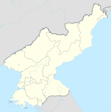 Riwon Location of airport in North Korea | |||||||||||
| Runways | |||||||||||
| |||||||||||
- ↑ Landings database page Archived 2011-07-23 at the Wayback Machine "Landings.Com", accessed 25 Aug 2010
- ↑ GlobalSecurity.org "Air Bases - North Korea", accessed 24 Aug 2010
| | This article about an airport in North Korea is a stub. You can help Wikipedia by expanding it. |