A ZIP Code is a system of postal codes used by the United States Postal Service (USPS). Introduced on July 1, 1963, the basic format consisted of five digits. In 1983, an extended ZIP+4 code was introduced; it included the five digits of the ZIP Code, followed by a hyphen and four digits that designated a more specific location.
Fredericksburg is an independent city in Virginia, United States. As of the 2020 census, the population was 27,982. It is 48 miles (77 km) south of Washington, D.C., and 53 miles (85 km) north of Richmond. The Bureau of Economic Analysis of the United States Department of Commerce combines the city of Fredericksburg with neighboring Spotsylvania County for statistical purposes.

Fauquier County is a county in the Commonwealth of Virginia. As of the 2020 census, the population was 72,972. The county seat is Warrenton.

Laporte is an unincorporated town, a post office, and a census-designated place (CDP) located in and governed by Larimer County, Colorado, United States. The CDP is a part of the Fort Collins, CO Metropolitan Statistical Area. The Laporte post office has the ZIP Code 80535. At the United States Census 2020, the population of the Laporte CDP was 2,409.

LaGrange is a town in Dutchess County, New York, United States. The population was 15,975 at the 2020 census. The town was named after the estate of the Marquis de Lafayette.

Shenandoah is a borough in Schuylkill County in the Coal Region of Pennsylvania. It is distinct from Shenandoah Heights, which is part of West Mahanoy Township immediately to the north. As of 2021, the borough's population was 4,247.

The Plains is a small incorporated town in Fauquier County, Virginia, United States. The population was 245 as of the 2020 census, up from 217 at the 2010 census. It is centered on the intersection of VA 55 and VA 245. The town of The Plains is situated off I-66. As of 2022, the mayor of The Plains is Lori Sisson.
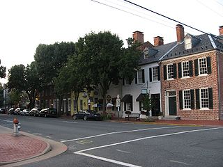
Leesburg is a town in and the county seat of Loudoun County, Virginia, United States. Settlement in the area began around 1740, which is named for the Lee family, early leaders of the town. Located in the far northeast of the state, in the War of 1812 it was a refuge for important federal documents evacuated from Washington, DC, and in the Civil War, it changed hands several times.

Pocahontas is a town in Tazewell County, Virginia, United States. It was named for Chief Powhatan's daughter, Pocahontas, who lived in the 17th-century Jamestown Settlement. The town was founded as a company mining town by the Southwest Virginia Improvement Company in 1881. It was the first company mining town in Virginia. The post office opened on June 30, 1882.

Philippi ('FILL-uh-pea') is a city in and the county seat of Barbour County, West Virginia, United States, along the Tygart Valley River. The population was 2,929 at the 2020 census. In 1861, the city was the site of the Battle of Philippi, known as the "Philippi Races". Although a minor skirmish, this is considered the earliest notable land action of the American Civil War. It is also known as the home of Alderson Broaddus University, a college affiliated with the American Baptist Churches. The city has a weekly newspaper, The Barbour Democrat.

Fairmont is a city in and county seat of Marion County, West Virginia, United States. The population was 18,313 at the 2020 census, making it the eighth-largest city in the state. It is the principal city of the Fairmont micropolitan area, which includes all of Marion County in North Central West Virginia and had a population of 56,205 in 2020. Fairmont is also a principal city of the larger Morgantown–Fairmont combined statistical area.

Berkeley Springs is a town in, and the county seat of, Morgan County, West Virginia, United States, in the state's Eastern Panhandle. Berkeley Springs is also commonly used to refer to the area in and around the Town of Bath. In 1776, the Virginia Legislature incorporated a town around the springs and named it Bath. Since 1802, it has been referred to by the name of its original post office, Berkeley Springs. The population was 758 at the 2020 census. It is part of the Hagerstown–Martinsburg metropolitan area.

The Virginia Peninsula is a peninsula in southeast Virginia, bounded by the York River, James River, Hampton Roads and Chesapeake Bay. It is sometimes known as the Lower Peninsula to distinguish it from two other peninsulas to the north, the Middle Peninsula and the Northern Neck.

Tidewater refers to the north Atlantic Plain region of the United States.

Lookout Mountain is a mountain ridge located at the northwest corner of the U.S. state of Georgia, the northeast corner of Alabama, and along the southeastern Tennessee state line in Chattanooga. Lookout Mountain was the scene of the 18th-century "Last Battle of the Cherokees" in this area during the Nickajack Expedition. On November 24, 1863, during the American Civil War, the Battle of Lookout Mountain took place here.

The Algonquian are one of the most populous and widespread North American native language groups. They historically were prominent along the Atlantic Coast and in the interior regions along Saint Lawrence River and around the Great Lakes. This grouping consists of the peoples who speak Algonquian languages.

Mitchells Plain is a large township located within the City of Cape Town, Western Cape, South Africa and situated about 28 km (17 mi) from the Cape Town city centre. It is one of South Africa's largest residential areas and contains multiple smaller suburbs. It is located on the Cape Flats on the False Bay coast between Muizenberg and Khayelitsha. Conceived of as a "model suburb" by the apartheid government, it was built during the 1970s to provide housing for Coloured victims of forced removal due to the implementation of the Group Areas Act.

The Upland South and Upper South are two overlapping cultural and geographic subregions in the inland part of the Southern United States. They differ from the Deep South and Atlantic coastal plain by terrain, history, economics, demographics, and settlement patterns.

The history of Williamsburg, Virginia dates to the 17th Century. First named Middle Plantation, it changed its name to Williamsburg in 1699.

Crow's Nest Natural Area Preserve is a large wilderness area located on the southern border of Stafford County, Virginia, United States, between Potomac Creek and Accokeek Creek. The greater portion of the Crow's Nest Peninsula is approximately 3,800 acres (15 km2) and lies within the coastal plain of Virginia. About 3,115 acres (12.61 km2) of the peninsula is protected as part of the Virginia Natural Area Preserve System.