Linden, Virginia

Last updated

Linden, Virginia
I-66 outside Linden.jpg
About 3 miles west of Linden on I-66
USA Virginia Northern location map.svg
Red pog.svg
Linden
Location within the Commonwealth of Virginia
USA Virginia location map.svg
Red pog.svg
Linden
Linden (Virginia)
Usa edcp location map.svg
Red pog.svg
Linden
Linden (the United States)
Coordinates: 38°54′29″N78°4′30″W / 38.90806°N 78.07500°W / 38.90806; -78.07500
CountryUnited States
State Virginia
County Fauquier and Warren
Time zone UTC−5 (Eastern (EST))
  Summer (DST) UTC−4 (EDT)
ZIP codes
22642
Area code 540

Linden is a small unincorporated village in Fauquier and Warren Counties in the U.S. state of Virginia. It is located west of Washington, D.C. at exit 13 off of Interstate 66.

Contents

History

In 1669 the "official" discovery of the Shenandoah Valley was credited to John Lederer and John Catlett at the present day site of Linden. The discovery and mapping of the area helped to open the area for further settlement. A marker at the intersection of VA 55 and SR 638 in Linden help commemorate this event. [1]

From the mid-18th century to the 1950s, the Linden area was home to 25 apple orchards. The Linden Methodist Church was built in 1842 and numerous buildings still exist dating from the 19th century. [2] In November 1954, tragedy struck the Linden church. A fire thought to be the caused by a faulty pipe in the wood-burning stove, destroyed the beautiful 62-year-old wooden structure. Its towering steeple and bell had long been an iconic landmark in the community. The Front Royal Fire Department courageously fought the blaze for four hours before it was squelched. Several heroic men in the Linden community, including Rev. B. L. Lock entered the burning building to salvage the church's antique pulpit, pews and bible. All were relics from a church building that had previously served the congregation.

The fire revealed several graves beneath the church's stone foundation making it very difficult to rebuild at the same site. Therefore, the congregation decided to relocate the Linden church next to the parsonage, on the opposite side of Highway 55. In December 1955, the ground breaking ceremony for the new Linden church at its current location took place. When completed, the new church was furnished with the pulpit and pews that had been rescued from the flames. [3]

Civil War

The relative ease settlers of crossing the Blue Ridge at the gap also allowed Linden to serve as a point of transit for the armies of both the Union and Confederate States during the United States Civil War. Linden was part of "Mosby's Confederacy" and served as rallying and rest points for the Confederate Rangers Mosby's Rangers under Colonel John S. Mosby. [4] [5] Numerous locations illustrating the daring and tenacity of the band are a short drive from Linden. [6]

Battle of Manassas Gap

A small battle and postscript to the Confederate Gettysburg campaign, the Battle of Manassas Gap occurred a half mile from Linden on July 23, 1863. After retreating across the Potomac River at Williamsport, Maryland, Lee's Army of Northern Virginia withdrew up the Shenandoah Valley. George G. Meade's Army of the Potomac crossed the river east of the Blue Ridge Mountains and followed Lee into Virginia. On July 23, Meade ordered the III Corps, under Maj.Gen. William H. French, to cut off the retreating Confederate columns at Front Royal, Virginia, by forcing passage through Manassas Gap. At first light, French began slowly pushing Brig. Gen. James A. Walker's Confederate brigade (the Stonewall Brigade, part of Maj. Gen. Richard H. Anderson's division) back into the gap. About 4:30 p.m., a strong Union attack drove Walker's men until they were reinforced by Robert E. Rodes's division and artillery. By dusk, the poorly coordinated Union attacks were abandoned. During the night, Confederate forces withdrew into the Luray Valley. On July 24, the Union army occupied Front Royal, but Lee's army was safely beyond pursuit.

Today

Appalachian Trail in Linden AppalachianTrailLindenVAUSA.jpg
Appalachian Trail in Linden

Linden is mostly a bedroom community with subdivisions known as Apple Mountain Lake and Blue Mountain. It has two gas stations, three stores, a restaurant, and a post office with zip code 22642. [7]

Linden is home to the Saint Dominic's Monastery, [8] Appalachian Trail access points, and the G. Richard Thompson Wildlife Management Area.

A primary Applachian Trail Access is on Tuckers lane off of Route 55 the John Marshall Highway. Turn onto Tuckers Lane from John Marshall Highway and go under I-66 to the parking area on your right. [9]

Geography

Mountains in Linden, VA (c) Michael Porterfield Linden-view.png
Mountains in Linden, VA © Michael Porterfield

Linden sits astride the Warren and Fauquier county lines, SR 55 (the John Marshall Highway) and Interstate Highway 66. At 945 feet (288 m) above sea level, it sits at the top of the Manassas Gap in the Blue Ridge Mountains making it a gateway into the Shenandoah Valley today, as it was for early settlers in the area. The Manassas Gap Railroad was completed in 1854, it ran through Linden from Mount Jackson to Manassas Junction giving the town of Manassas its name. Today the tracks form a part of the Norfolk Southern rail system. The popular north-south Appalachian Trail crosses Hwy 55 (John Marshall Hwy) and under I-66 in Linden at County Rd 725 (Tuckers Ln.) as it follows its way along the east side of the Blue Ridge.

While the "village" of Linden sets at 945 feet (288 m) above sea level many of the surrounding attractions and activity areas with road access climb above 2,100 feet (640 m) making for a diverse natural experience.

Geology

The soils in Linden are developed from granite, granite gneiss, greenstone and chloritic schist. The terrain ranges from rolling to steep landscapes that are dissected by Goose Creek and its tributaries that feed from runs and springs from the east side of the Blue Ridge Mountains. The rolling uplands contain soils that are loamy to silty and can be shallow to bedrock. On the steeper upland sections the soils are loamy with stones and rock outcrops evident on the surface. [2]

Schools

Schools K–12, operated by the Warren County School Board, [10] are located in Front Royal for students who live on the Warren County side of town. High Schoolers attend Warren County High School. Mountain Laurel Montessori School is in nearby Front Royal. [11]

Students who live in Fauquier County [12] attend primary and Middle Schools in the Marshall area while High School students attend Fauquier High School in Warrenton, VA.

Flora and fauna

Here is a list of commonly seen local flora and fauna in and around Linden.

Related Research Articles

<span class="mw-page-title-main">Fauquier County, Virginia</span> County in Virginia, United States

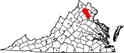
Fauquier County is a county in the Commonwealth of Virginia. As of the 2020 census, the population was 72,972. The county seat is Warrenton.

<span class="mw-page-title-main">Shenandoah Valley</span> Region of Virginia and West Virginia

The Shenandoah Valley is a geographic valley and cultural region of western Virginia and the Eastern Panhandle of West Virginia in the United States. The valley is bounded to the east by the Blue Ridge Mountains, to the west by the eastern front of the Ridge-and-Valley Appalachians, to the north by the Potomac River and to the south by the James River. The cultural region covers a larger area that includes all of the valley plus the Virginia highlands to the west, and the Roanoke Valley to the south. It is physiographically located within the Ridge and Valley province and is a portion of the Great Appalachian Valley.

<span class="mw-page-title-main">Shenandoah River</span> River in Virginia and West Virginia, United States

The Shenandoah River is the principal tributary of the Potomac River, 55.6 miles (89.5 km) long with two forks approximately 100 miles (160 km) long each, in the U.S. states of Virginia and West Virginia. The river and its tributaries drain the central and lower Shenandoah Valley and the Page Valley in the Appalachians on the west side of the Blue Ridge Mountains, in northwestern Virginia and the Eastern Panhandle of West Virginia. There is a hydroelectric plant along the Shenandoah river constructed in 2014 by Dominion.

<span class="mw-page-title-main">Skyline Drive</span> National Scenic Byway in Shenandoah National Park, Virginia, US

Skyline Drive is a 105-mile (169 km) National Parkway that runs the entire length of the National Park Service's Shenandoah National Park in the Blue Ridge Mountains of Virginia, generally along the ridge of the mountains. The drive's northern terminus is at an intersection with U.S. Route 340 (US 340) near Front Royal, and the southern terminus is at an interchange with US 250 near Interstate 64 (I-64) in Rockfish Gap, where the road continues south as the Blue Ridge Parkway. The road has intermediate interchanges with US 211 in Thornton Gap and US 33 in Swift Run Gap. Skyline Drive is part of Virginia State Route 48, which also includes the Virginia portion of the Blue Ridge Parkway, but this designation is not signed.

The Bull Run Mountains are a mountain range of the Blue Ridge Mountains in northern Virginia in the United States. Located approximately 20 miles (32 km) east of the main chain, across the Loudoun Valley. The Bull Run Mountains, together with Catoctin Mountain in Virginia and Maryland, make up the easternmost front of the Blue Ridge.

<span class="mw-page-title-main">Rockfish Gap</span>

Rockfish Gap is a wind gap located in the Blue Ridge Mountains between Charlottesville and Waynesboro, Virginia, United States, through Afton Mountain, which is frequently used to refer to the gap.

<span class="mw-page-title-main">Blue Ridge Mountain</span>

Blue Ridge Mountain, also known as Blue Mountain, is the colloquial name of the westernmost ridge of the Blue Ridge Mountains in northern Virginia and the Eastern Panhandle of West Virginia. The Appalachian Trail traverses the entire length of the mountain along its western slope and crest.

<span class="mw-page-title-main">National Register of Historic Places listings in Virginia</span>

Buildings, sites, districts, and objects in Virginia listed on the National Register of Historic Places:

<span class="mw-page-title-main">Ashby Gap</span>

Ashby Gap, more commonly known as Ashby's Gap is a wind gap in the Blue Ridge Mountains on the border of Clarke County, Loudoun County and Fauquier County in Virginia. The gap is traversed by U.S. Route 50. The Appalachian trail also passes across the gap.

<span class="mw-page-title-main">Loudoun Valley</span> Valley in northern Virginia

The Loudoun Valley is a small, but historically significant valley in the Blue Ridge Mountains located in Loudoun County in Northern Virginia in the United States.

<span class="mw-page-title-main">U.S. Route 50 in Virginia</span>

U.S. Route 50 is a transcontinental highway which stretches from Ocean City, Maryland to West Sacramento, California. In the U.S. state of Virginia, US 50 extends 86 miles (138 km) from the border with Washington, D.C. at a Potomac River crossing at Rosslyn in Arlington County to the West Virginia state line near Gore in Frederick County.

<span class="mw-page-title-main">Virginia State Route 55</span> State highway in Virginia, United States

State Route 55 is a primary state highway in the U.S. state of Virginia. Known for most of its length as John Marshall Highway, the state highway runs 64.71 miles (104.14 km) from the West Virginia state line, where the highway continues as West Virginia Route 55, east to U.S. Route 29 in Gainesville. West of its interchange with Interstate 81 (I-81) in Strasburg, SR 55 runs concurrently with the easternmost portion of US 48 as part of Corridor H. East of Front Royal, the state highway serves as the local complement of I-66 as it passes through the towns of Marshall, The Plains, and Haymarket.

The Manassas Gap Railroad (MGRR) ran from Mount Jackson, Virginia, to the Orange and Alexandria Railroad's Manassas Junction, which later became the city of Manassas, Virginia. Chartered by the Virginia General Assembly in 1850, the MGRR was a 4 ft 8 in narrow gauge line whose 90 completed miles of track included 38 miles (61 km) of 60 pounds-per-yard T-rail and 52 miles (84 km) of 52 pounds-per-yard T-rail. A total of nine locomotives and 232 cars were operated on the line, serving 20 stations.

Manassas Gap is a wind gap of the Blue Ridge Mountains on the border of Fauquier County and Warren County in Virginia. At an elevation of 887 feet above sea level, it is the lowest crossing of the Blue Ridge Mountains in the state. "The origins of the name "Manassas" are undocumented."

<span class="mw-page-title-main">Paris, Virginia</span> Unincorporated Village in Fauquier County, Virginia, U.S.

Paris is an unincorporated hamlet in Fauquier County, Virginia, United States. Located in Virginia's hunt country, it was established in a strategic spot at the eastern base of Ashby Gap along U.S. Route 17 and U.S. Route 50.

Chester Gap, sometimes referred to as Happy Creek Gap for the creek that runs down its western slope, is a wind gap in the Blue Ridge Mountains on the border of Rappahannock County, Fauquier County and Warren County in Virginia. The gap is traversed by U.S. Route 522. The Appalachian trail also passes across the gap, with a trailhead at the gap.

High Knob is a peak of the Blue Ridge Mountains in Warren and Fauquier counties, Virginia.

<span class="mw-page-title-main">Timeline of Fauquier County, Virginia in the Civil War</span>

Timeline of Fauquier County, Virginia in the Civil War

<span class="mw-page-title-main">Delaplane Historic District</span> Historic district in Virginia, United States

Delaplane Historic District is a national historic district located at Delaplane, Fauquier County, Virginia.

<span class="mw-page-title-main">Edward Carrington Marshall</span> American politician

Edward Carrington Marshall was a Virginia farmer, planter, businessman, and politician. He represented Fauquier County in the Virginia House of Delegates 1834-1838 and became president of the Manassas Gap Railroad.

References

  1. Bicentennial souvenir history of Warren County.
  2. 1 2 "Faquier County Community Planning" (PDF). Archived from the original (PDF) on May 28, 2010. Retrieved July 16, 2010.
  3. "Linden United Methodist Church". Umclinden-markham.org. Retrieved July 17, 2019.
  4. Mosby.
  5. Company D of the 43rd BATTALION VIRGINIA CAVALRY.
  6. Mosby Heritage Area.
  7. .Linden Post Office.
  8. Saint Dominics Monastery.
  9. "Interactive Map - Appalachian Trail Conservancy". Archived from the original on January 26, 2011. Retrieved January 25, 2011.
  10. Warren County Schools.
  11. "Mountain Laurel Montessori School".
  12. Fauquier County Schools.