Related Research Articles
The Advisory Committee on Antarctic Names is an advisory committee of the United States Board on Geographic Names responsible for recommending commemorative names for features in Antarctica.

Thurston Island is a largely ice-covered, glacially dissected island, 135 nautical miles long and 55 nautical miles wide, lying between Amundsen Sea and Bellingshausen Sea a short way off the northwest end of Ellsworth Land, Antarctica. The island is separated from the mainland by Peacock Sound, which is occupied by the west portion of Abbot Ice Shelf.
The Anare Mountains are a large group of mainly snow-covered peaks and ridges along the northern coast of Victoria Land, Antarctica. The group is bounded on the north and east by the Pacific Ocean, on the west by Lillie Glacier, and on the south by Ebbe Glacier and Dennistoun Glacier. They are north of the Concord Mountains and east of the Bowers Mountains.

Toney Mountain is an elongated snow-covered shield volcano, 38 nautical miles long and rising to 3,595 metres (11,795 ft) at Richmond Peak, located 35 nautical miles southwest of Kohler Range in Marie Byrd Land, Antarctica.
King Peninsula is an ice-covered peninsula, 100 nautical miles long and 20 nautical miles wide, lying south of Thurston Island and forming the south side of Peacock Sound, Antarctica. It projects from the continental ice sheet and trends west between the Abbot Ice Shelf and Cosgrove Ice Shelf to terminate at the Amundsen Sea.
Mount Minto is a lofty, mostly ice-free mountain rising to 4,165 metres (13,665 ft), located 2.5 nautical miles east of Mount Adam in the central portion of the Admiralty Mountains, Victoria Land, Antarctica.
The McCuddin Mountains are a small cluster of mountains in Antarctica consisting mainly of two large mountains, Mount Flint and Mount Petras, along with several scattered peaks and nunataks. Located in Marie Byrd Land, 64 km (40 mi) east of the Ames Range, with Wallace Rock as its southeast extremity.
Barnett Glacier is a large glacier in the Anare Mountains that flows east along the south side of Tapsell Foreland into Smith Inlet, northern Victoria Land, Antarctica.
Northern Foothills is a line of coastal hills on the west side of Terra Nova Bay, Victoria Land, Antarctica, lying southward of Browning Pass and forming a peninsular continuation of the Deep Freeze Range. It was named by the Northern Party of the British Antarctic Expedition, 1910–13 (BrAE), because during field operations Inexpressible Island, close southward, was originally referred to as the "Southern Foothills."

Kukri Hills is a prominent east-west trending range, about 25 nautical miles (46 km) long and over 2,000 metres (6,600 ft) high, forming the divide between Ferrar Glacier on the south and Taylor Glacier and Taylor Valley on the north, in Victoria Land, Antarctica. They are south of the Asgard Range, east of the Quartermain Mountains and north of the Royal Society Range.
Mount Dockery is a mountain, 1,095 m (3,590 ft) high, standing 6 km (4 mi) west of Mount Matthias in the western part of the Everett Range in the Concord Mountains of northern Victoria Land, Antarctica. It stands on the Pennell Coast, between Cape Williams and Cape Adare.
Gibraltar Peak is a peak in Antarctica.
The Morozumi Range is a mountain range in the Usarp Mountains of North Victoria Land, Antarctica. It extends northwest–southeast for 25 miles (40 km), with its northern elevations overlooking the convergence of Gressitt Glacier and Rennick Glacier.
Hobbs Ridge is a prominent arc-shaped ridge which circumscribes Hobbs Glacier to the north and northwest and forms the divide with the lower part of Blue Glacier, on the Scott Coast of Victoria Land, Antarctica. It was named in association with Hobbs Glacier. It forms the northernmost part of the Denton Hills.

Henderson Glacier is a glacier approximately 7 nautical miles long in the Enterprise Hills of the Heritage Range, Antarctica. It flows northeast from Schoeck Peak and Hoinkes Peak to enter Union Glacier just east of Mount Rossman. Henderson Glacier was mapped by the United States Geological Survey from surveys and U.S. Navy air photos 1961–66, and was named by the Advisory Committee on Antarctic Names for Felix E. Henderson, a United States Antarctic Research Program meteorologist at Eights Station in 1965.
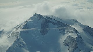
Toilers Mountain is a massive peak (1,955 m) standing 4 nautical miles (7 km) northeast of Halverson Peak in the northwest end of the King Range, Concord Mountains. The peak was used as a gravity station by the northern party of New Zealand Geological Survey Antarctic Expedition (NZGSAE), 1963–64. So named by them because of the long climb and unpleasant conditions encountered in occupying the summit.
Cape Lyttelton is a cape forming the southern entrance point of Shackleton Inlet, along the western edge of the Ross Ice Shelf, Antarctica.
The Crown Hills are a group of peaks and hills forming the south-east part of the Lanterman Range in the Bowers Mountains of Victoria Land, Antarctica. Lying between Zenith Glacier and Gambone Peak, and including All Black Peak, they rise to a height of 2,000 metres (6,600 ft). The name was given by the New Zealand Antarctic Place-Names Committee (NZ-APC) in 1983, at the suggestion of geologist M.G. Laird, in association with nearby Coronet Peak.
References
- ↑ "Halverson Peak". Geographic Names Information System . United States Geological Survey, United States Department of the Interior . Retrieved 2012-05-17.
![]() This article incorporates public domain material from "Halverson Peak". Geographic Names Information System . United States Geological Survey.
This article incorporates public domain material from "Halverson Peak". Geographic Names Information System . United States Geological Survey.
| | This Victoria Land location article is a stub. You can help Wikipedia by expanding it. |