Hamhung Station

Last updated
Hamhŭng
함흥

Kankou Station.JPG

The original station building.
Korean name
Hangul 함흥역
Hanja
Revised Romanization Hamheung-yeok
McCune–Reischauer Hamhŭng-yŏk
General information
Location Yŏkchŏn 1-dong,
Sŏngch'ŏngang-guyŏk,
Hamhŭng-si,
South Hamgyŏng
North Korea
Owned by Korean State Railway
Platforms 4 (2 islands)
Tracks 8
History
Opened 15 December 1919
Electrified yes
Original company Chosen Government Railway
Services
Preceding station  Korean State Railway  Following station
toward  Rajin
P'yŏngra Line
toward  P'yŏngyang
toward  Sinhŭng
Sinhŭng Line (1435 mm) Terminus
Terminus Sŏho Line
toward  Sŏho

Hamhŭng Station is a railway station in Yŏkchŏn 1-dong, Sŏngch'ŏngang-guyŏk, Hamhŭng city, South Hamgyŏng province, North Korea, located on the P'yŏngra Line of the Korean State Railway; [1] it is also the starting point of the Sinhŭng Line and the Sŏho Line. [1] A locomotive depot is located here, and there are spurs to the Hamhŭng Knitwear Factory and the Paekkŭmsan Combined Foodstuffs Factory in Haebit-tong, Sŏngch'ŏngang-guyŏk.

Hamhung Municipal City in Kwannam, North Korea

Hamhŭng is North Korea's second largest city, and the capital of South Hamgyŏng Province. In late 2005, nearby Hŭngnam was made a ward (kuyŏk) within Hamhŭng-si. It has a population of 768,551 as of 2008.

South Hamgyong Province Province in Kwannam, North Korea

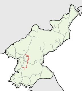
South Hamgyong Province is a province of North Korea. The province was formed in 1896 from the southern half of the former Hamgyong Province, remained a province of Korea until 1945, then became a province of North Korea. Its capital is Hamhung.

North Korea Sovereign state in East Asia

North Korea, officially the Democratic People's Republic of Korea, is a country in East Asia constituting the northern part of the Korean Peninsula, with Pyongyang the capital and the largest city in the country. The name Korea is derived from Goguryeo which was one of the great powers in East Asia during its time, ruling most of the Korean Peninsula, Manchuria, parts of the Russian Far East and Inner Mongolia, under Gwanggaeto the Great. To the north and northwest, the country is bordered by China and by Russia along the Amnok and Tumen rivers; it is bordered to the south by South Korea, with the heavily fortified Korean Demilitarized Zone (DMZ) separating the two. Nevertheless, North Korea, like its southern counterpart, claims to be the legitimate government of the entire peninsula and adjacent islands.

History

The station was originally opened on 15 December 1919 by the Chosen Government Railway as part of the 69.5 km (43.2 mi) Yŏnghŭng (nowadays Kŭmya)–Hamhŭng section of the Hamgyŏng Line.

Chosen Government Railway

The Chosen Government Railway was a state-owned railway company in Korea under Japanese rule. It was a department of the Railway Bureau of the Government-General of Korea, whose functions were the management and operation of railways in Korea, as well as the supervision of privately owned railway companies.

Kŭmya Station is a railway station in North Korea. It is located on the P'yŏngra Line of the Korean State Railway, and is the starting point of the Kŭmya Line.

Related Research Articles

Chongjin Municipal City in North Hamgyong, North Korea

Chŏngjin is the capital of North Korea's North Hamgyong Province and the country's third largest city. It is sometimes called the City of Iron.

Chung-guyok Place in North Korea

Chung-guyŏk is one of the 19 guyok which constitute the city of Pyongyang, North Korea. The district is located in the center of the city, between the Potong and Taedong Rivers, and is bordered to the north by Moranbong-guyok, to the northwest by Potonggang-guyok, and to the south by Pyongchon-guyok.

Kilju County County in North Hamgyong Province, North Korea

Kilju, sometimes romanized as Kilchu, is a county in North Hamgyong province, North Korea. The county seat is Kilju Town.

P'yŏngch'ŏn-guyŏk is one of the 19 guyŏk of P'yŏngyang, North Korea. It is bordered by the Taedong River in the south and the Potong River in the north and west, and to the east by Chung-guyŏk, from which it is separated by the yard area of P'yŏngyang railway station. It was established as a guyŏk in October 1960 by the P'yŏngyang City People's Committee through a mandate of the Central Committee of the Workers' Party of Korea.

Pyongyang Station railway station

Pyongyang Station is the central railway station of P'yŏngyang, North Korea. It is located in Yŏkchŏn-dong, Chung-guyŏk.

Sŏp'o Station is a railway station in Sŏp'o-dong, Hyongjesan-guyŏk, P'yŏngyang, North Korea. It is on located on the P'yŏngra and P'yŏngŭi lines of the Korean State Railway.

Sunan Station is a railway station in Sunan-guyŏk, P'yŏngyang, North Korea. It is on located on the P'yŏngŭi Line of the Korean State Railway.

Kowŏn Station is a railway station of the Korean State Railway in Kowŏn-ŭp, Kowŏn County, South Hamgyŏng, North Korea. It is the junction where the P'yŏngra Line, which connects P'yŏngyang to Rajin, meets the Kangwŏn Line running from Kowŏn to P'yŏnggang.

Pyongdok Line

The P'yŏngdŏk Line is an electrified standard-gauge trunk line of the Korean State Railway in North Korea running from Taedonggang Station in P'yŏngyang, where it connects to the P'yŏngbu, P'yŏngnam, P'yŏngra and P'yŏngŭi Lines, to Kujang, where it connects to the Manp'o and Ch'ŏngnyŏn P'arwŏn Lines. The total length of the line is 192.3 km (119.5 mi).

Hamhung concentration camp is a reeducation camp in North Korea. The official name of the camp is Kyo-hwa-so No. 9. The sub-facility for women is sometimes called Kyo-hwa-so No. 15.

Hungnam ward of Hamhung

Hŭngnam is a district of Hamhung, the third largest city in North Korea. It is a port city on the eastern coast on the Sea of Japan. It is only eight miles from the slightly inland city of Hamhung. In 2005 it became a ward of Hamhung.

Kim Chaek Iron & Steel Works is one of North Korea's largest steel mills. It is located in Songpyong-guyok,Chongjin, North Hamgyŏng Province. It was established by Nippon Steel during the Japanese occupation of Korea, and was subsequently nationalised after the establishment of the DPRK. In North Korea, this factory is called "The Big Metallurgic Base of the North ". It has fifty thousand employees.

Susŏng Station is a railway station in Susŏng-dong, Sŏngp'yŏng-guyŏk, Ch'ŏngjin-si, North Hamgyŏng, North Korea, on the Hambuk Line of the Korean State Railway.

Kadam Station is a railway halt in Sŏhŭng-dong, Tonghŭngsan-guyŏk, Hamhŭng city, South Hamgyŏng province, North Korea, on the Sinhŭng Line of the Korean State Railway.

Pumin Station is a railway halt in Pumil-li, Tonghŭngsan-guyŏk, Hamhŭng city, South Hamgyŏng province, North Korea, on the Sinhŭng Line of the Korean State Railway.

Sŏhamhŭng Station is a railway station in Sŏngch'ŏngang-guyŏk, Hamhŭng city, South Hamgyŏng province, North Korea, on the Sŏho Line of the Korean State Railway. Locomotive and rolling stock maintenance facilities for the narrow gauge equipment used on the line are located here.

Sŏho Station is a railway station in Sŏho 2-dong, Hŭngnam-guyŏk, Hamhŭng city, South Hamgyŏng province, North Korea on the P'yŏngra Line of the Korean State Railway; it is also one of the southern termini of the Sŏho Line.

The Pinallon Line or Vinylon Line is an electrified, freight-only industrial railway line of the Korean State Railway in Hamhŭng, South Hamgyŏng, North Korea, running from Hamhung marshalling yard to Hŭngnam via the February 8 Vinylon Complex in Hŭngnam.

References

  1. 1 2 Kokubu, Hayato, 将軍様の鉄道 (Shōgun-sama no Tetsudō), ISBN   978-4-10-303731-6

Coordinates: 39°54′43″N127°32′43″E / 39.9119°N 127.5454°E / 39.9119; 127.5454

Geographic coordinate system Coordinate system

A geographic coordinate system is a coordinate system that enables every location on Earth to be specified by a set of numbers, letters or symbols. The coordinates are often chosen such that one of the numbers represents a vertical position and two or three of the numbers represent a horizontal position; alternatively, a geographic position may be expressed in a combined three-dimensional Cartesian vector. A common choice of coordinates is latitude, longitude and elevation. To specify a location on a plane requires a map projection.