Hamish Hay Bridge

Last updated

Hamish Hay Bridge
Hamish Hay Bridge 529.JPG
The bridge in 2013
Coordinates 43°31′40″S172°38′07″E / 43.527778°S 172.635278°E / -43.527778; 172.635278 (Hamish Hay Bridge)
Carriespedestrians, cyclists
Crosses Avon River
Locale Victoria Square, Christchurch, New Zealand
Other name(s)
  • Victoria Street Bridge
  • Victoria Bridge
  • Papanui Bridge
  • Market Place Bridge
Characteristics
Designcast iron girders
MaterialSteel, concrete deck
Width20.1 m
No. of spans1
History
Designer Charles Fox (London)
James Wylde (Christchurch)
Constructed by Edward George Wright
Opened28 September 1864 (1864-09-28)
Statistics
Daily traffic none
Designated2 April 2004
Reference no.1832
Location
Hamish Hay Bridge

Hamish Hay Bridge (also known as Victoria Street Bridge; previously Victoria Bridge and initially variably Papanui Bridge and Market Place Bridge) is located in Victoria Square, Christchurch, New Zealand. Built in 1864, it was renamed in 1989 for Sir Hamish Hay, Mayor of Christchurch; a commemorative bronze plaque is affixed to the bridge's guard rail in the middle of the structure to honor Hay's services. The bridge, the oldest heritage feature in the square, is also the country's oldest cast iron and stone bridge. It survived the 2011 earthquake undamaged. Architectural features include the bridge arch and the balustrade's neo-gothic ornamentation. The bridge is registered as a Category II heritage structure with the New Zealand Historic Places Trust.

Contents

Location

Christchurch was surveyed in 1850 with a regular grid layout, interrupted by the Avon River and two diagonal roads making connections to the port in Lyttelton and to the northern hinterland. [1] The northern diagonal crosses the Avon in an area that was set aside as a market square. A simple bridge was built to cross the river in March 1852 in the location of the current bridge. The road that the bridge served was originally called Whately Road, named after the Archbishop of Dublin, Richard Whately, who was a member of the Canterbury Association. [2] The road name changed the Victoria Street, and the name of the market square changed to Victoria Square. [1]

History

First bridge (1852)

After settlement of Christchurch having started in December 1850, the Society of Land Purchasers under the chairmanship of Guise Brittan arranged for a first bridge to be erected in the market square, and this was done in March 1852. [1] [3] [4] [5] [6] The bridge gave access from Christchurch to the 36 hectares (89 acres) Papanui Bush, some 6.5 kilometres (4.0 mi) away and at the time the end of the road. Papanui Bush was one of only two forests on the Canterbury Plains and thus an important source of building material and firewood; the bridge thus became known as the Papanui Bridge. [1] [7] In 1852, the price of firewood in Christchurch was 21s to 24s depending on quality, but only 7s in Papanui Bush, with the balance the cost of carting, which demonstrates the importance of making transport easier. [6] The bridge was also referred to as the Market Place Bridge, as it was the centrally located in the square that was initially known as Market Place. [8]

Second bridge (1856)

Advertisement advising of the closure of the bridge in September 1863 Press 1863 09Sep 21.jpg
Advertisement advising of the closure of the bridge in September 1863

This first single-lane cart bridge was replaced by a structure 16 feet (4.9 m) wide in February 1856. Construction took 13 days, during which it was closed for traffic, was supervised by the Provincial Engineer, Edward Dobson, and cost £294. [7] By 1857, Papanui Bush was exhausted and timber had to be carted from much further away, and carts with 16 to 20 bullocks regularly crossed the bridge. [7] A one-day traffic count from January 1862 shows the following survey results: [9]

Counttypenotes
10bullock drays58 bullocks
51horse drays66 horses
36horse carts51 horses
1donkey cart1 donkey
199saddle horses
20cows and bullocks
204sheep
1000pedestrians

In March 1862, the Christchurch Town Council was set up, but the bridge initially remained under the control of the Canterbury Provincial Council due to its strategic importance. [10] The Provincial Council decided in 1862 to replace the bridge, and originally budgeted £2,000 to do so. [11] This was increased by a further £1,000 before construction started. [12]

In August 1863, it was resolved for lights to be installed by the Christchurch Town Council on the Colombo and Papanui bridges, so that pedestrians could find their way to the safe crossing points at night. [13] But before this happened, the Provincial Secretary wrote to the town council on 18 September 1863, requesting that Papanui Bridge be closed for all cart traffic until such time that a new bridge can be constructed. [14] The City Surveyor duly advertised the closure the next day, also advising of a temporary footbridge to be constructed to which the light would be fitted. [1] [15] [16]

Present bridge (1864)

The provincial government contracted Sir Charles Fox in London to design a more substantial bridge. Fox and Henderson Co. was also charged with tendering the work, and the commission for wrought iron girders went to Head Ashby of Stockton-on-Tees at a cost of £605. A delay was caused by the girders being found to be deficient, and they had to be recast before shipping to New Zealand. [1]

Meanwhile, the local bridge design was undertaken by the Assistant Provincial Engineer, James Wylde, and the site works awarded to Edward George Wright, whose winning tender was £2,375. Wright began his work in January 1864, whilst the iron girders did not arrive in Lyttelton until July of that year. [1] However, the journey by sea had been rough, and shifting cargo had caused three of the girders to crack. This was repaired at John Anderson's foundry at a cost of over £300; Anderson had wrought iron plates riveted over the cracks. [17] Wright constructed solid square stone blocks for the girders to terminate in, and the bridge was built at a width of 27 feet 6 inches (8.38 m). It opened on 28 September 1864 with considerable ceremony, with four guards placed at the bridge the previous evening so that nobody would cross it prior to the opening ceremony. The honour of opening the bridge fell to John Ollivier as chairman of the Christchurch Town Council, and Dr William Donald as resident magistrate of Lyttelton. Ollivier broke a bottle of champagne on the bridge to declare it open, [17] [18] and it fell to Donald to officially name it Victoria Bridge. [19] The new bridge was heavily criticised by one of the local newspapers, The Press , for being of a much more complex and expensive construction type than would have been necessary, yet they questioned whether the abutments would even withhold the lateral forces induced by the reasonably flat girders. [8] The total cost of the bridge was reported to the Town Council as £3,410 10s. [20] At the same time, ownership of the bridge was transferred from the Provincial Council to the Town Council. The Provincial Council allocated a further £300 to the project, and thus paid £3,300 towards the total costs. [21]

Market Place in 1864 during the construction of the Papanui Bridge Victoria Square, 1864.jpg
Market Place in 1864 during the construction of the Papanui Bridge

The Canterbury foothills were hit by a severe rainstorm on 3 February 1868, and the Waimakariri River broke its banks between Courtenay and Halkett (near Kirwee), entering the headwater of the Avon River at Avonhead. The flood water reached Christchurch at 10 am of the following day and rose rapidly and that evening, the city was under water. In Dr Barker's house, located on the corner of Worcester Street and Oxford Terrace and thus only some 400 metres (1,300 ft) upstream from the Victoria Bridge, the water was 3 feet (0.91 m) deep. [22] The Worcester Street Bridge was washed downstream by a distance of 150 yards (140 m), [22] and the north end of the Colombo Street Bridge was swept away. [23] The Gloucester Street suspension footbridge and the much more substantial Victoria Bridge survived the flood without damage, and the Madras Street and Stanmore Road bridges further downstream were also undamaged. [24]

The bridge was widened in 1875 to a design by Samuel A'Court. [1] Wing piers were added and outrigger wooden footpaths were added. The wing piers are documented on a commemorative plaque, but the description is technically incorrect, as the piers are not load-bearing structural elements. [17] In October 1877, George Gould presented a petition to the city council to have Whately Road renamed to Victoria Street, which was acceded to. [25]

Steam trams started their regular service to St Albans along Whately and Papanui Roads on 5 June 1880, [26] [27] and by August the line had been extended to reach its terminus at the Papanui railway station. [28]

In 1885, only ten years after the last occasion, the bridge was widened again, this time to its ultimate width of 20.1 metres (66 ft), which is the standard legal (i.e. boundary to boundary) width of most roads in the central city of one chain. The work was undertaken by Walter Bory Scott, who at the same time constructed the nearby Worcester Street Bridge; this other bridge is also registered as a Category II heritage structure. [1] [29]

Victoria Bridge decorated with the floral arches in honour of the Duke and Duchess of Cornwall and York in June 1901 Victoria Bridge, 1901.jpg
Victoria Bridge decorated with the floral arches in honour of the Duke and Duchess of Cornwall and York in June 1901

The Duke and Duchess of Cornwall and York arrived in Christchurch on 22 June 1901. A number of arches of greenery were erected in their honour, and the last one for them to pass through was the government arch at Victoria Bridge; it was the most impressive of all the arches. Nine semi-circular arches spanned the width of the bridge, and rose to a height of 6.6 metres (22 ft). The royal visitors had been invited by the mayor, Arthur Rhodes, to lay the foundation stone for the Queen Victoria Statue in honour of the Queen, as a jubilee memorial for the Canterbury pioneers, but also as a memorial to those soldiers who had died in the Second Boer War. [30]

On 10 September 1954, the last timetabled tram service in Christchurch crossed the bridge; with the demise of the Papanui–Cashmere route, trams were replaced by buses. [31] In July 1989, Victoria Street through Victoria Square was closed to motorised traffic in preparation for the square to be turned into an urban park, and to enable the construction of the Parkroyal Hotel on the corner of Durham and Kilmore Streets. [17] Part of the bridge deck was removed to make the cast iron girders visible, and tram tracks were incorporated into the design as a reminder of the transport history. At the same time, the bridge was renamed after the outgoing mayor, Hamish Hay. [17]

The bridge appears to have survived the 2011 earthquake undamaged. [32]

Heritage registration

The Hamish Hay Bridge is registered as a Category II heritage item by the New Zealand Historic Places Trust. It was registered on 2 April 2004 with registration number 1832. The bridge is significant for its previous transport function, for its association with several early engineers in Christchurch, for its high regard with the public, as this was central to Victoria Square's redevelopment in the 1980s, and as the first cast iron bridge in New Zealand. [1] It is also notable for its commemoration of the significance of Victoria Square and, through plaques, of the tram system and Hamish Hay, and for establishing the neo-gothic style for Avon River bridges, which was subsequently adopted at another five bridges. [1] [33]

On the same day, the other neo-gothic bridges were also registered (downstream to upstream):

Geoffrey Rice, an emeritus professor in history from the University of Canterbury who is writing a book on the history of Victoria Square, regards the Hamish Hay Bridge the most important heritage bridge in Christchurch. [32]

See also

Notes

  1. 1 2 3 4 5 6 7 8 9 10 11 "Victoria Street Bridge". New Zealand Heritage List/Rārangi Kōrero. Heritage New Zealand . Retrieved 13 August 2013.
  2. Harper, Margaret. "Christchurch Street Names T to V" (PDF). Christchurch City Libraries. p. 88. Retrieved 16 August 2013.
  3. "Meeting of the Society of Land Purchasers". Lyttelton Times . Vol. I, no. 39. 4 October 1851. p. 5. Retrieved 14 August 2013.
  4. "The Lyttelton Times". Lyttelton Times . Vol. I, no. 52. 3 January 1852. p. 4. Retrieved 14 August 2013.
  5. "Christchurch: A Chronology". Christchurch City Libraries . Retrieved 14 August 2013.
  6. 1 2 "Christchurch". Lyttelton Times . Vol. II, no. 62. 13 March 1852. p. 5. Retrieved 17 August 2013.
  7. 1 2 3 Lamb 1981, p. 79.
  8. 1 2 "The Market Place Bridge". The Press . Vol. V, no. 595. 26 September 1864. p. 2. Retrieved 14 August 2013.
  9. Lamb 1981, pp. 79–80.
  10. Lamb 1981, p. 80.
  11. "Provincial Council". Lyttelton Times . Vol. XVIII, no. 1050. 3 December 1862. p. 3. Retrieved 17 August 2013.
  12. "Christchurch". The Press . Vol. III, no. 281. 24 September 1863. p. 2. Retrieved 17 August 2013.
  13. "City Council". The Press . Vol. III, no. 238. 5 August 1863. p. 3. Retrieved 17 August 2013.
  14. "City Council". The Press . Vol. III, no. 284. 28 September 1863. p. 2. Retrieved 17 August 2013.
  15. "Town and Country". Lyttelton Times . Vol. XX, no. 1133. 19 September 1863. p. 4. Retrieved 16 August 2013.
  16. "Public Notice". The Press . Vol. III, no. 278. 21 September 1863. p. 3. Retrieved 17 August 2013.
  17. 1 2 3 4 5 Thornton 2001, p. 243.
  18. "Town and Country". Lyttelton Times . Vol. XXII, no. 1297. 29 September 1864. p. 4. Retrieved 16 August 2013.
  19. "The Press". The Press . Vol. V, no. 598. 29 September 1864. p. 2. Retrieved 16 August 2013.
  20. "City Council". The Press . Vol. V, no. 597. 28 September 1864. p. 2. Retrieved 16 August 2013.
  21. "Provincial Council". The Press . Vol. V, no. 598. 29 September 1864. p. 2. Retrieved 16 August 2013.
  22. 1 2 Lamb 1981, p. 37.
  23. 1 2 "Colombo Street Bridge". New Zealand Heritage List/Rārangi Kōrero. Heritage New Zealand . Retrieved 16 August 2013.
  24. "The Flood". The Press . Vol. XII, no. 1637. 6 February 1868. p. 2. Retrieved 17 August 2013.
  25. "City Council". The Press . Vol. XXVIII, no. 3823. 23 October 1877. p. 3. Retrieved 16 August 2013.
  26. "Local and General". The Star. No. 3787. 4 June 1880. p. 2. Retrieved 16 August 2013.
  27. Cyclopedia Company Limited 1903, p. 389.
  28. "The Star". The Star. No. 3841. 9 August 1880. p. 2. Retrieved 16 August 2013.
  29. 1 2 "Worcester Street Bridge". New Zealand Heritage List/Rārangi Kōrero. Heritage New Zealand . Retrieved 15 August 2013.
  30. Lamb 1981, p. 82.
  31. "The Christchurch Tramway". Christchurch City Libraries . Retrieved 16 August 2013.
  32. 1 2 Rice, Geoffrey (23 September 2011). "Keep cars out of Victoria Square's peaceful haven". The Press . Retrieved 13 August 2013.
  33. "Hamish Hay Bridge Commemorative Plaques". Christchurch City Council. 13 September 2011. Archived from the original on 12 February 2013. Retrieved 13 August 2013.
  34. "Armagh Street Bridge". New Zealand Heritage List/Rārangi Kōrero. Heritage New Zealand . Retrieved 16 August 2013.
  35. "Gloucester Street Bridge". New Zealand Heritage List/Rārangi Kōrero. Heritage New Zealand . Retrieved 16 August 2013.
  36. "Park Bridge". New Zealand Heritage List/Rārangi Kōrero. Heritage New Zealand . Retrieved 16 August 2013.

Related Research Articles

<span class="mw-page-title-main">Cathedral Square, Christchurch</span> Square in Christchurch, New Zealand

Cathedral Square, locally known simply as the Square, is the geographical centre and heart of Christchurch, New Zealand, where the city's Anglican cathedral, ChristChurch Cathedral is located. The square stands at the theoretical crossing of the city's two main orthogonal streets, Colombo Street and Worcester Street, though in practice both have been either blocked off or detoured around the square itself. The square was badly damaged in the February 2011 Christchurch earthquake.

<span class="mw-page-title-main">Isaac Luck</span> New Zealand builder, architect and politician (1817–1881)

Isaac Luck was a New Zealand architect. A professional builder, he arrived in Lyttelton on the Steadfast in 1851. He was the third chairman of the Christchurch Town Council. He was the brother-in-law of and in partnership with Benjamin Mountfort, and was the less well-known architectural partner for the design of the Canterbury Provincial Council Buildings.

<span class="mw-page-title-main">Christchurch Central City</span> Central area of Christchurch, New Zealand

Christchurch Central City or Christchurch City Centre is the geographical centre and the heart of Christchurch, New Zealand. It is defined as the area within the Four Avenues and thus includes the densely built up central city, some less dense surrounding areas of residential, educational and industrial usage, and green space including Hagley Park, the Christchurch Botanic Gardens and the Barbadoes Street Cemetery.

<span class="mw-page-title-main">John Joseph Dougall</span> New Zealand politician

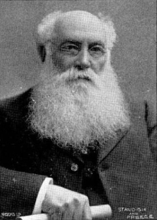
John Joseph Dougall was Mayor of Christchurch in 1911–1912. He was a solicitor by profession. In his later life, the Navy League was his main interest.

<span class="mw-page-title-main">John Anderson (mayor)</span> New Zealand blacksmith and businessman (1820–1897)

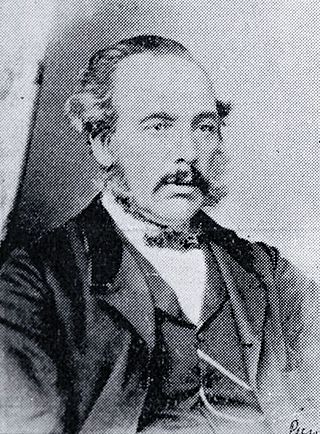
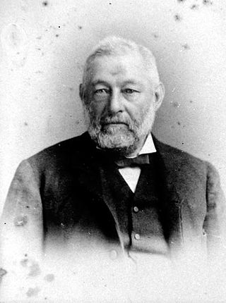
John Anderson was the second Mayor of Christchurch in New Zealand 1868–1869, and a successful businessman. He had a close connection with three buildings that have later received Category I heritage registrations by Heritage New Zealand. Two of these buildings were demolished following the February 2011 Christchurch earthquake.

<span class="mw-page-title-main">Henry Richard Webb</span> New Zealand businessman and politician

Henry Richard Webb JP FRMS was a New Zealand businessman and politician. He represented Lyttelton in Parliament for 2½ years and was a supporter of education in his later years. Born in Australia, he came to Canterbury in 1868.

Daniel Reese was a 19th-century Member of Parliament from Christchurch, New Zealand.

William Thomson was a 19th-century politician from Christchurch, New Zealand, originally from Scotland. He held office at all levels of government, from Parliament and Provincial Council to chairman of a road board. In his professional life, Thomson was an auctioneer, accountant and commission agent. He had rural holdings in Governors Bay and at the Esk River.

<span class="mw-page-title-main">Alfred Cox (politician)</span> New Zealand politician (1825–1911)

Alfred Cox was a 19th-century runholder and Member of the New Zealand House of Representatives. Born in New South Wales into an upper middle class military family, he was sent home to England to learn about farming. Upon returning to New South Wales, he heard about the large profits that were possible in South Canterbury and bought licences for land that he had not seen. He stocked the land, put a manager in charge and made another trip to England with his wife and their, at that time, small family. He moved to New Zealand permanently in 1857 and lived on his large farm, Raukapuka, which stretched from the sea to the foothills, and of which the homestead was located in present-day Geraldine. He sold his South Canterbury interests and moved to the Waikato, where he bought large land holdings in Hamilton and Thames. He tried to drain his swamp land and lost a lot of money with those ventures. He sold up in 1882 and moved to Christchurch, where he retired.

<span class="mw-page-title-main">Colombo Street</span> Main road in Christchurch, New Zealand

Colombo Street is a main road of the city of Christchurch, New Zealand. It runs south-north through the centre of Christchurch with a break at Cathedral Square. As with many other central Christchurch streets, it is named for a colonial Anglican bishopric, Colombo, Sri Lanka in what at the time was known as Ceylon. Parts of the street which run through Sydenham were known as Addison Street during the 1880s, and some parts were known as Colombo Road.

<i>Lyttelton Times</i>

The Lyttelton Times was the first newspaper in Canterbury, New Zealand, publishing the first edition in January 1851. It was established by the Canterbury Association as part of its planned settlement of Canterbury and developed into a liberal, at the time sometimes seen as radical, newspaper. A successor paper, The Star, is published as a free bi-weekly newspaper.

<span class="mw-page-title-main">Lyttelton Times Building</span> Initially commercial, now hostel in Christchurch, New Zealand

The Lyttelton Times Building, last known as Base Backpackers, in 56 Cathedral Square, Christchurch Central City, was the last headquarters of the Lyttelton Times before its demise in 1935 as the then-oldest newspaper in New Zealand. The building in Chicago School architectural style was registered with New Zealand Historic Places Trust as a Category I heritage item, with the registration number 7216. The building's last use was as a backpackers' hostel and a restaurant. It was demolished following the February 2011 Christchurch earthquake.
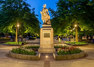
<span class="mw-page-title-main">Cecil Wood (architect)</span> New Zealand architect (1878–1947)

Cecil Walter Wood was a New Zealand architect. He was the dominant architect in Canterbury during the interwar period.

<span class="mw-page-title-main">Joseph Maddison</span> New Zealand architect (1850–1923)

Joseph Clarkson Maddison was a New Zealand architect. He trained as an architect in his native London and came to Canterbury at the age of 22. At the end of the 19th and beginning of the 20th century, he was one of the most prominent architects in Christchurch, receiving commissions from all over the country. Until the February 2011 Christchurch earthquake, 13 of his buildings were listed by Heritage New Zealand on their register, with three of those Category I listings, but many of the Christchurch buildings have been demolished since. His style was plain and utilitarian, and he specialised in the classical Italian mode.

<span class="mw-page-title-main">Trinity Congregational Church, Christchurch</span> Restaurant in Christchurch, New Zealand

TheTrinity Church or Trinity Congregational Church designed by Benjamin Mountfort, later called the State Trinity Centre, is a Category I heritage building listed with Heritage New Zealand. Damaged in the 2010 Canterbury earthquake and red-stickered after the February 2011 Christchurch earthquake, the building was threatened with demolition like most other central city heritage buildings. In June 2012, it was announced that the building would be saved, repaired and earthquake strengthened. The building, post its church status, has housed some commercial operations, including the State Trinity Centre; 'The Octagon' (2006–2010); and later, following earthquake repairs, a business called 'The Church Brew Pub' (2023–present).

<span class="mw-page-title-main">Samuel Farr (architect)</span>

Samuel Charles Farr was a 19th-century builder and architect in Christchurch, New Zealand. He intended to emigrate from England to Auckland, but significant shipping problems saw him end up in Akaroa in 1850 instead. From 1862, he lived in Christchurch. Farr has a number of firsts against his name: the first marriage in Canterbury, he designed Akaroa's first church, designed New Zealand's first iron verandahs, and he started Sunday schools in Canterbury. As a leading member of the Acclimatisation Society, he stocked almost every lake and river in Canterbury with fish and was instrumental in introducing the bumblebee to New Zealand. His most notable building was Cranmer Court, the former Normal School, in the Christchurch Central City; this building was demolished following the February 2011 Christchurch earthquake.

<span class="mw-page-title-main">Victoria Square, Christchurch</span> Public place in Christchurch, New Zealand

Victoria Square is located in central Christchurch, New Zealand. Originally known as Market Place or Market Square, it was the site of market days, fairs, and trade before its redevelopment in 1896–1897 into a park. Subsequent to the February 2011 earthquake, the square was located in the Central City Red Zone and was closed, reopening in November 2012. Its notable landmarks include the Captain James Cook statue, Queen Victoria statue, H. L. Bowker Fountain, and the Victoria Square Poupou. It also features the country's oldest cast iron and stone bridge, now known as the Hamish Hay Bridge.

<span class="mw-page-title-main">Victoria Street, Christchurch</span>

Victoria Street is a road in the central city of Christchurch, New Zealand. It runs from the intersection of Papanui Road and Bealey Avenue in the north-west, and terminates in the south-east at the corner of Kilmore and Durham Streets. One of the two diagonal roads that break the original grid plan, it was very important in the development of Christchurch.

<span class="mw-page-title-main">Henry Le Cren</span>

Henry John Le Cren was a New Zealand merchant. Born in London, he was an early settler in Lyttelton and traded both in the port town and central Christchurch. He moved to Timaru in 1858 and is regarded as one of the town's pioneers. Companies owned by him or his eldest son are predecessors to the New Zealand agricultural supply business PGG Wrightson.

Robert William England was a New Zealand architect from Christchurch.

References