Bayswater, New Zealand

Last updated

Bayswater
Bayswater Marina and Takapuna.jpg
Bayswater marina with Takapuna in the background
Bayswater, New Zealand
Coordinates: 36°48′54″S174°46′23″E / 36.815°S 174.773°E / -36.815; 174.773
CountryNew Zealand
City Auckland
Local authority Auckland Council
Electoral ward North Shore ward
Local board Devonport-Takapuna Local Board
Established1850s (Approx.)
Area
[1]
  Land110 ha (270 acres)
Population
 (June 2023) [2]
  Total2,760
Postcode(s)
0622
Ferry terminalsBayswater Marina
(Waitemata Harbour) Hauraki
(Waitemata Harbour)
Pfeil oben.svg
Pfeil links.svgBayswaterPfeil rechts.svg
Pfeil unten.svg
Belmont
(Waitemata Harbour) Narrow Neck

Bayswater is a suburb located on the North Shore of Auckland, New Zealand. It lies on a peninsula which juts into the Waitemata Harbour. Politically the suburb is part of the Devonport-Takapuna Local Board and the North Shore ward of Auckland Council. [3]

Contents

Demographics

Bayswater covers 1.10 km2 (0.42 sq mi) [1] and had an estimated population of 2,760 as of June 2023, [2] with a population density of 2,509 people per km2.

Historical population
YearPop.±% p.a.
20062,643    
20132,823+0.95%
20182,865+0.30%
Source: [4]

Bayswater had a population of 2,865 at the 2018 New Zealand census, an increase of 42 people (1.5%) since the 2013 census, and an increase of 222 people (8.4%) since the 2006 census. There were 1,038 households, comprising 1,365 males and 1,503 females, giving a sex ratio of 0.91 males per female. The median age was 37.1 years (compared with 37.4 years nationally), with 564 people (19.7%) aged under 15 years, 669 (23.4%) aged 15 to 29, 1,281 (44.7%) aged 30 to 64, and 354 (12.4%) aged 65 or older.

Ethnicities were 80.6% European/Pākehā, 11.7% Māori, 6.3% Pacific peoples, 10.3% Asian, and 3.8% other ethnicities. People may identify with more than one ethnicity.

The percentage of people born overseas was 32.5, compared with 27.1% nationally.

Although some people chose not to answer the census's question about religious affiliation, 54.6% had no religion, 32.9% were Christian, 0.3% had Māori religious beliefs, 0.5% were Hindu, 0.7% were Muslim, 1.0% were Buddhist and 2.3% had other religions.

Of those at least 15 years old, 783 (34.0%) people had a bachelor's or higher degree, and 222 (9.6%) people had no formal qualifications. The median income was $43,000, compared with $31,800 nationally. 684 people (29.7%) earned over $70,000 compared to 17.2% nationally. The employment status of those at least 15 was that 1,257 (54.6%) people were employed full-time, 315 (13.7%) were part-time, and 72 (3.1%) were unemployed. [4]

History

Bayswater was originally named O'Neill's Point after the first European settlers in the area, brothers Allan and James O'Neill. [5] Originally settling at the point (which still bears their name) at the end of the peninsula in the 1840s, by the 1850s [6] the O'Neill's owned much of the peninsula. [7] The name is a descriptive one. [8]

O'Neill's Point Cemetery

View of O'Neill's Point Cemetery towards Shoal Bay O'Neill's Point Cemetery.jpg
View of O'Neill's Point Cemetery towards Shoal Bay

O'Neill’s Point Cemetery is located at 122 Bayswater Avenue. It was opened in 1891 and named after Alan and James O'Neill. The cemetery contains the official war graves of 41 men who served in the New Zealand forces and one man who served with the UK forces during World War I and who died before September 1, 1921. A number of World War I graves (returned soldiers and soldiers who died of the flu and other causes at the nearby Narrow Neck army camp) can be found here. [9]

Takapuna Boating Club

Takapuna Boating Club Takapuna Boating Club (13241194354).jpg
Takapuna Boating Club

opened in 1923 this notable building was the clubhouse for the Takapuna Boating Club until they relocated to Takapuna Beach in the 1970s. [10]

St Michael's and All Angels Church

St. Michael's and All Angels Anglican Church, Bayswater St. Michael's and All Angels, Bayswater.jpg
St. Michael's and All Angels Anglican Church, Bayswater

In 1910, the Anglican church of St. Michael and All Angels was moved to Bayswater from its original position on Church Street, Devonport, where Holy Trinity Church now stands. The church was dedicated in 1865. It took the place of the first St. Michael's church, which was also constructed in 1865 but was destroyed by fire in 1908. [11]

In 2011 the church was deconsecrated and in 2013 it was repurposed as a martial arts studio . [12] [13]

Takapuna Tramways and Ferry Company Ltd

Image of Steam Tram leaving Bayswater Wharf Steam Tram leaving Bayswater Wharf.jpg
Image of Steam Tram leaving Bayswater Wharf

The company ran steam trams from the ferry terminal in Bayswater to Takapuna.

Environment

New Zealand Dotterel (Charadrius obscurus) New Zealand Dotterel. (Charadrius obscurus) (32094680023).jpg
New Zealand Dotterel (Charadrius obscurus)

To the north of Bayswater, Shoal Bay is a DoC high priority site of special wildlife interest, SSWI, because of its significance for wading birds.

Many shore birds graze in this significant estuary.

Every year, the bar-tailed godwit migrates from Alaska to New Zealand. About 200 come to the Shoal Bay estuary in March to feed, relax, and then return.

Shoal Bay is also home to the New Zealand Dotterel, which builds its nests above high tide and descends to the estuary at low tide to forage. [14]

Education

Bayswater School, New Zealand Bayswater School.jpg
Bayswater School, New Zealand

Bayswater School is a coeducational contributing primary (years 1–6) school with a roll of 115 as of February 2024. [15] [16] The school celebrated its 50th Jubilee in 2003. [17] Yachtsman Peter Blake was an alumnus of the school. [18]

Sport

Bayswater Park, community football pitches. The park, along with Stanley Bay Park, is home to North Shore United AFC.

Belmont Park Racquets Club, Established in 1935 the club provides tennis and squash courts.

Belmont Park Bowling Club, crown green bowling.

Takapuna Grammar School Rowing Club have their boathouse at Bayswater Marina.

Related Research Articles

<span class="mw-page-title-main">Devonport, New Zealand</span> Suburb in Auckland, New Zealand

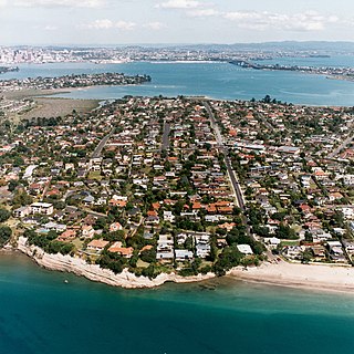
Devonport is a harbourside suburb of Auckland, New Zealand. It is located on the North Shore, at the southern end of the Devonport Peninsula that runs southeast from near Lake Pupuke in Takapuna, forming the northern side of the Waitematā Harbour. East of Devonport lies North Head, the northern promontory guarding the mouth of the harbour.

<span class="mw-page-title-main">North Shore, New Zealand</span> Subregion of Auckland, New Zealand

The North Shore is one of the major geographical regions of Auckland, the largest city in New Zealand. The area is defined as the northern shores of the Waitematā Harbour as far north as the Ōkura River.

<span class="mw-page-title-main">Northcote, Auckland</span> Suburb in Auckland, New Zealand

Northcote is a suburb of Auckland in northern New Zealand. It is situated on the North Shore, on the northern shores of Waitematā Harbour, 4 kilometres (2.5 mi) northwest of the Auckland City Centre. The suburb includes the peninsula of Northcote Point where the northern approaches to the Auckland Harbour Bridge are located, and Northcote Central, the commercial centre of Northcote. Northcote features two volcanic maars.

<span class="mw-page-title-main">Takapuna</span> Suburb in Auckland, New Zealand

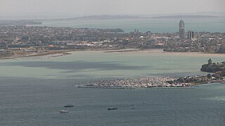
Takapuna is a suburb located on the North Shore of Auckland, New Zealand. The suburb is an isthmus between Shoal Bay, arm of the Waitematā Harbour, and the Hauraki Gulf. Lake Pupuke, a volcanic maar and one of the oldest features of the Auckland volcanic field, is a freshwater lake located in the suburb.

<span class="mw-page-title-main">Milford, New Zealand</span> Suburb in Auckland, New Zealand

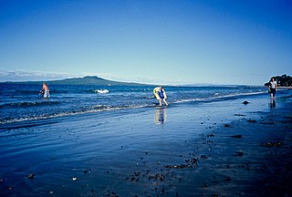
Milford is a suburb located on the North Shore, Auckland. It is located on northern side of Lake Pupuke. It also has a popular swimming beach, which runs some two kilometres from Black Rock in the south to Castor Bay in the north. The Wairau Creek reaches the sea at the Hauraki Gulf at the northern end of Milford Beach, and its lower tidal reaches host the Milford Marina.

<span class="mw-page-title-main">Browns Bay, New Zealand</span> Suburb in Auckland, New Zealand

Browns Bay is one of the most northernmost suburbs in the contiguous Auckland metropolitan area, located in the North Shore. Named after the Brown family who settled here in 1876, Browns Bay became a holiday destination in the late 19th century. The area gradually developed into a suburb of Auckland in the 1950s, and was the administrative centre for the East Coast Bays City from 1975 until it was disestablished in 1989. During the 1990s, the suburb became a hub for the South African New Zealander community.

<span class="mw-page-title-main">Forrest Hill, New Zealand</span> Suburb in Auckland, New Zealand

Forrest Hill is a suburb located on the North Shore of Auckland, New Zealand.

<span class="mw-page-title-main">Torbay, New Zealand</span> Suburb in Auckland, New Zealand

Torbay is a northern suburb of Auckland, New Zealand. It is located in the upper East Coast Bays of the city's North Shore, and is governed by Auckland Council.

<span class="mw-page-title-main">Hillcrest, Auckland</span> Suburb in Auckland, New Zealand

Hillcrest is a suburb of the contiguous Auckland metropolitan area located in New Zealand. Since 2010, it has been under the jurisdiction of the Auckland Council, and is located in the North Shore, surrounded by Glenfield, Wairau Valley, Northcote and Birkenhead. The Auckland Northern Motorway passes to the east.

<span class="mw-page-title-main">Hauraki, Auckland</span> Suburb in Auckland, New Zealand

Hauraki is a suburb in the southern North Shore of Auckland, the largest metropolitan city in New Zealand. It is under the local governance of the Auckland Council.

<span class="mw-page-title-main">Belmont, Auckland</span> Suburb in Auckland, New Zealand

Belmont is a suburb of Auckland, New Zealand, located on the North Shore. The suburb is in the North Shore ward, one of the thirteen administrative divisions of Auckland Council.

<span class="mw-page-title-main">Narrow Neck, New Zealand</span> Suburb in Auckland, New Zealand

Narrow Neck is a suburb located on the North Shore of Auckland, New Zealand. It is under the local governance of the Auckland Council.

<span class="mw-page-title-main">Takapuna Grammar School</span> Secondary school in Auckland

Takapuna Grammar School is a state coeducational secondary school located in the suburb of Belmont on the North Shore of Auckland, New Zealand. Established in 1927, the school mainly serves the eponymous suburb of Takapuna and the entire Devonport Peninsula. A total of 2,100 students from Years 9 to 13 attend the school as of February 2024.

<span class="mw-page-title-main">Castor Bay</span> Suburb in Auckland, New Zealand

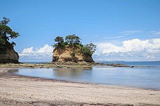
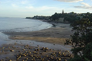
Castor Bay is a bay and suburb of the North Shore, located in Auckland which is in the North Island of New Zealand. Located between Milford and Campbells Bay, it is part of the East Coast Bays. To the east lies the islands of Rangitoto and Motutapu, which are easily visible from land. The suburb is in the North Shore ward, one of the thirteen administrative divisions of Auckland Council.

<span class="mw-page-title-main">Murrays Bay</span> Suburb in Auckland, New Zealand

Murrays Bay is a small suburb in the East Coast Bays region, located in the North Shore of Auckland. The suburb is roughly the same size as Rothesay Bay, the suburb to the immediate north. It is primarily a residential area but does have a community centre, restaurant and café. Murrays Bay is regularly serviced by buses which go to Takapuna and the Auckland city centre.

<span class="mw-page-title-main">Campbells Bay</span> Suburb in Auckland, New Zealand

Campbells Bay is a suburb of the North Shore located in Auckland, New Zealand.

<span class="mw-page-title-main">Wairau Valley, Auckland</span> Suburb in Auckland, New Zealand

Wairau Valley is a suburb of Auckland, New Zealand. The area is predominantly light industrial/commercial. The Northern Motorway passes to the east, and the Wairau Park shopping complex extends to the north. The valley is drained by the Wairau Creek, which flows on through Milford and discharges into the Hauraki Gulf from an estuary at the northern end of Milford Beach.

<span class="mw-page-title-main">Devonport-Takapuna Local Board</span> Local board of Auckland Council in New Zealand

The Devonport-Takapuna Local Board covers from Castor Bay, and Sunnynook south to the end of the Devonport Peninsula; it is separated from the Kaipātiki board area by the Northern Motorway. This local board sits in the Auckland Council office buildings on The Strand in Takapuna. These were the North Shore City Council offices until the North Shore City Council was merged into Auckland Council in 2010. It is part of the North Shore Ward of Auckland Council, which also includes the Kaipātiki Local Board.

<span class="mw-page-title-main">Devonport-Takapuna</span> Local board area in Auckland, New Zealand

Devonport-Takapuna is a local government area in Auckland, in New Zealand's Auckland Region, governed by the Devonport-Takapuna Local Board and Auckland Council. It currently aligns with the council's North Shore Ward.

<span class="mw-page-title-main">Shoal Bay, New Zealand</span> Bay in the Waitematā Harbour

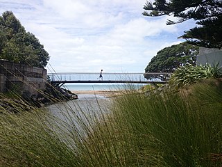
Shoal Bay is a bay of the Waitematā Harbour in Auckland, New Zealand. It is located on the North Shore.

References

  1. 1 2 "ArcGIS Web Application". statsnz.maps.arcgis.com. Retrieved 2 July 2022.
  2. 1 2 "Population estimate tables - NZ.Stat". Statistics New Zealand . Retrieved 25 October 2023.
  3. Council, Auckland. "Auckland Council explained". Auckland Council. Retrieved 15 December 2021.
  4. 1 2 "Statistical area 1 dataset for 2018 Census". Statistics New Zealand. March 2020. Bayswater (129400). 2018 Census place summary: Bayswater
  5. Wises New Zealand Guide (7 ed.). Wises Publications. 1979. p. 316.
  6. Wises New Zealand Guide (7 ed.). Wises Publications. 1979. p. 29.
  7. "Gone and forgotten - Aucklander News". NZ Herald. 29 May 2024. Retrieved 28 May 2024.
  8. "Place name detail: 327". New Zealand Gazetteer. New Zealand Geographic Board.
  9. "O'Neill's Point Cemetery". Welcome to Heritage New Zealand. 7 July 2022. Retrieved 18 April 2023.
  10. "The shining white building perched over Shoal Bay". heritageetal.blogspot.com. 17 March 2021. Retrieved 29 October 2023.
  11. Titchener, Paul (25 September 1979). "Bishop Selwyn dedicated Bayswater Church". natlib.govt.nz. North Shore Times Advertiser. Retrieved 13 November 2023.
  12. Willis, Liz (22 October 2013). "North Shore Church Sales Finalised". stuff.co.nz. Retrieved 13 November 2023.
  13. Willis, Liz (10 March 2011). "St Michaels to Close". stuff.co.nz. Retrieved 13 November 2023.
  14. Williams, David (13 June 2022). "Marina Development Threatens Shoal Bay Birds, Say Residents". tewahanui.nz. Retrieved 14 November 2023.
  15. "New Zealand Schools Directory". New Zealand Ministry of Education. Retrieved 14 March 2024.
  16. Education Counts: Bayswater School
  17. "Bayswater School 50th Jubilee Reunion". Education Gazette New Zealand. 82 (16). 1 September 2003.
  18. "Blake, PeterJames". Teara.govt.nz. 3 April 2023. Retrieved 3 April 2023.