Demographics
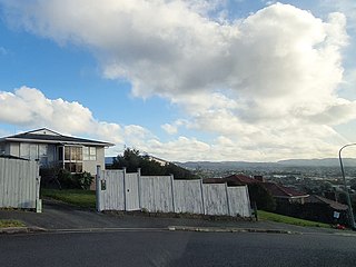
The statistical area is called Stanley Point. It covers 0.99 km2 (0.38 sq mi) [1] and had an estimated population of 1,930 as of June 2023, [2] with a population density of 1,949 people per km2.
Historical population| Year | Pop. | ±% p.a. |
|---|
| 2006 | 2,028 | — |
|---|
| 2013 | 2,040 | +0.08% |
|---|
| 2018 | 2,025 | −0.15% |
|---|
| Source: [10] |
Stanley Point had a population of 2,025 at the 2018 New Zealand census, a decrease of 15 people (−0.7%) since the 2013 census, and a decrease of 3 people (−0.1%) since the 2006 census. There were 615 households, comprising 1,050 males and 975 females, giving a sex ratio of 1.08 males per female. The median age was 37.7 years (compared with 37.4 years nationally), with 387 people (19.1%) aged under 15 years, 492 (24.3%) aged 15 to 29, 891 (44.0%) aged 30 to 64, and 252 (12.4%) aged 65 or older.
Ethnicities were 88.7% European/Pākehā, 7.6% Māori, 2.1% Pacific peoples, 4.0% Asian, and 5.6% other ethnicities. People may identify with more than one ethnicity.
The percentage of people born overseas was 31.0, compared with 27.1% nationally.
Although some people chose not to answer the census's question about religious affiliation, 58.4% had no religion, 32.1% were Christian, 0.4% had Māori religious beliefs, 0.1% were Hindu, 0.7% were Buddhist and 2.2% had other religions.
Of those at least 15 years old, 684 (41.8%) people had a bachelor's or higher degree, and 87 (5.3%) people had no formal qualifications. The median income was $47,800, compared with $31,800 nationally. 567 people (34.6%) earned over $70,000 compared to 17.2% nationally. The employment status of those at least 15 was that 945 (57.7%) people were employed full-time, 237 (14.5%) were part-time, and 33 (2.0%) were unemployed. [10]

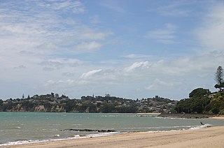
Devonport is a harbourside suburb of Auckland, New Zealand. It is located on the North Shore, at the southern end of the Devonport Peninsula that runs southeast from near Lake Pupuke in Takapuna, forming the northern side of the Waitematā Harbour. East of Devonport lies North Head, the northern promontory guarding the mouth of the harbour.

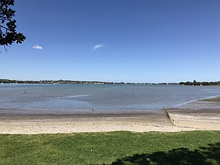
Waitematā Harbour is the main access by sea to Auckland, New Zealand. For this reason it is often referred to as Auckland Harbour, despite the fact that it is one of two harbours adjoining the city. The harbour forms the northern and eastern coasts of the Auckland isthmus and is crossed by the Auckland Harbour Bridge. It is matched on the southern side of the city by the shallower waters of the Manukau Harbour.

Tāmaki is a small suburb of East Auckland, 11 kilometres from the Auckland CBD, in the North Island of New Zealand. It is located by the banks of the estuarial Tāmaki River, which is a southern arm of the Hauraki Gulf. The suburb is between the suburbs of Point England to the north and Panmure to the south.

Mission Bay is a seaside suburb of Auckland city, on the North Island of New Zealand. The suburb's beach is a popular resort, located alongside Tamaki Drive. The area also has a wide range of eateries. Mission Bay is located seven kilometres to the east of the city centre, on the southern shore of the Waitematā Harbour, between Ōrākei and Kohimarama. It covers an area of 1.08 km2, about three quarters of which comprises low hills, surrounding the remaining quarter, which slopes down to the sea. Local government of Mission Bay is the responsibility of the Ōrākei Local Board, which also includes the suburbs of Ōrākei, Kohimarama, St Heliers, Glendowie, St Johns, Meadowbank, Remuera and Ellerslie.
New Windsor, founded in 1865, is a suburb of Auckland, New Zealand. It is located 10 kilometres (6.2 mi) from the Auckland city centre, between Mount Albert, Blockhouse Bay, Mt Roskill and Avondale.

Forrest Hill is a suburb located on the North Shore of Auckland, New Zealand.

Waima is a suburb of West Auckland, New Zealand. It is under the local governance of the Auckland Council. The majority of the modest population is clustered around the comparatively prominent Waima superette, situated just off the main arterial road Woodlands Park Road, on such streets as Waima Crescent, Hollywood Avenue, Boylan Road and Rimutaka Place. The central "hub" could be considered Waima reserve, which consists of various public amenities such as a playground, basketball court, toilets and a sport field.

Mellons Bay is a suburb of East Auckland. It is south of Eastern Beach and north of Howick.
Cockle Bay is a suburb of East Auckland, New Zealand. The suburb is in the Howick local board, one of the 21 administrative divisions of Auckland.

Farm Cove is a suburb located in East Auckland, New Zealand. The suburb is in the Howick ward, one of the thirteen administrative divisions of Auckland. The Rotary Walkway Reserve runs through Farm Cove.

Bayswater is a suburb located on the North Shore of Auckland, New Zealand. It lies on a peninsula which juts into the Waitemata Harbour. Politically the suburb is part of the Devonport-Takapuna Local Board and the North Shore ward of Auckland Council.

Belmont is a suburb of Auckland, New Zealand, located on the North Shore. The suburb is in the North Shore ward, one of the thirteen administrative divisions of Auckland Council.

Narrow Neck is a suburb located on the North Shore of Auckland, New Zealand. It is under the local governance of the Auckland Council.
Kohimarama is a coastal residential Auckland suburb, located to the east of the city. Kohimarama is situated between Mission Bay and St Heliers and has an accessible beach with a boardwalk and green recreational spaces located amongst residential areas. Local government of Kohimarama is the responsibility of the Ōrākei Local Board, which also includes the suburbs of Ōrākei, Mission Bay, St Heliers, Glendowie, St Johns, Meadowbank, Remuera and Ellerslie.
Wai o Taiki Bay is a suburb in Auckland, New Zealand. It is under the local governance of Auckland Council.
Pinehill is a small suburb in the East Coast Bays area of Auckland, New Zealand. Pinehill contains two shopping centres, one along East Coast Road and the other along Greville Road. The suburb has only recently grown because of the housing estates being built in the area for the rapidly growing Albany area. Pinehill is regularly serviced by buses which go to Takapuna and the Auckland city centre. The Auckland Northern Motorway passes to the west of the suburb.
Manukau, or Manukau Central, is a suburb of South Auckland, New Zealand, centred on the Manukau City Centre business district. It is located 23 kilometres south of the Auckland Central Business District, west of the Southern Motorway, south of Papatoetoe, and north of Manurewa. The industrial and commercial suburb of Wiri lies to the east and south.

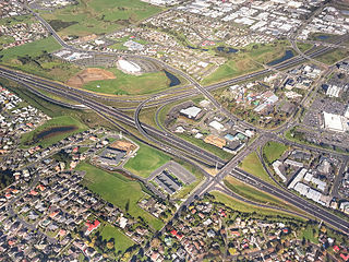
The Devonport-Takapuna Local Board covers from Castor Bay and Sunnynook south to the end of the Devonport Peninsula; it is separated from the Kaipātiki board area by the Northern Motorway. This local board sits in the Auckland Council office buildings on The Strand in Takapuna. These were the North Shore City Council offices until the North Shore City Council was merged into Auckland Council in 2010. It is part of the North Shore Ward of Auckland Council, which also includes the Kaipātiki Local Board.
Tauranga Central is a suburb and the central business district of Tauranga, in the Bay of Plenty Region of New Zealand's North Island.

Customs Street is a street in the Auckland City Centre, New Zealand, located between Hobson Street and Beach Road. The street is split into two sections at the junction of Queen Street, Customs Street West and Customs Street East.


