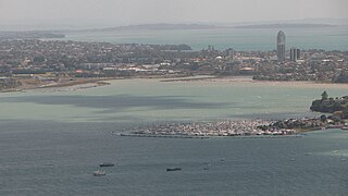
Devonport (/ˈdɛvənpɔːrt/DEV-ən-port)[3] is a harbourside suburb of Auckland, New Zealand. It is located on the North Shore, at the southern end of the Devonport Peninsula that runs southeast from near Lake Pupuke in Takapuna, forming the northern side of the Waitematā Harbour. East of Devonport lies North Head, the northern promontory guarding the mouth of the harbour.
The suburb hosts the Devonport Naval Base of the Royal New Zealand Navy, the main facility for the country's naval vessels, but is also known for its harbourside dining and drinking establishments and its heritage charm. Devonport has been compared to Sausalito, California, US due to its setting and scenery.[4]
Etymology
Devonport is named after the English naval town of Devonport.[5]
Eastern Devonport is known as Cheltenham, named after the English town of Cheltenham.[6]
Devonport is a peninsula at the mouth of the Waitematā Harbour on the North Shore of Auckland. It is surrounded by Ngataringa Bay to the northwest, the Waitematā Harbour mouth to the south, and the Rangitoto Channel of the Hauraki Gulf to the east.[7]
The suburb of Stanley Point can be found to the west of Devonport, while the suburbs of Narrow Neck and Vauxhall are found to the north.[7] The northwestern section of Devonport is located at Duders Point, a peninsula within Ngataringa Bay.[7]
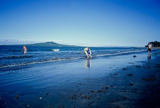
The suburb has three beaches: Devonport Beach and Duders Beach to the south,[8][9] and Cheltenham Beach to the northeast.[10]
Devonport is home to three volcanoes of the Auckland volcanic field: Takarunga / Mount Victoria, Maungauika / North Head and Takararo / Mount Cambria. Of these three volcanoes, Maungauika / North Head is the oldest, estimated to have last erupted around 87,500 years ago. Takaroro / Mount Cambria and Takarunga / Mount Victoria are estimated to have last erupted 42,300 and 34,800 years ago respectively.[11] Takarunga / Mount Victoria is the taller of the volcanoes, reaching a height of 81 metres (266ft),[12] with Maungauika / North Head reaching a height of 65 metres (213ft).[13] Takararo / Mount Cambria formerly stood at a height of 30 metres (98ft), but was quarried in the 1870s. Another scoria cone, the 20 metres (66ft) high Duders Hill, believed to be a section of Takarunga / Mount Victoria, was quarried in the early 20th century.[14]
History
Tainui Landing Memorial, marking the spot where the Tainui migration canoe landed c.1350.
Around 40,000 years ago Devonport consisted of three islands of volcanic origin, Mount Victoria, North Head and between them Mount Cambria (now largely quarried away).[15]
The earliest evidence for Māori settlement dates from the mid-14th century (roughly the same time as the believed landing of the Tainuimigration canoe, which is commemorated by a stone memorial on the foreshore).[16] A significant Māori settlement on North Head was ended by attacks from rival tribes in the 1790s.[17] About 50 Māori were still living in Torpedo Bay, with their meeting house just east of Cambridge Terrace, until they fled to the Waikato when the colonial government launched war on Waikato Māori in 1863.[18][19]
Jules Dumont d'Urville, a French explorer, is thought to have gone ashore in the area in 1827, possibly as the first European.[16] The first European building on the foreshore was a gunpowder magazine built in 1840.[20]
Devonport is one of the oldest colonial settlements in Auckland, and the first on the North Shore.[21] The Royal Navy survivors of HMS Buffalo settled at Devonport.[21] In 1841 a signal station for Auckland's shipping was erected on Mount Victoria (Takarunga), and the signal master, Robert Snow, and his family became the first Europeans to live in the area permanently.[20] From then until the 1860s, the settlement was called Flagstaff, because of the flagstaff at the signal station.[22] Flagstaff was subdivided for town sections and farms in the early 1850s.[20]
For the first half century or so of its existence Devonport was geographically isolated from the rest of the North Shore, and was sometimes called "the island" by the local inhabitants.[23] Only a thin strip of land beside the beach at Narrow Neck connected Devonport to Belmont and the rest of the North Shore peninsula. In the late 19th century the mangrove swamp that stretched from Narrow Neck to Ngataringa Bay was filled in to form a racecourse, now a golf course.[23] A new road was built along the western edge of the racecourse allowing more direct travel to the north.
On the southern shore, to the west of the centre of Devonport, a nearby deep water anchorage suitable for Royal Navy vessels, the Devonport Naval Base was established in 1841. William Hobson, then the Governor of New Zealand, considered the sandspit-protected area a better choice for a naval installation than the shallower waters on the southern side of the Waitematā Harbour.[16] While some facilities have expanded and shifted in location over time, the area is still the primary base for the Royal New Zealand Navy. The Calliope Dock at Stanley Bay, part of the base, was opened on 16 February 1888 and at the time was the largest dock in the Southern hemisphere. The suburb also had one of the oldest New Zealand shipyards, now part of the Devonport Yacht Club area.[16]
The main centre of the suburb slowly shifted west from Church Street and the original wharf at Torpedo Bay, to its current location around the ferry wharf.[16] The settlement itself was renamed Devonport by 1859 after the English naval town of Devonport.[5] Devonport achieved Borough status in 1886 and was incorporated into North Shore City in 1989.
Devonport played a special role in the nuclear free movement. In 1981 the Devonport Borough Council voted to declare Devonport a nuclear-free zone, the first local council in New Zealand to do so.[24]
In July 2007, Devonport was given permission to be excluded from a list of local Auckland growth node centres. The Auckland Regional Council accepted that while it was encouraging intensified growth (such as higher-density housing) around transport nodes such as Devonport, the character and historical nature of the Devonport Wharf area would make such a designation inappropriate in this case.[25]
Ferries
The Kea at Devonport Wharf
The first ferry services to Auckland city began in the 1840s. These were open sailing cutters operated by local seamen running passengers to the foot of Queen Street, Auckland's main road. In 1860 the first paddlesteamer ferries began operation.[15][23] These were in turn replaced by double-ended, screw-driven ferries in 1904.[23] Both passenger and vehicle ferries operated on the Devonport run until the opening of the Auckland Harbour Bridge in 1959. Immediately after the opening of the bridge, passenger ferry services to other North Shore destinations (such as Northcote and Birkenhead) were cancelled, as were all vehicular ferries. The Devonport passenger ferry was retained on a much reduced timetable. The majority of the ferries were scrapped, only a handful being retained until being replaced by more modern vessels. The last of the old-style double-ended ferries, the diesel-engined Kestrel (built in 1905), was retired from the commuter run in 1988 and was then operated for cruises and sightseeing.
In 2002 the Kestrel was moved to Tauranga to serve as a floating restaurant. The Kestrel changed hands again in 2010 and moved back to Auckland.[26] On 8 March 2016 the Kestrel broke up and sank while tethered in its Wynyard Quarter berth.[27] She was refloated, but her future remains uncertain.[28]
Character
Devonport maintains many old villas some of which date back to the 19th century.[29]
The navy base at Devonport features strongly in the local character, with the North Shore City Council having signed a Memorandum of Understanding with the Navy which recognises the developing partnership between them.[30] The Torpedo Bay Navy Museum is also located in Devonport.[31]
Demographics
Devonport covers 1.89km2 (0.73sqmi)[1] and had an estimated population of 5,010 as of June 2024,[2] with a population density of 2,651 people per km2.
Devonport had a population of 5,079 in the 2023 New Zealand census, a decrease of 279 people (−5.2%) since the 2018 census, and a decrease of 408 people (−7.4%) since the 2013 census. There were 2,421 males, 2,634 females and 21 people of other genders in 2,097 dwellings.[34] 3.2% of people identified as LGBTIQ+. The median age was 49.3 years (compared with 38.1 years nationally). There were 771 people (15.2%) aged under 15 years, 807 (15.9%) aged 15 to 29, 2,313 (45.5%) aged 30 to 64, and 1,185 (23.3%) aged 65 or older.[33]
People could identify as more than one ethnicity. The results were 92.3% European (Pākehā); 6.4% Māori; 2.7% Pasifika; 4.5% Asian; 2.1% Middle Eastern, Latin American and African New Zealanders (MELAA); and 2.8% other, which includes people giving their ethnicity as "New Zealander". English was spoken by 98.2%, Māori language by 1.2%, Samoan by 0.4%, and other languages by 16.3%. No language could be spoken by 0.9% (e.g. too young to talk). New Zealand Sign Language was known by 0.2%. The percentage of people born overseas was 36.4, compared with 28.8% nationally.
Of those at least 15 years old, 2,184 (50.7%) people had a bachelor's or higher degree, 1,599 (37.1%) had a post-high school certificate or diploma, and 528 (12.3%) people exclusively held high school qualifications. The median income was $55,300, compared with $41,500 nationally. 1,236 people (28.7%) earned over $100,000 compared to 12.1% nationally. The employment status of those at least 15 was that 2,028 (47.1%) people were employed full-time, 738 (17.1%) were part-time, and 90 (2.1%) were unemployed.[33]
From 1876 until 1886, Devonport was a part of the Takapuna Riding administered by the Waitemata County, a large rural county north and west of the city of Auckland.[37] In 1886, the area split from the council, forming the Devonport Borough Council. In 1989, the borough was merged into the North Shore City, and in 2010 incorporated into the single unitary council, run by Auckland Council.
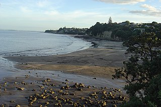
Cheltenham Beach from North HeadThe Vic Theatre, 2008
Between the wharf and Mount Victoria are the Devonport shops and several landmarks:
The Esplanade Hotel – this is an elegant example of an 1890s seaside hotel, reminiscent of many an English seaside resort of the period. A modern extension was added on in the 1950s which has now been replaced by an apartment complex. The Edwardian building was sold for $7 million in 2015.[38]
Windsor Reserve – located just to the east of the Devonport Wharf; it is an area of open lawn, notable for the partially underground toilet block designed in 1989 by Jeremy Salmond,[39] and the Edwardian archway at the northern end.
King Edward Parade Reserve – to the north of the Windsor Reserve on the other side of the road is the King Edward Parade Reserve; here are located the Public Library, the War Memorial (a bronze soldier figure by Richard Gross) and under the Moreton Bay Fig trees a 1950s styled bandstand.
The former Post Office – an Art Deco building from the 1930s.
The Left Bank – a 1920s neoclassical building now housing a cafe/bar/restaurant.
The Victoria Theatre – built in 1912 and remodelled internally and externally in the 1930s in the then fashionable Art Deco style; this is apparently the oldest cinema in the Southern Hemisphere in continuous use. The cinema was purchased for $1.55 million in 2006 by the North Shore City Council on behalf of the city.[40]
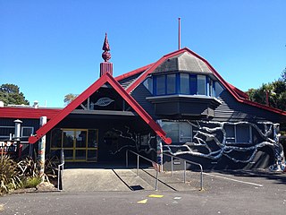
Devonport Museum, a museum on local history, opened in 1977.[41]Torpedo Bay Navy Museum, a military and maritime museum, opened to the public in 2010.[42][43]
The Cheltenham area also includes several landmarks:
Goldwater house, 26 Cheltenham Road, 1907, late villa-style family home owned by the Goldwater family until the mid-1980s.[45]
Morrison house, 5 Jubilee Avenue, 1896, Two-storey Italianate-villa, owned by the Morrison family 1907–1967.[46]
Watson houses, 15-17 Jubilee Avenue, 1899 and 1901, two villas, built and owned by the Watson family until 1917.[47][48]
Devonport Wharf
Today, ferry services to Devonport Wharf are more numerous again, and are subsidised by Auckland Transport, . A crossing between the Auckland CBD and Devonport takes about 12 minutes, usually on the 'Seabus Kea', a newer double-ended ferry.[23]
The Devonport Wharf / Ferry Terminal received a variety of maintenance and repairs during 2011 in advance of the Rugby World Cup. Further structural works were carried out in 2012.[49]
In 2015 a $24 million redevelopment project to upgrade parts of Devonport including the wharf began. The renovation of the Devonport wharf is all but complete, with applications for retail services currently underway. The project includes an improved car park and an overall modernisation of the building itself, as well as structural improvements and refurbishments.[50]
Flight Support for Albatross (sculpture in Auckland, New Zealand)
The 1929 wharf underwent significant repair in the 2010s[51] and is now home to the sculpture Flight Support for Albatross by Greer Twiss.[52]
Local media
The Flea 88.2 FM and 107.1FM is a community radio station in Auckland, New Zealand.[53] The station founder, Mike Baker, died on 4 April 2009, at the age of 71.[54]
Education
Devonport Primary School is a contributing primary (years 1–6) school with a roll of 235[55] located on the side of Mount Victoria with the address of 18 Kerr Street. The school was established in 1870 on a plot of land given to them by the Trevarthen family for the purposes of a chapel, before it was later renegotiated to be used as a school.[56]
Class at St Leo's Primary School c1900
St Leo's School is a state-integrated Catholic primary (years 1–6) school with a roll of 55.[57] It was founded in 1893.[58]
Both these schools are co-educational. Rolls are as of November 2024.[59]
Religion
Places of worship in Devonport include:
St Francis de Sales and All Souls Roman Catholic church
North Shore Rugby Football Club is a Rugby Union club located in Devonport that play their games at Devonport Domain. Founded in 1873, it is one of the oldest clubs in New Zealand.
Notable people
Finn Andrews and Sophia Burn – members of London-based band The Veils. Both grew up in Devonport and attended Takapuna Grammar School.
Eliza McCartney – NZ women's pole vault champion and women's pole vault World Junior Record holder. 2016 Olympics Pole Vault Bronze medal winner. Born 1996.
Isabel Peacocke – teacher, novelist, broadcaster, born in Devonport in 1881.[60]
William C Daldy, a historical steam tug currently berthed in Devonport
Related Research Articles
The North Shore is one of the major geographical regions of Auckland, the largest city in New Zealand. The area is defined as the northern shores of the Waitematā Harbour as far north as the Ōkura River.
Northcote is a suburb of Auckland in northern New Zealand. It is situated on the North Shore, on the northern shores of Waitematā Harbour, 4 kilometres (2.5 mi) northwest of the Auckland City Centre. The suburb includes the peninsula of Northcote Point where the northern approaches to the Auckland Harbour Bridge are located, and Northcote Central, the commercial centre of Northcote. Northcote features two volcanic maars.
Takapuna is a suburb located on the North Shore of Auckland, New Zealand. The suburb is an isthmus between Shoal Bay, arm of the Waitematā Harbour, and the Hauraki Gulf. Lake Pupuke, a volcanic maar and one of the oldest features of the Auckland volcanic field, is a freshwater lake located in the suburb.
Glenfield is a suburb of Auckland, New Zealand, located on the North Shore. Established as a rural community in the 1850s, the area developed as a suburban part of Auckland after the completion of the Auckland Harbour Bridge in 1959.
Milford is a suburb located on the North Shore, Auckland. It is located on northern side of Lake Pupuke. It also has a popular swimming beach, which runs some two kilometres from Black Rock in the south to Castor Bay in the north. The Wairau Creek reaches the sea at the Hauraki Gulf at the northern end of Milford Beach, and its lower tidal reaches host the Milford Marina.
Browns Bay is one of the most northernmost suburbs in the contiguous Auckland metropolitan area, located in the North Shore. Named after the Brown family who settled here in 1876, Browns Bay became a holiday destination in the late 19th century. The area gradually developed into a suburb of Auckland in the 1950s, and was the administrative centre for the East Coast Bays City from 1975 until it was disestablished in 1989. During the 1990s, the suburb became a hub for the South African New Zealander community.
Mairangi Bay is a coastal suburb of North Shore, Auckland, located in the northern North Island of New Zealand, on the south-east-facing peninsula forming the northern side of the Waitematā Harbour. Mairangi Bay came under the local governance of the North Shore City Council until subsumed into the Auckland Council in 2010.
Chatswood is a suburb in the city of Auckland, New Zealand, in the middle-eastern side of the North Shore. It contains a primary school and many parks. To the south of Chatswood is Kendall's Bay, a small bay of the Waitematā Harbour. The suburb is under the governance of Auckland Council. The Royal New Zealand Navy's Kauri Point Armament Depot is located in Chatswood. Chelsea Sugar Refinery is located in Chatswood.
Hillcrest is a suburb of the contiguous Auckland metropolitan area located in New Zealand. Since 2010, it has been under the jurisdiction of the Auckland Council, and is located in the North Shore, surrounded by Glenfield, Wairau Valley, Northcote and Birkenhead. The Auckland Northern Motorway passes to the east.
Bayswater is a suburb located on the North Shore of Auckland, New Zealand. It lies on a peninsula which juts into the Waitematā Harbour. Politically the suburb is part of the Devonport-Takapuna Local Board and the North Shore ward of Auckland Council.
Belmont is a suburb of Auckland, New Zealand, located on the North Shore. The suburb is in the North Shore ward, one of the thirteen administrative divisions of Auckland Council.
Narrow Neck is a suburb located on the North Shore of Auckland, New Zealand. It is under the local governance of the Auckland Council.
Castor Bay is a bay and suburb of the North Shore, located in Auckland which is in the North Island of New Zealand. Located between Milford and Campbells Bay, it is part of the East Coast Bays. To the east lies the islands of Rangitoto and Motutapu, which are easily visible from land. The suburb is in the North Shore ward, one of the thirteen administrative divisions of Auckland Council.
North Head is a volcano and Tūpuna Maunga forming a headland at the east end of the Waitematā Harbour in Auckland, New Zealand, in the suburb of Devonport. Known for its sweeping views over the harbour and the Hauraki Gulf, since 1885 the head was mainly used by the military as a coastal defence installation, which left a network of accessible old bunkers and tunnels as its legacy, forming part of the attraction. The site was protected as part of Hauraki Gulf Maritime Park in 1972 and listed as a Category I historic place in 2001. As part of a 2014 Treaty of Waitangi claim settlement the volcanic cone was officially named Maungauika and the reserve unofficially renamed Maungauika / North Head Historic Reserve.
Murrays Bay is a small suburb in the East Coast Bays region, located in the North Shore of Auckland. The suburb is roughly the same size as Rothesay Bay, the suburb to the immediate north. It is primarily a residential area but does have a community centre, restaurant and café. Murrays Bay is regularly serviced by buses which go to Takapuna and the Auckland city centre.
Wairau Valley is a suburb of Auckland, New Zealand. The area is predominantly light industrial/commercial. The Northern Motorway passes to the east, and the Wairau Park shopping complex extends to the north. The valley is drained by the Wairau Creek, which flows on through Milford and discharges into the Hauraki Gulf from an estuary at the northern end of Milford Beach.
The Devonport-Takapuna Local Board covers from Castor Bay and Sunnynook south to the end of the Devonport Peninsula; it is separated from the Kaipātiki board area by the Northern Motorway. This local board sits in the Auckland Council office buildings on The Strand in Takapuna. These were the North Shore City Council offices until the North Shore City Council was merged into Auckland Council in 2010. It is part of the North Shore Ward of Auckland Council, which also includes the Kaipātiki Local Board.
Shoal Bay is a bay of the Waitematā Harbour in Auckland, New Zealand. It is located on the North Shore.
The Devonport & Lake Takapuna Tramway was a 1-mile (1.6 km) horse tramway system in Auckland, New Zealand that operated between Victoria Wharf in Devonport to Cheltenham Beach from 1886 to 1888. It was the only commercial horsetram system to run on Auckland's North Shore.
Torpedo Bay(or Te Hau Kapua) is a bay on the southern coast of Devonport, New Zealand between North Head (Maungauika) and Devonport Beach. The bay is home to the Torpedo Bay Navy Museum.
↑ Upton, Clive; Kretzschmar, William A. Jr. (2017). The Routledge Dictionary of Pronunciation for Current English (2nded.). Routledge. p.351. ISBN978-1-138-12566-7.
↑ Hopkins, Jenni L.; Smid, Elaine R.; Eccles, Jennifer D.; Hayes, Josh L.; Hayward, Bruce W.; McGee, Lucy E.; van Wijk, Kasper; Wilson, Thomas M.; Cronin, Shane J.; Leonard, Graham S.; Lindsay, Jan M.; Németh, Karoly; Smith, Ian E. M. (3 July 2021). "Auckland Volcanic Field magmatism, volcanism, and hazard: a review". New Zealand Journal of Geology and Geophysics. 64 (2–3): 213–234. doi:10.1080/00288306.2020.1736102. hdl:2292/51323. S2CID216443777.
↑ Cameron, Ewen; Hayward, Bruce; Murdoch, Graeme (2008). A Field Guide to Auckland: Exploring the Region's Natural and Historical Heritage (rev.ed.). Random House New Zealand. p.149. ISBN978-1-86962-1513.
1 2 Duder, John (2011). "Auckland Ferries". In La Roche, John (ed.). Evolving Auckland: The City's Engineering Heritage. Wily Publications. pp.117–119. ISBN9781927167038.
↑ Reidy, Jade (2009). "How the West Was Run". In Macdonald, Finlay; Kerr, Ruth (eds.). West: The History of Waitakere. Random House. pp.238–239. ISBN9781869790080.
This page is based on this Wikipedia article Text is available under the CC BY-SA 4.0 license; additional terms may apply. Images, videos and audio are available under their respective licenses.