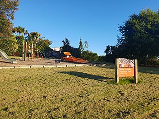
Demographics
Hauraki covers 1.09 km2 (0.42 sq mi) [1] and had an estimated population of 4,210 as of June 2023, [2] with a population density of 3,862 people per km2.
Historical population| Year | | |
|---|
| 2006 | 3,792 | — |
|---|
| 2013 | 3,969 | +0.65% |
|---|
| 2018 | 4,131 | +0.80% |
|---|
| Source: [4] |
Hauraki had a population of 4,131 at the 2018 New Zealand census, an increase of 162 people (4.1%) since the 2013 census, and an increase of 339 people (8.9%) since the 2006 census. There were 1,434 households, comprising 1,998 males and 2,133 females, giving a sex ratio of 0.94 males per female. The median age was 37.0 years (compared with 37.4 years nationally), with 861 people (20.8%) aged under 15 years, 774 (18.7%) aged 15 to 29, 1,977 (47.9%) aged 30 to 64, and 522 (12.6%) aged 65 or older.
Ethnicities were 73.3% European/Pākehā, 6.0% Māori, 2.4% Pacific peoples, 22.6% Asian, and 3.3% other ethnicities. People may identify with more than one ethnicity.
The percentage of people born overseas was 40.4, compared with 27.1% nationally.
Although some people chose not to answer the census's question about religious affiliation, 56.9% had no religion, 32.6% were Christian, 0.3% had Māori religious beliefs, 1.2% were Hindu, 1.2% were Muslim, 1.4% were Buddhist and 1.5% had other religions.
Of those at least 15 years old, 1,329 (40.6%) people had a bachelor's or higher degree, and 207 (6.3%) people had no formal qualifications. The median income was $44,800, compared with $31,800 nationally. 1,008 people (30.8%) earned over $70,000 compared to 17.2% nationally. The employment status of those at least 15 was that 1,773 (54.2%) people were employed full-time, 459 (14.0%) were part-time, and 96 (2.9%) were unemployed. [4]

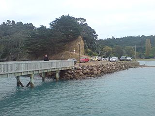
Coromandel, also called Coromandel Town to distinguish it from the wider district, is a town on the Coromandel Harbour, on the western side of the Coromandel Peninsula, which is in the North Island of New Zealand. It is 75 kilometres east of the city of Auckland, although the road between them, which winds around the Firth of Thames and Hauraki Gulf coasts, is 190 km long. The population was 1,930 as of June 2023.

Auckland is one of the 16 regions of New Zealand, which takes its name from the eponymous urban area. The region encompasses the Auckland metropolitan area, smaller towns, rural areas, and the islands of the Hauraki Gulf. Containing 33 percent of the nation's residents, it has by far the largest population and economy of any region of New Zealand, but the second-smallest land area.
Paeroa is a town in the Hauraki District of the Waikato Region in the North Island of New Zealand. Located at the base of the Coromandel Peninsula, it is close to the junction of the Waihou River and Ohinemuri River, and is approximately 20 kilometres south of the Firth of Thames.

Hauraki District is a territorial authority governed by the Hauraki District Council within the Waikato region of New Zealand. The seat of the council is at Paeroa.

Colville, a small town in the north of the Coromandel Peninsula in the North Island of New Zealand, lies 26 kilometres north of Coromandel in Colville Bay on the Hauraki Gulf, and is the northernmost town of any note on the peninsula. North of Colville, 28 kilometres of rough road lead to the small settlement of Port Jackson, close to the peninsula's northwesternmost point, Cape Colville and 20 km to Port Charles on the northeastern side.

Ngatea is a small town on the Hauraki Plains in the North Island of New Zealand. It is located 18 kilometres southwest of Thames and 70 kilometres southeast of Auckland. Ngatea lies on the Piako River, eight kilometres south of its outflow into the Firth of Thames.

Tāmaki is a small suburb of East Auckland, 11 kilometres from the Auckland CBD, in the North Island of New Zealand. It is located by the banks of the estuarial Tāmaki River, which is a southern arm of the Hauraki Gulf. The suburb is between the suburbs of Point England to the north and Panmure to the south.

Waima is a suburb of West Auckland, New Zealand. It is under the local governance of the Auckland Council. The majority of the modest population is clustered around the comparatively prominent Waima superette, situated just off the main arterial road Woodlands Park Road, on such streets as Waima Crescent, Hollywood Avenue, Boylan Road and Rimutaka Place. The central "hub" could be considered Waima reserve, which consists of various public amenities such as a playground, basketball court, toilets and a sport field.

Mellons Bay is a suburb of East Auckland. It is south of Eastern Beach and north of Howick.

Belmont is a suburb of Auckland, New Zealand, located on the North Shore. The suburb is in the North Shore ward, one of the thirteen administrative divisions of Auckland Council.

Narrow Neck is a suburb located on the North Shore of Auckland, New Zealand. It is under the local governance of the Auckland Council.
McLaren Park is a suburb of West Auckland, New Zealand. It is named after New Zealand Formula One driver and founder of the McLaren Formula One Team Bruce McLaren. The local State secondary schools are Henderson High School, Rutherford College, St Dominic's College and Liston College.

Ostend is a settlement on Waiheke Island, in New Zealand's Hauraki Gulf within the Auckland Region. Ostend is located in the west of the island, on and around a small peninsula which juts into Putiki Bay, one of two large indentations in the island's southwest coast. The southwest of the island contains much of the island's population, with Ostend being located immediately to the east of the settlement of Surfdale, and to the southwest of Onetangi.
Turua is a small village community on the banks of the Waihou River in the Hauraki Plains in the North Island of New Zealand. It is located close to the mouth of the river, 9 kilometres south of the Firth of Thames and 12 km south of Thames. It is connected by road to SH 25 in the north and SH 2 to the south.

Boulcott is a central suburb of Lower Hutt, in the Wellington Region of New Zealand. The suburb lies about a kilometre north-east of the Lower Hutt CBD.
Northcross is a northern suburb of the North Shore in the contiguous Auckland metropolitan area in New Zealand. It is located in the East Coast Bays, a string of small suburbs that make up the northern North Shore. It is located north of the Waitematā Harbour and is currently under local governance of Auckland Council.
One Tree Hill is a suburb of Auckland, New Zealand. The residential part of the suburb is located to the east and south-east of Maungakiekie / One Tree Hill, from which it takes its name, with the volcanic peak located within the suburb's boundaries.

Waitakaruru is a rural community in the Hauraki District and Waikato region of New Zealand's North Island. It is situated at the mouth of Waitakaruru River
Kerepehi is a rural community in the Hauraki District and Waikato region of New Zealand's North Island. The alternative spelling Kerepeehi was in use until 1933.
Rural Waiheke comprises the eastern and southern parts of Waiheke Island in the Hauraki Gulf near Auckland, in New Zealand. Apart from small settlements at Ōmiha and Orapiu, the area south and east of Onetangi is mostly private farmland. Waiheke Island Aerodrome is approximately in the centre of the island.

